 Introduction
| Pembina
River | Cypress and Crystal Creeks
Assiniboine River | Cypess River | Here & There | Sources    Here & There  Across our region there are well over a hundred bridges over
the
lesser-known streams. Each stream has its place in the lives of
local residents and in the stories of the pioneers. Even the smallest
ravine can pose a problem to vehicular traffic. Horses and oxen can
swim, cars can't, so once we entered the automobile age bridge building
began in earnest. There were several basic bridge designs that one
could choose from to serve a situation.
From the dozens of choices available we present here a selection of bridges... 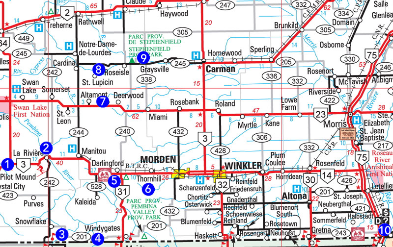 Here and There: 1. Pilot Creek Bridge (Pilot Mound): N49.21953, W98.88439 2. Mary Jane Creek CPR Bridge: N49.26269, W98.67328 3. Snowflake Creek Bridge: N49.02101, W98.60361 4. Mowbray Bridges 5. Old Darlingford: Approx: N49.18449, W98.4003 6.Alexandria Crossing, Dead Horse Creek - Viewpoint: N49.14820, W98.22350 7. CNR Bridge - Deerwood: N49.39924, W98.33688 8. Roseisle Creek, Babcock Site: N49.47109, W98.45383 9. Boyne River, Graysville: N49.50582, W98.20652 10. Emerson 1. Here and There: Pilot Creek Bridge (Pilot Mound) N49.21953, W98.88439 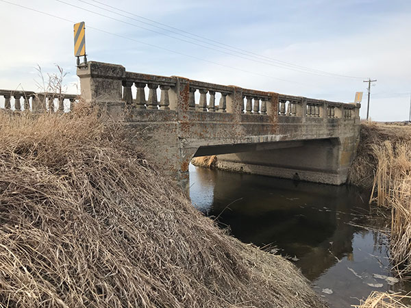 This concrete beam bridge over Pilot Creek, on a former section of Highway 3, was constructed in 1920. (Historic Sites) 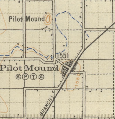 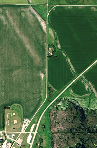 Today Highway #3 follows a new path - but the original road can serve as the "scenic route" 2. Here and There: Mary Jane Creek CPR Bridge N49.26269, W98.67328 This railway bridge over the Mary Jane Creek at La Riviere was built in the early 20th century . 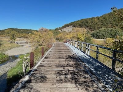 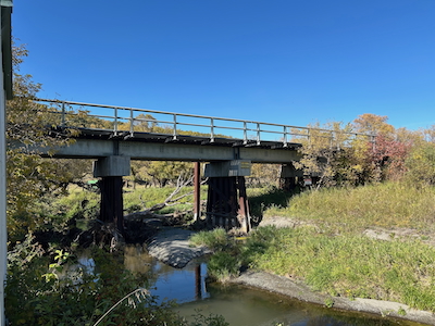 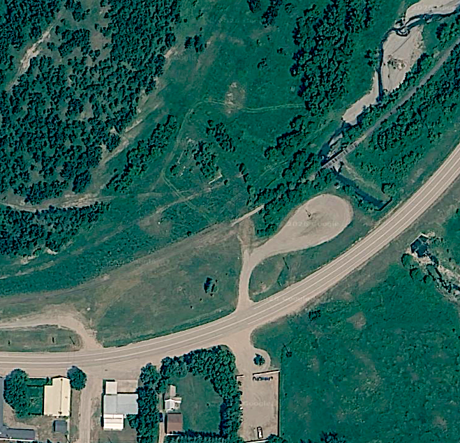 It is close to town, just east of the elevators and station sites. 3. Here and There: Snowflake Creek Bridge N49.02101, W98.60361 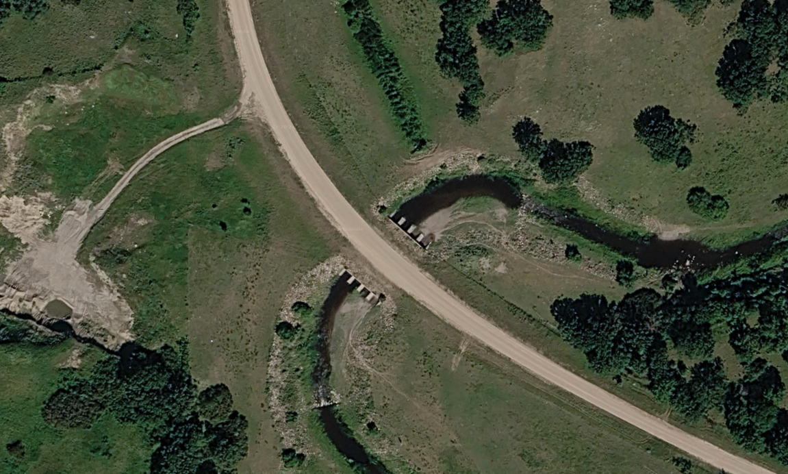 The concrete culvert bridge over Snowflake Creek 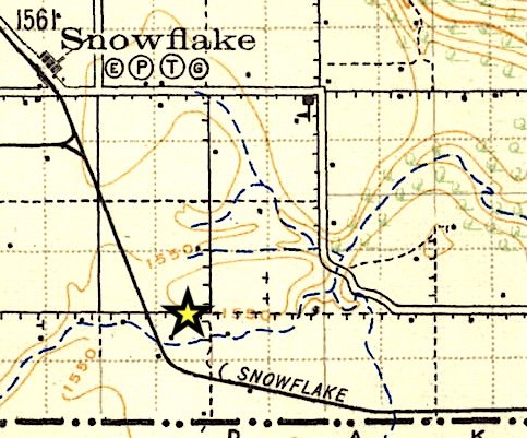 Snowflake Creek, from which the village got its name, had to be crossed to get to the next town, Mowbray. The railway used a trestle bridge that was later replaced by culverts. The line has long been abandoned. The traffic bridge remains on what was once a busy road. 4. Here and There: Mowbray Bridges 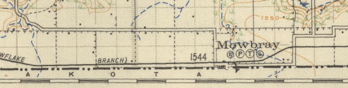 The village of Mowbray must be unique in terms of its location alongside the US Border. In a way the Mowbray story reminds one of a simpler time when crossing the border could be an everyday thing. I haven't yet found an explanation as to the reason the rail line that created the village travels only about 500 metres north of the border for this stretch of about 10 km between Snowflake and Mowbray. Across the Boundary Trail region there are several towns close to the border, all of which enjoyed a close relationship to their American neighbours. Snowflake is just 5km from the line but Mowbray is right on the line 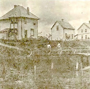 The village was divided by Mowbray Creek. It is a small stream and was quite easily forded in most seasons, but as the old photo shows, the banks were steep in places. A bridge was a priority. This wooden structure, for some reason was called the "Greek Bridge". A bridge that carried vehicles was later replaced by a footbridge. 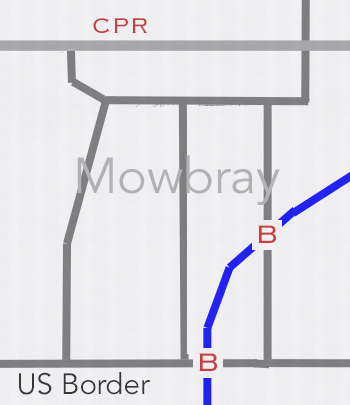 The village plan, based on the hand-drawn one in the Mowbray History, shows Mowbray Creek running through town. Water for the school was fetched from a well on the American side. No tariffs! 5. Here and There: Old Darlingford Ford Approx: N49.18449, W98.4003 A pioneer memory... Passing Calf Mountain, so called because an early traveler saw a buffalo calf lying on top of it, we reached Darlingford, another town site consisting of a store and a hotel run by a Mr. Alderson. After being refreshed by a good square meal and our horses by a feed of oats, we pressed on. (Meet You On The Trail, PMA) 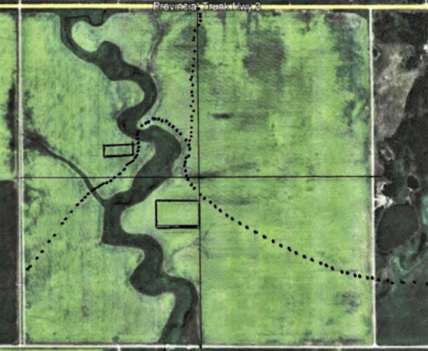 Patrick Thiessen’s research on behalf of the Darlingford Heritage Museum places site of the original Old Darlingford (the large rectangle) about a half kilometre south of the ford which was on the NW quarter of 6/3/7 From Sites along the Boundary Commission Trail: Mr. William C. Alderson, the pioneer merchant of Mountain City, moved to Township 3-7 where he built another stopping house. It was located on the E ½ 6-3-7 in June 1877. Through this property flowed the Little Pembina River, a stream over which Mr. Robert Bell of Mountain City had constructed a provincial government bridge during the summer of 1879, just a little more than a half-mile southeast of Calf Mountain. Thiessen found evidence suggesting a trail from the town site to the ford, as shown above, but no evidence of Alderson’s Bridge. Years ago there were signs of possible campsites on the west side of the ford, (small rectangle). 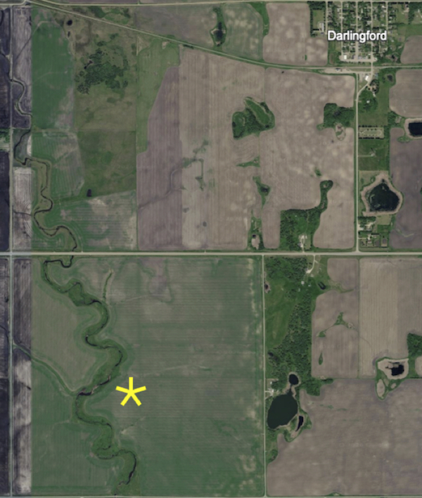 A likely spot for the crossing. 6. Here and There: The Alexandria Crossing over Dead Horse Creek Viewpoint N49.14820, W98.22350 Dead Horse Creek Crossing (Approx) N49.14730, W98.22716 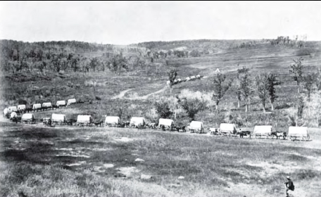 The Boundary Commission Trail - The Oldest Highway in the West (PMA -Lost Towns) The Boundary Commission trail was the route taken by the
Boundary
Commission in 1873 & 74 as they surveyed the Canada – US Border.
They bridged creeks, established crossings, and cleared bush as
necessary; but the general route they followed spans centuries, crosses
cultural lines, and involves a multitude of goals and purposes.
Although one short period of its life at the dawn of European settlement gave the trail its name, it was well travelled long before that time. Parts of it began as a First Nations travel and trading route, which the fur traders of the 18th Century naturally used when they began penetrating the interior of Rupert's Land as the region was then called. Not too long afterwards, the Red River carts of the Métis wore grooves into the prairie sod of the trail in their pursuit of the bison as the large animals retreated ever westward. Many of the pioneers of European origin who came to take up homesteads in the southwestern corner of Manitoba in the 1880’s came from Ontario. One popular route was via boat to Duluth on Lake Superior, then by rail to a point on the Red River directly south of Winnipeg, where they might have a choice between a riverboat or a train to Emerson on the Manitoba - Dakota Territory border. Before the CPR began regular service west from Winnipeg in late 1881, most made their way westward along the Boundary Commission Trail, often in wagons drawn by oxen or horses, with whatever belongings and supplies they owned. It was a long, slow, journey, but the trail first blazed by the Boundary Commission in 1873 was well travelled, and several “Stopping Houses”, pioneer versions of the roadside motel, had been established in farmhouses along the trail. If the weather cooperated, and the wagon didn’t lose a wheel or break an axle, it might well have been almost an enjoyable trip. As technology marched on, new routes were drawn, first for trains, then for cars, and while the Boundary Trail was still useful for local travel for a time, the increased use of cars meant that even local and regional transportation shifted onto to those conveniently provided road allowances that bordered each section of land. Evidence of the old trail faded except in a few places where the ruts were deeply etched into a hillside or valley wall. 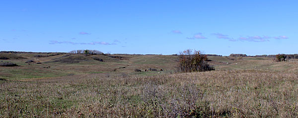 The view from a cairn placed to mark the spot of the Village of Alexandria that grew up along the trail in the settlement era. 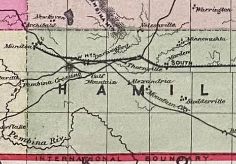 The region in the 1880's A Memory... We set out across the frozen prairie on the Boundary Commission Trail to walk 125 miles west into the wilderness to find a homestead. Mother carried the baby in her arms. Uncle George managed to walk. I carried a big old gun which had been used in the Civil War. Father carried a big stick and pushed hard on the wagon box, saying "You'd been a good many miles behind if I hadn't kept shoving on the tailboard''. Robert Blackwell 7.Here and There: Canadian National Railway Bridge - Deerwood N49.39924, W98.33688 A wooden trestle bridge on the former CNR line was abandoned when the railway line was discontinued in 2006. The steel tracks were removed in 2007. The trestle is now a popular trail. (Historic Sites) 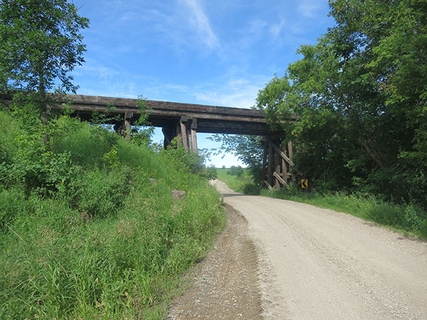 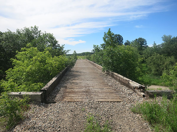 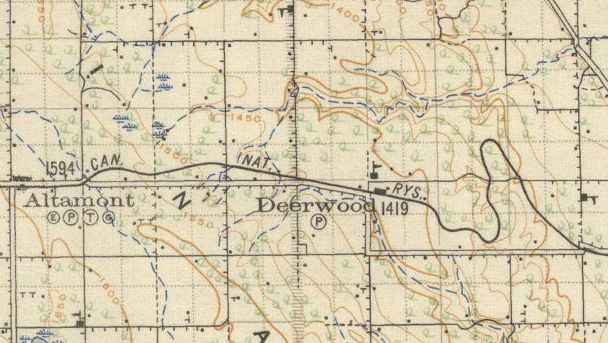 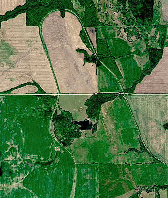 The path of the rail line tells a story about railways and valleys. Railway builders will take a long detour to avoid steep grade. Those attractive railway trestle bridges crossing steep wide valleys look impressive but are very expensive to build and maintain. 8. Here and There: Roseisle Creek, Babcock Site N49.47109, W98.45383 In 1907 The Commercial Cement Company began manufacture of cement at a site between Roseisle and Cardinal. A side track connected the company’s plant with the main line of the Canadian Northern Railway. The enterprise operated for about 17 years, from 1907 to 1924 and included the mine site, large masonry kilns, processing facility, rail spurs, and various houses and storage buildings. Today scant evidence exists along a winding road in this scenic valley. 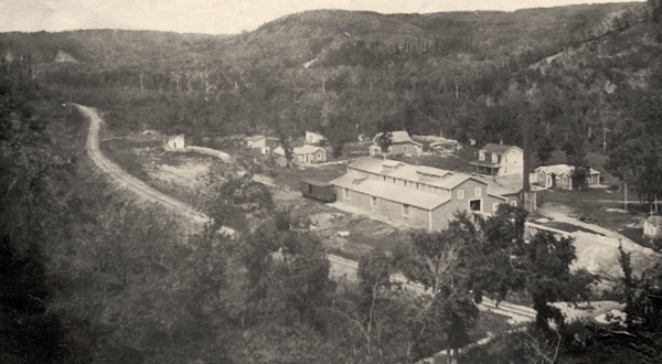 The Commercial Cement Company, An Investigation of an Early Manitoba Industry - David Butterfield Although the nearby rail line would have been the main mode of transportation, one would think that they would have needed a convenient road access to the north side of the Creek, but it doesn't show on this 1922 map. 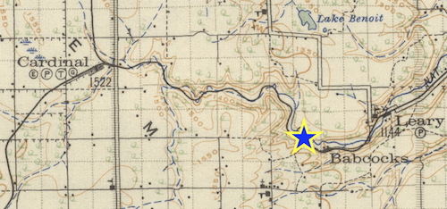 A bridge exists however, merely a series of culverts in concrete. 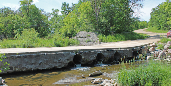 This shortcut to bridge buildings is common on small seasonal streams throughout the prairies. 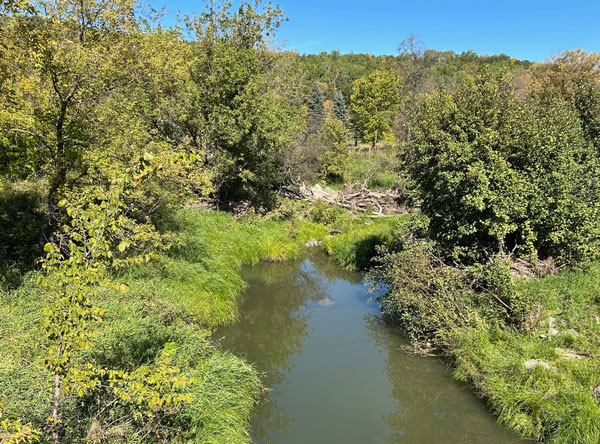 Just to the east the creek runs in a steeper and narrower course, a more traditional bridge was required. 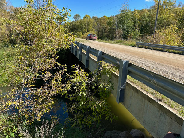 The bridge near Leary's 9. Here and There: Boyne River, Graysville N49.50582, W98.20652 Two modest but architecturally interesting concrete beam bridges over the Boyne River illustrate how bridge design has to accommodate the terrain * All photos from Historic Sites 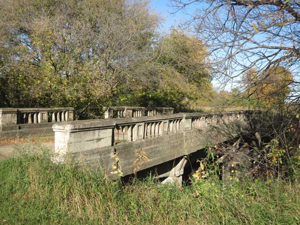 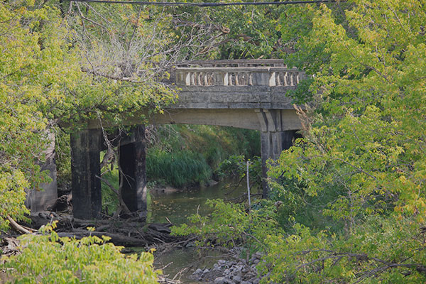 This abandoned concrete beam bridge over the Boyne River on highway 245, between the communities of Stephenfield and Graysville required long piles 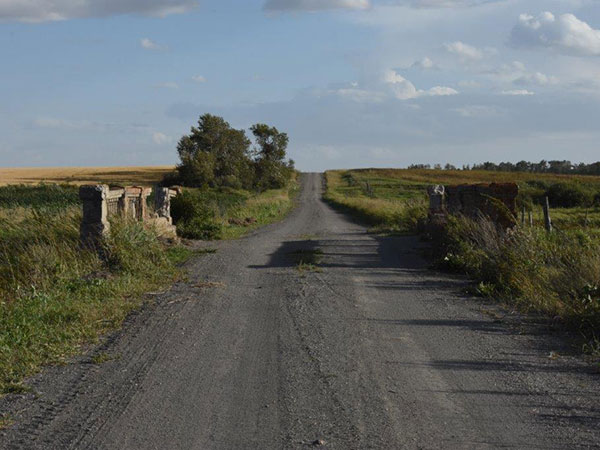 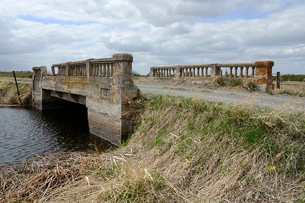 While this one over a different section of the same stream was able to uses a different support, the platforms are similar. Here and There: Emerson Bridges In the settlement era, for many newcomers to Boundary Trail Region, Emerson was where one got off of the riverboat or the train and prepared for the journey westward. The town was relatively new - but the immediate vicinity already had a long history as a commercial centre in the fur trade era. In the later period of settlement, it became an important point on the developing trade route, both overland and by river, between the Red River Settlement and St. Paul. It served as a refueling point for the steamers that began to ply the Red in the 1850's and came to represent that important point separating British and American territory. 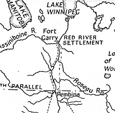 The Crow Wing Trail was the major land route between Manitoba and Northern States. It ran to the east of the Red River, but the Hudson's Bay Post located were Emerson is today, and the rival North West Company Post, Fort Pembina, about three km south, both needed access to that trail, That was a challenge because the Red River is deep and wide with steep banks in this area. There was a spot however, just a few km north of the border that was suitable and used for decades. 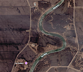 Fort Dufferin, built in 1873 for the Boundary Commission was just north of Emerson. The ford site was somewhere near the centre of this image. The Red River carts were floated on top of the wooden wheels which taken off were used as floats to keep the loaded carts above the water line. Getting the horses and oxen across was not easy. A rope was put around their neck and they were pulled across. Some didn't make it. . Today. on both sides of the stream, horse and oxen bones are still found. The choice to develop the site of the HBC Post as a town was influenced (perhaps dictated) by the knowledge that it would soon be served to central Canada by the Pembina branch of the Pacific Railroad and the St. Paul, Minneapolis and Manitoba line, During the years between 1876 and the arrival of the first train at the border on November II, 1878, Emerson established itself as a trading center for an area that stretched 200 miles westward along the international boundary. The original location of the town-site had an advantage because of its proximity to the railroad. However, it also had a disadvantage because the majority of Emerson's trade was found on the west side of the Red River. A ferry, put into operation shortly after the town was settled, did not completely solve the problem. It was, to say the least, extremely hazardous. The steep river banks made it almost impossible for horses and wagons to get on and off the ferry without injury. And, of course, during the late spring and early fall, when ice conditions were unsafe, Emerson was completely cut-off from trade on the west side. In 1879 the situation became more serious when the Hudson's Bay Company established the town-site of West Lynne. This unwanted and brash competitor was soon getting much of the trade that formerly had been Emerson's. Referring to itself as the, "infant metropolis", and the, "center of the grain trade in Manitoba", this new town very quickly cut into the lucrative farm markets immediately to the west. A bridge was essential, as was a rail link to the new communities springing up along the Boundary Trail. 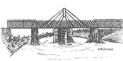 An artist's rendition of the first traffic bridge built in 1881. 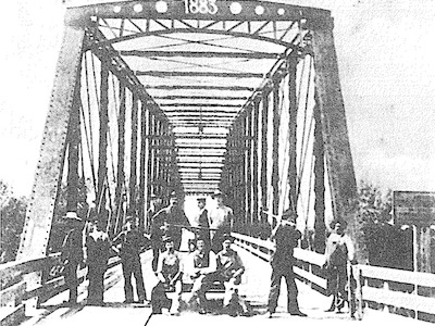 This bridge built in 1883 accommodated the rail line and vehicle. It served until 1913 when a new rail bridge was built that still serves today. 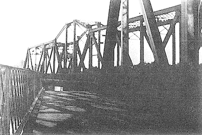 The 1913 bridge would rotate to allow for larger river craft. 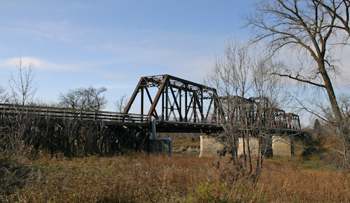 Today the structure supports a footbridge alongside the tracks. |