 Introduction | Pembina River | Cypress and Crystal Creeks Assiniboine River | Cypess River | Here & There | Sources    The Assibiboine River  The Assiniboine River rises in east-central Saskatchewan. For much of its length in Manitoba it flows though well-populated farmland. Many fur trading posts, ferries, crossings, pioneer villages and landings have been located on its banks. 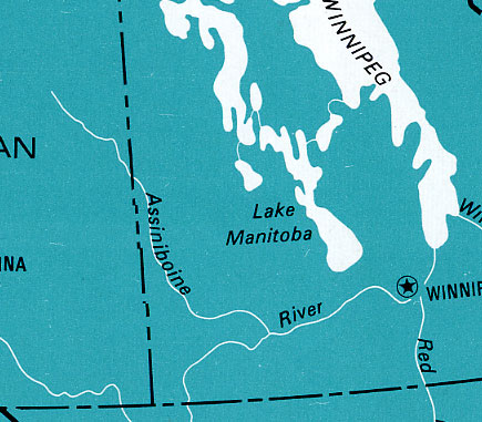 For centuries it was the primary water route westward from Winnipeg. It is noteworthy for being navigable by shallow draft steamboats. Such vessels were introduced on the Red River in 1857 and started regular service on the Assiniboine in 1878. Their use coincided with the first wave of European agricultural settlement in Manitoba. Most newcomers to the South Central region arrived via the Boundary Trail, but some coming to the districts south of Rathwell and Treherne could use the Assiniboine route. 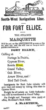 This ad was in the Winnipeg Times on April 27,1880 In 1880 when ads like this were common in Winnipeg paper,
most
immigrants came by way of the Great Lakes to Duluth, then to the Red
River where steamboats or the railway would get them to Emerson and
Winnipeg. The most direct route for settlers heading to homestead in
southern Manitoba was along the Boundary Commission Trail from Emerson.
Steamboat companies promoted their service from Winnipeg as the less difficult more comfortable option even if it took out of your way. Anyone who did travel for days in a cart pulled by oxen, over barely recognizable trails, and difficult stream crossings might well agree. But you still had to face that trip from the Assiniboine to your new home it was indeed shorter. An Overview: 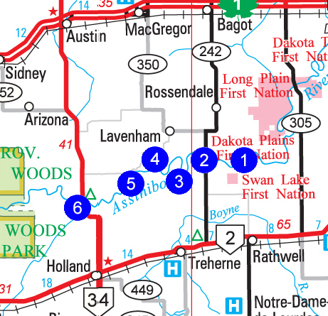 The Assiniboine River Sites 1. Indianford: N49.74748,W98.56007 2. Rossendale Bridge: N49.85935, W98.44942 3. Hird's Ferry: N49.73582, W98.69423 4. Harland’s Ferry: N49.75227, W98.71632. 5. Ladysmith Ferry: N49.74202, W98.77921 6. Rae’s Ferry: N49.69896, W98.90018 1. The Assiniboine River: Indianford N49.74748,W98.56007 The first and most commonly used trail from near Portage southwards though the Tiger Hills settlement (Treherne area) was called the Yellow Quill Trail. As it struck out across the Long Plains Indian Reservation, this trail brought the traveler to the banks of the Assiniboine River, at a crossing known as Indianford. First Nations travelers had used it for centuries. At this crossing, a man named Fortney operated a boat to help people across. 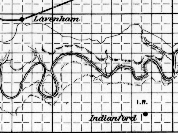 The community, including a Church and a School and Post Office took the name Indianford. 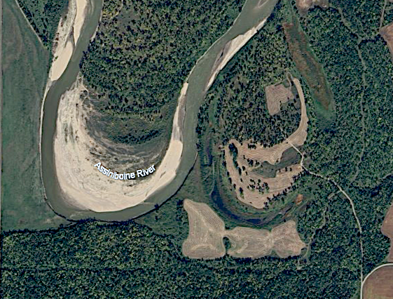 The vicinity. 1. The Assiniboine River: Rossendale Bridge N49.85935, W98.44942 From the Rossendale History we learn that Johnson Henry built a ferry on the Assiniboine, which served until 1962 when a bridge was built. That seems a bit late but only a few kilometres to the west there were the Lavenham area ferries and bridges. We also find this memory... "Roads also were greatly improved (1910) in a very short time and my old "pontoon" bridge at Alex Armstrong's was discarded. I had found it fun when the logs bumped up and down as Kilburn went across, sometimes sinking to the wheel hubs of the buggy. Mother found it nerve-wracking on her weekly trips to Rossendale for mail and groceries. Thank goodness there would be no more free baths for her and Kilburn." Times change. The Lavenham area crossing are closed, the nearest crossing to the west is on Highway 34 and the main route from Portage to Treherne in on Rd 242 through Rossendale. 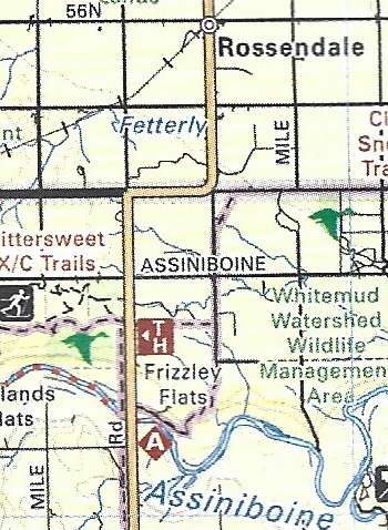 The Assiniboine River: The Lavenham Area Crossings 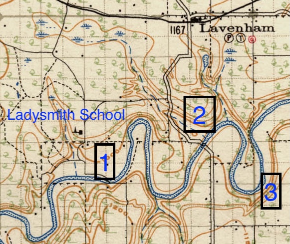 For people north of the Assiniboine in the Lavenham area,
the closest
larger "market" towns, of Holland and Trehene, were south of the river.
The fact that three ferries served a short stretch of river indicates
the demand for convenient access to those towns and the goods and
services available there. Above all, farmers relied on reasonable
access to elevators. In 1962 one site was chosen for a bridge (#2) but
that has since gone.
While the Local History reports agree that #1 on the map is the Ladysmith Ferry there is some conflicting information as to the Hird and Harland Ferries. Several reports place Harland's Ferry at 14-8-9-10, 9 1/2 miles north of Treherne on the Matchettville Road. That would be #2. At least two reports mention that the Hird Ferry was replaced by a bridge, but maps and other sources indicate that the bridge was located at the site #2. Ron Catt, whose family has been near Ladysmith for over 100 years, tells me that #2 is indeed Harland's and he would know. Sometimes memories fade and sometimes the names locals use to identify locations change, so I can't vouch for the total accuracy of the labels on a few images I have used. 3. The Assiniboine River: Laveham Area: Hird's Ferry. N49.73582, W98.69423 The first "ferry" in the region was a raft, likely powered by river current and/or poles, set up by John Hird. 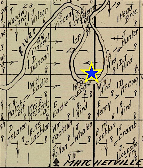 This excerpt Cummins Rural Directory (1923), shows that Mr. Hird owned the land near the location. Between 1895 and 1898, a ferry run by the river current was
built. A
large steel cable was stretched across the river. Then two smaller
cables were attached to the ferry - one at each end. These ran through
pulleys on the large cable and back to windlasses which were operated
by hand letting the ferry run at an angle according to which way you
wished to go. New models were built over the following decades.
By 1921 traffic reached many as 110 rigs in a single day. 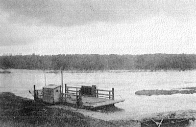 Likely the last Hird's Ferry. 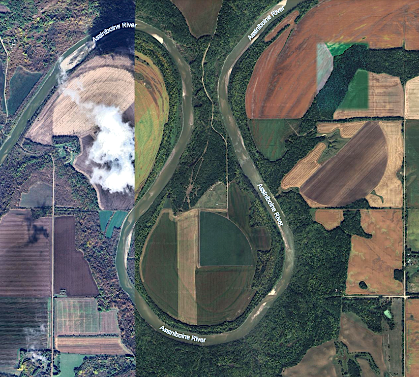 No definitive trace exists from Google Earth. It was somewhere near the south end of the loop.  In 1938 or 39 there was a temporary bridge placed in the spring and taken off for the winter. This set up only lasted a few years. Two of the piers washed out with the heavy ice flow. The council then decided to move a ferry down from Ladysmith. Operational Details To accommodate night travellers while Frank McKeen was Hird's operator he installed a battery operated bell in the ferry house, with push buttons on both sides of the river. This system worked much better than an old plow share beaten with an old axe which had been previously used. It worked too well on Hallowe'en as the "trick or treaters" usually gave the bell a good workout. Dangerous Crossings Tragedy struck several times over the years. Mrs. Morrison of the Arbroath district lost her life when she and her husband were crossing on the ferry with their horse and buggy. The table at the back of the ferry, which should have been raised, had been neglected. The horse became restless and backed up over the end of the ferry, tipping the buggy sideways and throwing Mrs. Morrison out. The ferryman was unable to rescue her. In the spring and fall when the ice prevented the ferry from crossing and was yet too thin to support traffic, people would cross using the ferry cable as support in case the ice gave out. The ferryman, Mr. Hobbs had just taken a passenger across on a plank hung on ropes and two pulleys to the large cable. When he started back something went out of control and he fell through the thin ice and couldn't be saved. On the lighter side... 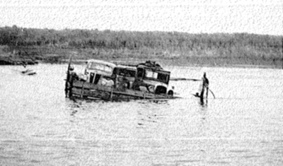 In 1939 the ferry took on too much and sank. The ferry could be sunk by overloading. Once a farm truck,
loaded with
grain, crossed and the driver lied about the size of his load. George
Hird was called home from Treherne to pull the ferry out with his
tractor.
These stories and other are available in theTreherne History, including a detailed report by Fannv Gibbs (p78). A Memory... There was a "toll" on "out of municipality" cars and on all cars after seven p.m. One fellow, a stranger to Frank, insisted he came from South Norfolk and got across twice without paying. After confirming his suspicions that the man was in reality an outsider, Frank alerted Mr. Tom Woodward on the Harland Ferry at Lavenham. The stranger never came back over the Hird ferry, but Mr. Woodward caught him on the Harland Ferry and charged him for unpaid trips. 4. The Assiniboine River: Laveham Area: Harland’s Ferry N49.75227, W98.71632. The Harland's Ferry started as a private enterprise in 1904,
but the
municipality sanctioned the operation and supplied the material and
cable.
The fee for crossing for non-residents was 25¢ anytime. After sundown municipality travellers paid 25¢. It was operated in this manner for a few years, and was eventually taken over by the municipality who hired an operator for each summer. The ferry operated on a heavy cable anchored by big poles on each bank of the river. By angling the ferry in the current or the river, the ferry would be propelled across. The ferryman lived in a small house on the south bank. Eventually it became River Park, a popular picnic spot for folks on a Sunday. On the first Sunday in August, 1922, 75 cars were parked there. Nine swings, a boarded in pool for the tots and the whole river available for adults with picnicking for all. 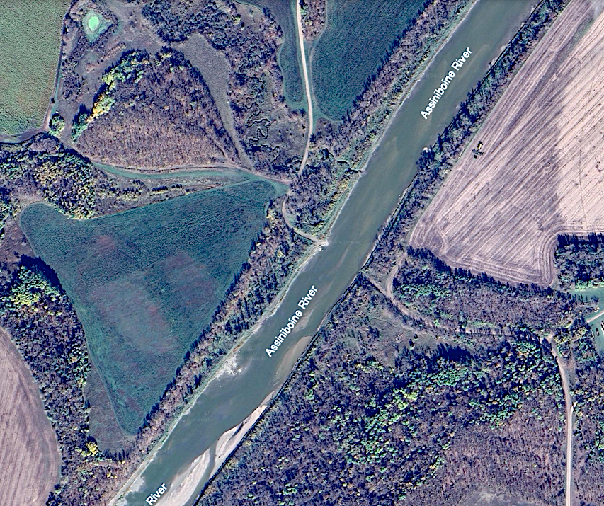 The site from Google Earth. 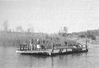 Each fall the ferry would be hauled up high on the riverbank to avoid damage by the Ice. 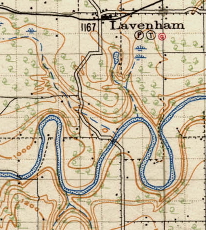 The ferry, and later a bridge, served the main route from Lavenham to Treherne. 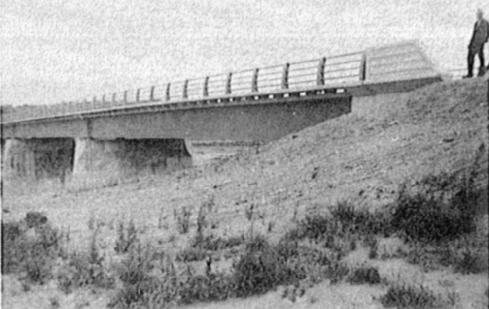 The bridge was built in 1962. A Memory (From the Treherne History) One Saturday night a group, including some of Bill Eadie's family, put on our skates at Harlands ferry and skated on the river ... clear as glass ... across to Ladysmith Ferry. 5. The Assiniboine River: Laveham Area: Ladysmith Ferry N49.74202, W98.77921 In 1903, the municipality built and operated a ferry at the Ladysmith crossing, on SW 16-9-10, the homestead of Harry Catt. 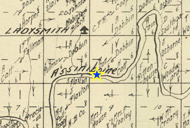 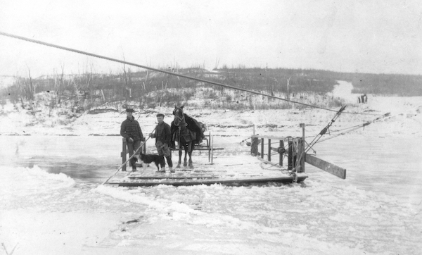 This photo from the MB Archives is identified as the Catt Ferry, and was probably taken when Mr. Catt was in charge. 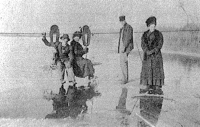 Using the ferry cable as support to walk across. After World War I, Dr. Laurie Lamont cared for most of the
sick around
Lavenham and district. In the spring and fall, when the ferries could
not operate due to river conditions the doctor often crossed the river
in a small boat or on a plank fastened to pulleys on the ferry cable.
In 1944, after the Ladysmith ferry was discontinued, Hugh Ross Sr., Clarence Dobbin and Philip Woodward constructed a portable bridge of timber about a kilometre upstream from the ferry crossing. This bridge was put on and taken off in sections with the help of a portable crane. This bridge was used for a few years until unusually high water discouraged further use of it. 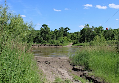 The site of the bridge that replaced the Ladysmith Ferry More Mishaps.... When a farmer needed to get his steam engine outfit across the river there was no way that the the old ferry could handle it, so the decided to ford the river. About half way across they were stopped by a big stone under the water. The water was deep enough that while they were stuck, the water put out the fire in the boiler. They left it there all night, and the next morning they were able to get out. 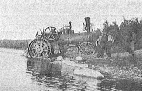 C.V. Dobbin, with his brothers Garnet and Carl, fording the river in 1926 at Ladysmith Crossing. 6. The Assiniboine River: Rae’s Ferry N49.69896, W98.90018 James Hamilton floated lumber down from Little's sawmill,
which was
situated on the south bank of the Assiniboine River near the mouth of
the Cypress River, to this crossing, where he built and launched a
ferry in 1882. He was given a charter by the municipality to operate it
and all rights, in addition, to river crossings for a distance of eight
miles west of the site for five years.
Nelson Drew was the first ferryman and his salary was $160.00 a year. The ferryman was required to be in attendance from 7 a.m. to 9 p.m. each day from spring break-up until freeze-up in the fall. There was to be no charge for resident ratepayers in the municipality except after hours when a 25 cent charge was levied. Each person driving a single or double rig from outside the municipality had to pay 50 cents each way or 75 cents for both ways, while a foot passenger from outside the municipality paid 10 cents each way. In 1934 Tom Woodley and Oliver Tichborne built a new ferry which has since given way to the Holland Austin Bridge built in 1954. 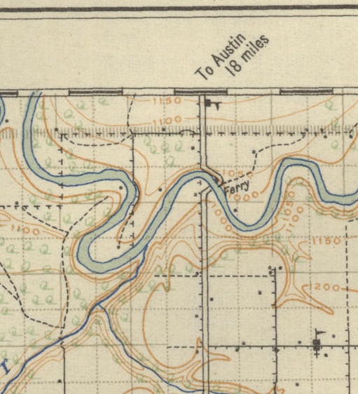 This map from 1922 shows both the ferry and the new bridge. 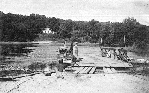 Rae Ferry with residence in the background. Oscar Mays in charge. Mishaps Nelson Drew was captain of the barge when something broke, and let the ferry loose, to float down stream, Mrs. Stockwin, her horse and buggy on it. It followed on the outside of the current and slowed up in the willows. Mr. Drew was able to jump off onto the bank and snub the ferry to a tree. It was some time before they got it towed back to its proper place. A tragedy happened on this ferry in 1950. The river was very high and Edwin Walker went to town in his model A coupe to bring home Mrs. Willis Graham and her seven day old baby. The crossing was unsafe, and as they got on the ferry something went wrong and the car plunged into the turbulent water. All three were lost. |