 Introduction | Pembina River | Cypress and Crystal Creeks Assiniboine River | Cypess River | Here & There | Sources    The Pembina River  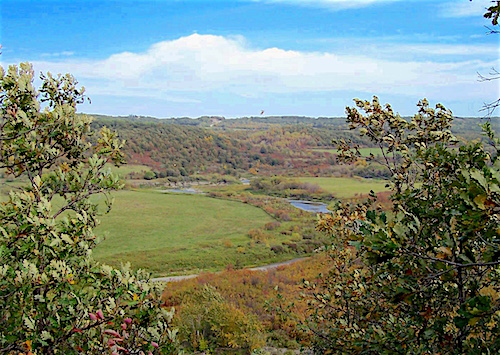 The Pembina River in the Pembina Hills Provincial Park - the final leg of its journey through Southern Manitoba before it dips into the North Dakota. The Pembina River originates on the east side of Turtle Mountain, south of the town of Boissevain. It is a small stream until it tumbles into the Pembina Valley at the outlet of Pelican Lake. 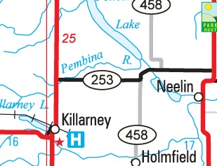 This valley was created as last the ice age ended, a drainage system that emptied a huge body of melt water called Lake Souris, and is the origin of today's Souris River 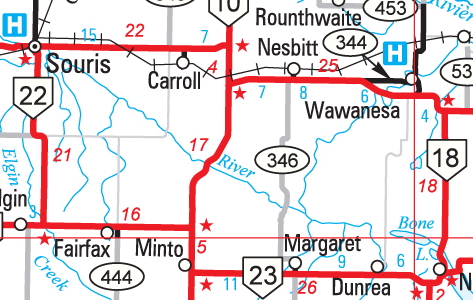 But a curious thing happened to that waterway. A casual look at this map might lead you to think that the Souris River shown here angling southeast from Souris might logically keep rolling in that path instead of making an abrupt turn towards Wawanesa. It used to do just that, but rivers, even large ones, change. As the land in the southern prairies was coming out of the ice age, the glacier receded, melting on its way, the waters gathered, waited, and then followed the ice. They gouged deep trenches into the gravel and shale as they fell northwards. In a particular stretch of southern Manitoba, one such stream proceeded southeast from about Souris before emptying into what was to become the Red River. Their combined waters then flowed northwards into the retreating sea. As the ice disappeared, the thick shell of the earth, feeling the effect of a much-lightened load, began to rise. A steep-walled gorge was created as the river it cut through an old delta, and through an ancient seabed. Then, as now, a river tends to grow weary of its course and take every opportunity to strike a new one. They erode the outer banks until a new path of least resistance opens and the water follows. But in this case more powerful forces were at play. As the earth's crust rebounded, the increased elevation overtook the stream's effort and it found its path blocked, or rather, it found an alternate route. It was "captured" by a northward bound tributary of the Assiniboine, and abandoned its ancient spillway at a point called the Souris Bend or the Souris Elbow of Capture, just north of present-day Margaret. It changed course and headed towards Wawanesa and became the river we know today. 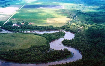 The Souris Elbow of Capture - looking east. The river takes a sharp left, but it used to continue straight ahead into what is now the Pembina Valley The old course, heading southeast towards Ninette became the Pembina Valley, although the stream that bears that name didn't, as we've seen, join the valley until the southeast end of Pelican Lake. Then another curious thing happened. Flow from the upstream portion of its basin (Souris River) has been diverted out of the valley to the Assiniboine. Since this 'capture', much less water flowed through the valley downstream. Steep-sloped tributaries began to dump sediment onto the valley bottom. The Pembina River, the small river that now occupies the valley through the area, was not large enough to cut through this sediment, so 'dams' have formed across the valley where tributaries meet it. These fan-shaped dams have formed Pelican, Lorne, Louise, Rock and Swan Lakes. 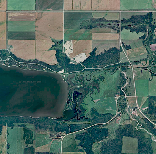 This GE image of the east end of Rock Lake offers a good example of how this looks from above. The ends of Pelican Lake and Swan Lake look much the same. From that point it flows unimpeded through the remainder of its course. We will start our exploration of the Pembina River Crossings at Rock Lake and proceed downstream. Pembina River Sites 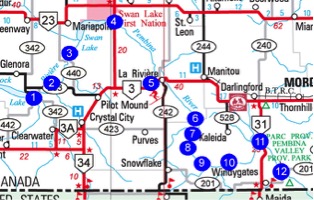 1. Dempster's Crossing: N49.20788, W99.08398 2. Wilson Bridge (Marringhurst Area): N49.22155, W99.03496 3. Vassart's Bridge (Freedy Bridge): N49.28067, W98.98853 The Creamery Bridge Site: 49.29569, W98.97159 4. Swan Lake Crossings: Bridge 1: N49.36367, W98.83973 Bridge 2: N49.35471. W98.81764 5. LaRiviere Area West Bridge: N49.24057, W98.67532 South Bridge: N48.23229, W98.68082 New South Bridge: N49.23233, W98.68091 6. Kaleida Area SE: N49.13187, W98.56363 7. Pembina Crossing: N49.14831, W98.56400 8. Smith's Bridge / Hamilton Crossing: N 49.07517, W98.59004 9. Connor's Bridge: N49.05531. W9853738 10. McLeod's Bridge: N49.05749, W98.46983 11. Windygates Bridge: N49.09315, W98.35133 12. Holo Crossing: N49.09316, W9835129 1. The Pembina River: Dempster's Crossing N49.20788, W99.08398 The first settlers in the Marringhurst district, just east of where Glenora would later be located, were Mr. and Mrs. John Wilson, sons Richard and James, and daughter Louise. They crossed the Pembina River a mile east of Rock Lake and settled on their homestead just a short distance to the north. It was a popular crossing, but even the most advantageous crossing can be deceptively dangerous. One very early pioneer tried crossing the same spot east on a sand bar had his ox drown ox was drowned. He walked the rest of the seven miles home. Soon someone established a makeshift ferry, described as "a raft tied to a tree." Locals referred to it as Dempster's Crossing. 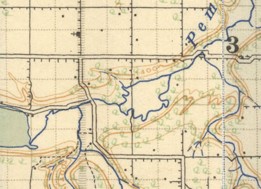 The current bridge is now located on or near that spot. 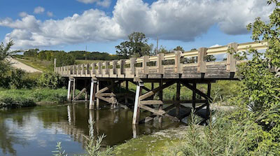 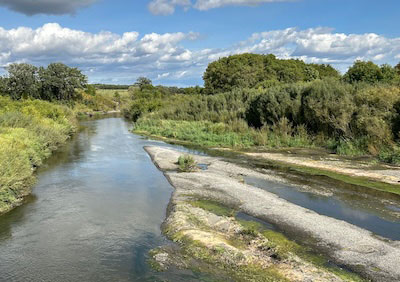 The view from the bridge today. 2. The Pembina River: Wilson Bridge (Marringhurst Area) N49.22155, W99.03496 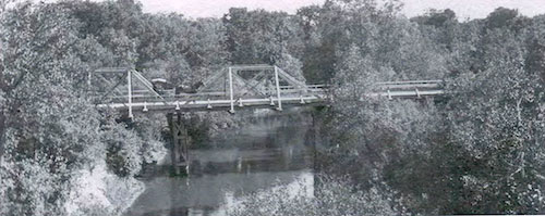 The first bridge in the Marrihghurst area was built in
1879. (PMA)
As mentioned before, the John Wilson family were Marringhurst pioneers. Mrs. Wilson was the first white woman to settle in the district. Their farm was a stopping place for homesteaders who had just forded the Pembina on the way farther west and the Wilsons were renowned for their hospitality. With the help of neighbours they built a bridge across the Pembina River in the winter of 1879-80. They built it a little closer the to their farm than the original crossing. 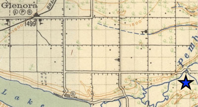 This image from 1922 shows the Wilson Bridge a few kilometres upstream from the Dempster Crossing near the east end of Rock Lake. 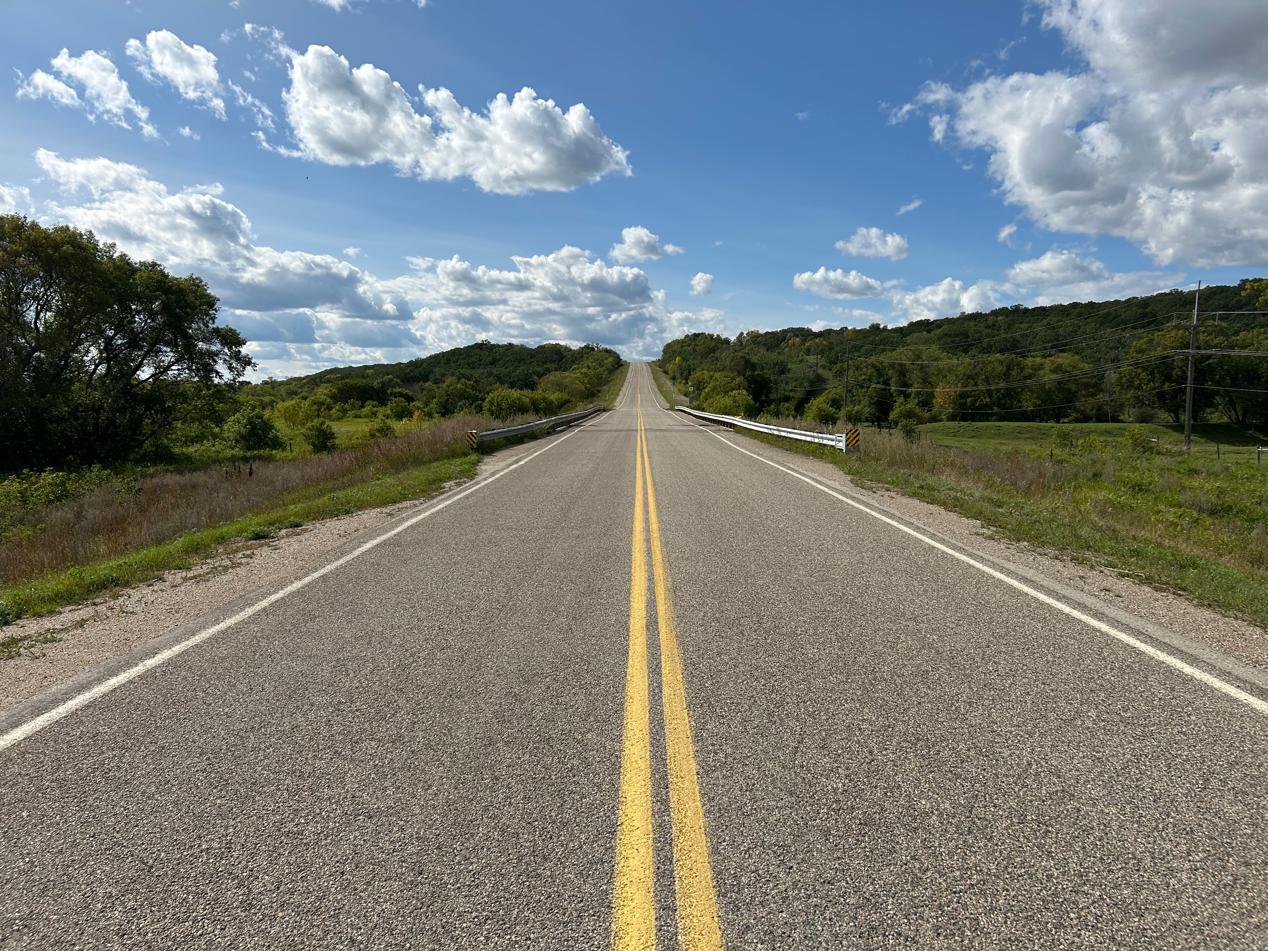 The "new" bridge in 2026. Good spots to ford a river are often not good spots to establish a ferry. Ferries require an easy smooth access to the river, but they also require a certain depth of water. Bridges on the other hand sometime works better with more defined riverbanks containing a narrow channel. 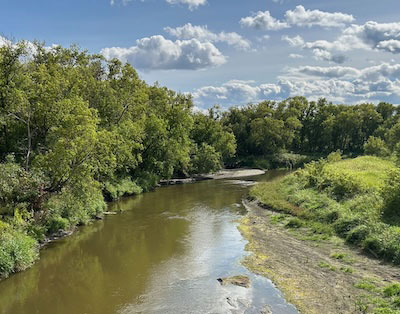 This view northwards from the Wilson Bridge shows a likely spot for a ford and may well be a crossing location for the early pioneers. 3.The Pembina River: Vassart's Bridge & Creamery Bridge N49.28067, W98.98853 The short stretch of the Pembina River joining Swan Lake with Rock Lake features an active bridge in the Dry River area. 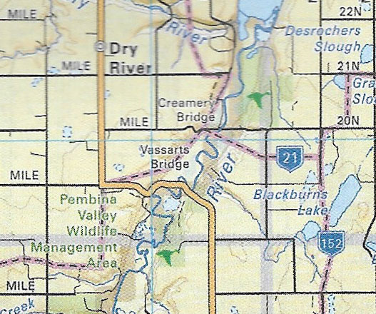 Backroad Maps identifies the bridge as Vassarts on Rd 19 N. It was also known as Freedy's. The same map shows Creamery Bridge just to the north at Rd 20N. Google Earth and a recent site visit confirm that the Creamery Bridge is no longer there. 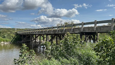 Vassart's Bridge in 2026 The Creamery Bridge Site 49.29569, W98.97159 A look at a map from 1922 shows the Creamery Bridge was once on the main route. Although I could find to record of the fate of the Creamery Bridge the most likely possibility is that when it was no longer safe, or in need of maintenance, a better route was found nearby. 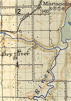 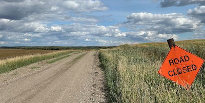 The road to the Creamery Bridge site. 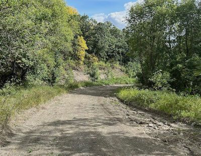 As often happens the first site chosen for a crossing remains the more scenic route. The road to is still passable in dry weather. Otherwise, it s bit of a hike. 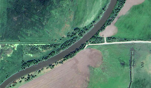 Google Earth shows that it is more accessible from the east side. Local history refers to a Creamery Road. I could find no record of a creamery in the region, but creameries like the one in Pilot Mound would pick up loaded cream cans from farms on established routes. There must be a story there. 4. The Pembina River: Swan Lake Crossings Bridge 1: N49.36367, W98.83973 Bridge 2: N49.35471. W98.81764 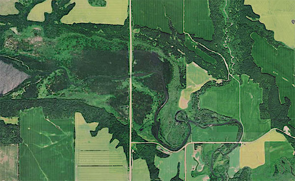 There are two bridges over the Pembina River as it exits Swan Lake. The #34 Highway Bridge (#2) is at the centre of this image. Before Highway 34 was built the main route south from the Town crossed the river on Sheffield Hill Road (1). 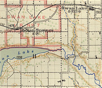 This map from 1922 tells us that the Sheffield Road route was the first crossing to get a bridge. Later, a more direct route was used along today's Highway 34. 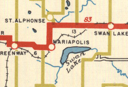 The Manitoba Highway map from 1936 shows the main route still went directly south from the town. 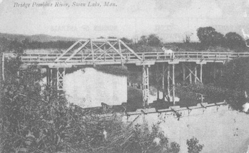 The Swan Lake Bridge on Sheffield Road in 1900. 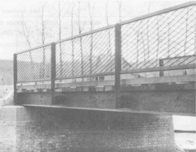 Upgrades in 1916 included a stronger beam and masonry abutments. 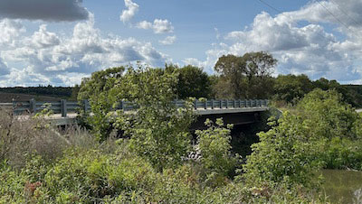 The Sheffield Road Bridge in 2026 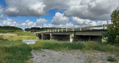 The Highway 34 Bridge 5.The Pembina River: LaRiviere West Bridge. N49.24057, W98.67532 South Bridge. N48.23229, W98.68082 New South Bridge N49.23233, W98.68091 Before ferries were installed and bridges built, navigating the various fords could be perilous. Oxen could swim and people could cross in the wagon box. In LaRviere, a wooden bridge was built in 1883. A second bridge, with stonework at each end, was built higher up, in 1901. This was called the Iron Bridge or the Red Bridge. 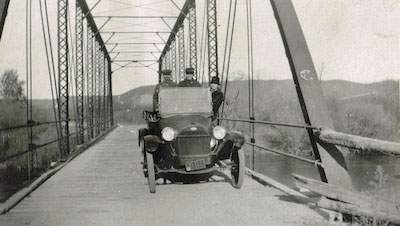 The Iron Bridge or Red Bridge from1903 was used until the new Maurice Ridley Bridge was opened in1960. Photo from the Connor Collection, PMA. 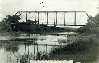 The bridge in 1918 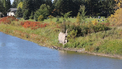 The concrete and stone abutments visible to the west of the current bridge were constructed in 1901 to support the second bridge at the site. 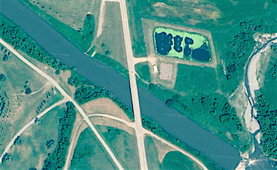 An overview 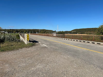 The Maurice Ridley Bridge LaRiviere North Bridges are expensive to build and to maintain. As cars
became common,
and municipalities expanded, enhanced and maintained roads, it was no
longer a hardship to drive a few extra kilometres to get to town or
visit a neighbour. The trend was to abandon bridges that had fallen
into disrepair, or as often happened, been damaged by flooding or
oversized loads.
This was especially true with a river like the Pembina that travelled in a deep wide valley. That left long stretches, like the path from LaRiviere to Swan Lake without a crossing. At first some of these bridges were missed, but accelerated rural depopulation reduced the demand. 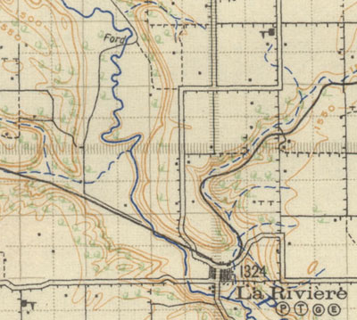 Today there is a modern bridge over Highway #3. Both a ford and a bridge appear in the first few kilometres northwest of town on this 1922 map. Then there is a long stretch of uninterrupted river valley until Swan Lake. 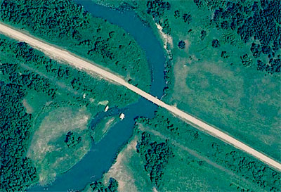 The road NE ran alongside the rail line. 6. The Pembina River: The Kaleida Area SE of Kaleida N49.13187, W98.56363 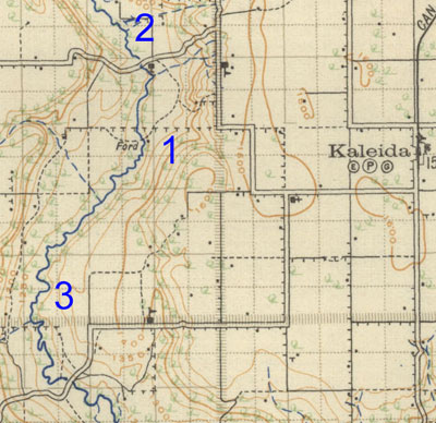 This map from 1922 shows a ford west of Kaleida. (1) In the early days fords like this provided the direct route westward from Kaleida. Soon bridges would replace fords at Pembina Crossing (2) and on the route to Snowflake (3), but fords remained useful for local travel. 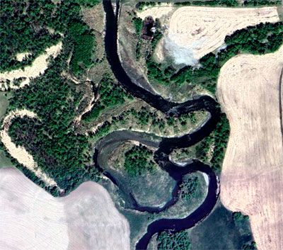 Both the map and Google Earth show traces of the former trail. 7. The Pembina River: Pembina Crossing N49.14831, W98.56400 "There is no more historic site in southern Manitoba," noted the 19 April 1897 edition of the Manitou Mercury in referring to Pembina Crossing. The original ford, and a bridge built by the Boundary Commission in June 1874, was located some 300 yards southwest of the present site of St. Luke's Anglican Church. Here the NWMP camped for their noon meal on Tuesday, 14 July 1874. 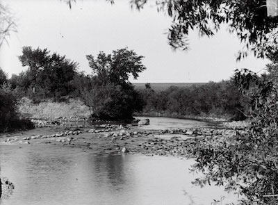 A photo of the ford site by Cecil Guest. (PMA) The ford at Pembina Crossing was used by the Aboriginal travellers and by the Metis and their Red River carts on their way to the buffalo hunt until the 1860s. The ford was also used by the Boundary Commission, and the north West Mounted Police during their treks through southern Manitoba. The bridge over the river was built to the west of the ford. 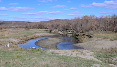
This photo was taken from that bridge. A pioneer account: "The third day brought them to the ford at Pembina crossing, located a few hundred feet downstream from the site of the present bridge on route 423." From Meet You on the Trail by Felix K (PMA) By 1878, only traces of the bridge built by the road construction crews of the Boundary Commission remained and, the following year, it was replaced. Its engineers were several settlers from the Paisley district of Ontario who had taken up land in the vicinity of Pilot Mound. In 1879 Mr. Winram obtained a grant to build a bridge. That bridge served for a short time. 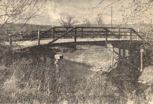 One of the earliest bridges at the site. 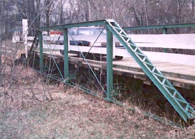 The Agricultural Museum in Austin Mb has that bridge . Railway Dreams "Pembina Crossing, halfway between Turtle Mountain and the
Red River,
was to be the divisional point and the location of the bridge over the Pembina River. They, as you know, were unable to secure a charter for this line, but in spite of this, Pembina Crossing continued to expand." The Southern Manitoba West Lynn Times, July1881 The site in 2026 (Photo by Tina August Photography) From the diary of James J. Dougall (recounted in the Story of Manitou) The next morning, we were up at 5 o’clock and got started for the Pembina River, with half our load. It took us till noon to cover about 5 or 6 miles and then we spent the afternoon in bringing up the remainder of the load. Then we camped for the night. May 28th Rose at 4 o’clock this morning, reading for the last lap of our journey. We swam the oxen across the river, took the goods over in a boat, loaded up once more and after a few miles of tough travelling, we arrived at our homesteads that evening, none of us feeling any the worse after a long and wearisome journey. Proceeding slowly down the side of the valley, we arrived at the town of Pembina Crossing. This seems to be destined to be one of the chief towns in the Pembina Mountain district. It already has two hotels, The Valley House, operated by J. Adamson and The Pioneer’s Rest, by W. P. Hutcheson. A flour and saw mill is in course of construction and everything points to the general prosperity of the place. We were warned that the bridge over the Pembina had almost collapsed and on nearing it, we found this to be the case. It was shaped exactly like a W. Unhitching our horses, we lead them carefully over and then returned for our buckboard. Soon we were ready for another start when a hail from an approaching immigrant wagon warned us that aid would be acceptable to the new arrivals. Again the business of unhitching the horses and leading them over, then unloading the heavy load and carrying it across, putting our shoulders to the wheels and pushing the wagon up the steep inclines of the bridge, was gone through. 8. The Pembina River: Smith 's Bridge / Hamilton Crossing N 49.07517, W98.59004 Hamilton, like nearby Pembina Crossing, was one of those
pioneer towns
that looked destined for growth until a railway company decision
changed everything.
It was situated where the old Missouri trail reached the top of the south hills of the Pembina Valley. As of September 16, 1881 it was establishing itself as the commercial centre of the district. A town was surveyed and 20 lots were sold.. All sort off plans were made. The April 29, 1881 issue of the Southern Manitoba Times, published in Emerson/West Lynne, describes the Victoria Day celebration on May 24 and the building of the first bridge over the Pembina at Hamilton Ford in the June 17, 1881 issue, much was made of the future success of this community.  The left half of this image shows 28-2-9W. (PMA) 1 is the site of Hamilton Cemetery. Most of the graves were
later moved
to Snowflake Cemetery.
2 is the point where the Missouri Trail rises from the Pembina Valley, and was the town site of Hamilton. 3 shows the approximate site of the South Ford or Hamilton Ford. This was also called Connor's Crossing and later, the Smith Bridge. The town site of Hamilton failed, when the railroad followed the path to Snowflake three kilometres to the southwest. Bafore bridges were built travelers also used Sims' Crossing, located not far upstream from Smith's Bridge. The First Connor's Bridge The bridge built near the Hamilton Crossing was originally called the Connor's Bridge after Archie Connor who homesteaded at that location. That name was later applied to a bridge a few kilometres downstream. Mr. Archie Conner chose his homestead in the valley north of the river, where the old Missouri Trail crossed through. Here there was always feed and rest for the horses, and a good meal and a clean bed for the weary travellers. They might arrive late at night but shelter was always prepared for them. Mr. Conner built and operated a small ferry.  Connor's Crossing about 8 km northeast of Snowflake is mentioned in several pioneer accounts. "The next morning, we were up at 5 o’clock and got started for the Pembina River, with half our load. It took us till noon to cover about 5 or 6 miles and then we spent the afternoon in bringing up the remainder of the load. Then we camped for the night." Snowflake news June 17th, 1881: "The bridge over Pembina River is now completed and council has passed it. Glory! The long looked-for and wished-for is here."  The region as of 1922  The remains of the first bridge at Connor's. Photo from the Connor Collection PMA  Taken shortly after the collapse . Cecil Guest  The second bridge  The bridge today is known as Smith's Bridge and serves mostly local traffic. It is quite a scenic drive. 9. The Pembina River: Connor's Bridge N49.05531. W9853738 The Back Roads map shows what is essentially the second location of a bridge named after the Connors family. It was near the home of James Connor. 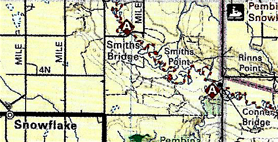 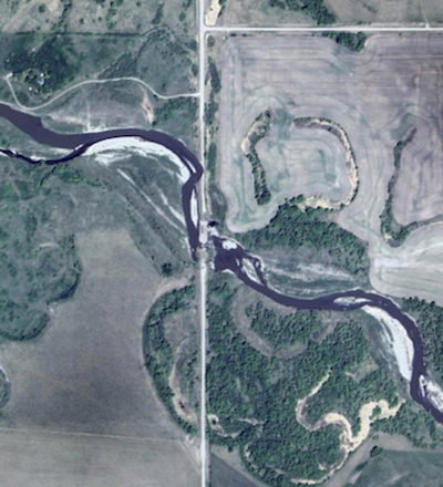 The first bridge there was replaced by culverts and the crossing was later abandoned. 10. The Pembina River: McLeod's Bridge N49.05749, W98.46983 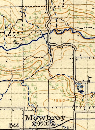 McLeod's Bridge replaced an earlier ford on the route from Kaleida to Mowbray. 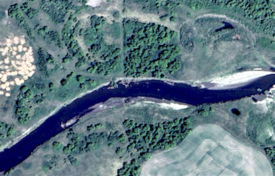 Ford at: N49.15167, W98.49244 Note the ford was to the east of bridge. Pioneer reminiscence provides plenty of river crossing adventures and mishaps. They mention that there were several crossings that have been long forgotten without being specific as to the exact locations. Here are two Google Earth clips that show evidence of former crossings. The sign of a trail that approaching from each side that is still visible after all these decades is a pretty good indicator. 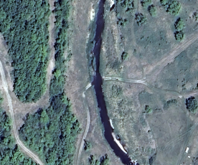 N49.04318, W98.54784 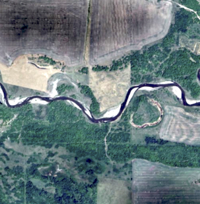 N49.04647, W98.50638 11. The Pembina River: Windygates Bridge N49.09315, W98.35133 The route from Darlingford to the US Border at Windygates takes you through across the Pembina River at the Windygates Bridge. 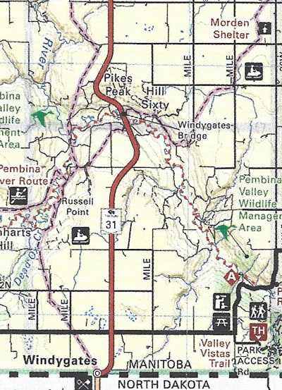 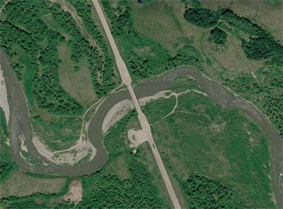 The view from above. 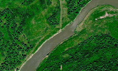 To the west at: N49.09021, W98.36907 there are telltale signs of an earlier crossing. The good news for travellers on the Boundary Trail is that the Pembina River is a relatively small stream and locations for fords were well identified. Of course the twisting nature of the stream meant that on a journey from Emerson to Cartwright one might have to cross it three times! 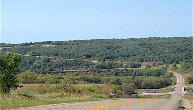 12. The Pembina River: Holo Crossing N49.09316, W9835129 The last crossing before Provincial Road 201 lead us into the Pembina Valley Provincial Park, and the Pembina River dips into North Dakota is called Holo Crossing. Today a modern bridge crosses the river. 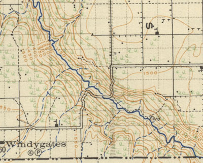 Note the ford marked to the east of the bridge From the 1-6 history book... Butler (Olsen) Holo and his wife, of Norwegian descent, were among the first immigrants to settle in the Akra-Cavalier district of N.D. They lived there for several years before coming to Manitoba. While in the U.S., he served in the Grand Army of the Republic 1861 - 1865 and received a lifetime pension. For a short time after coming to Manitoba, they lived near Morden before staking a claim on NW 18-1-6. When the land was opened for homesteading he filed on this quarter where they spent their remaining years. He then changed his name from Olsen to Holo. 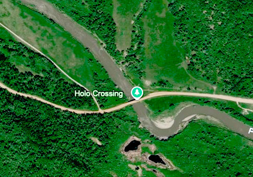 Overview 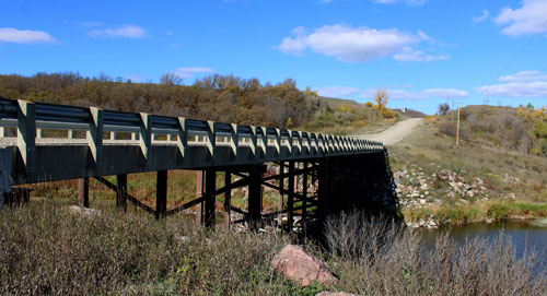 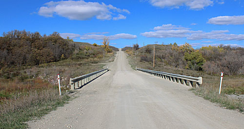 The site in 2021 |