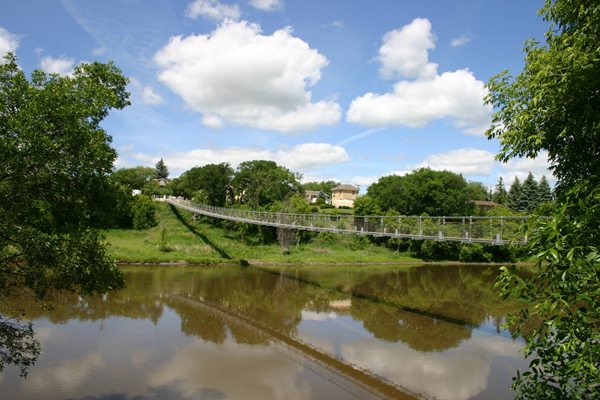
 |
 |
 |
Stops on the Journey
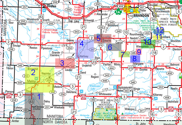
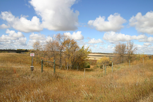
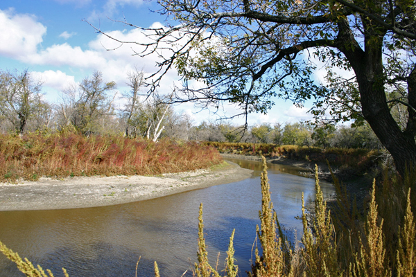
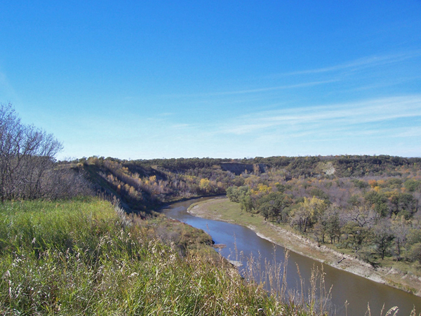
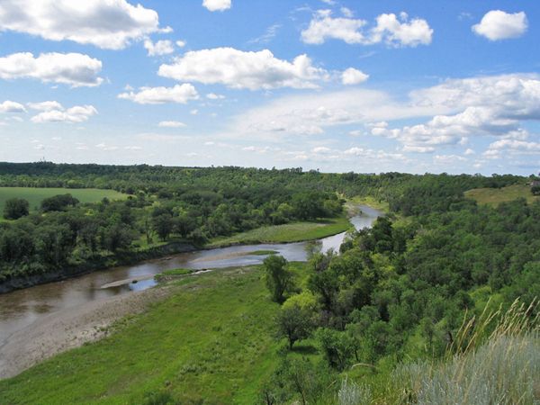
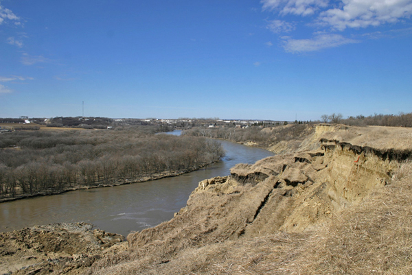
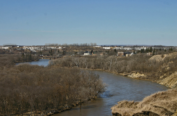
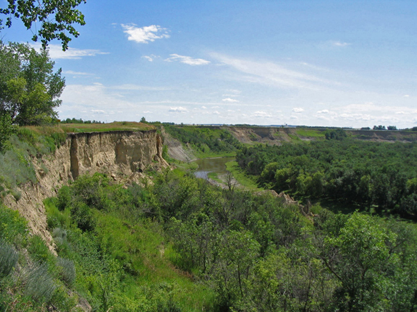
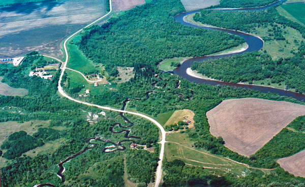
The region today
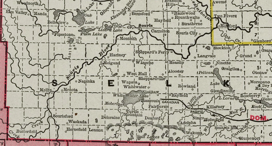
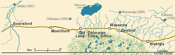
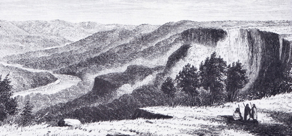
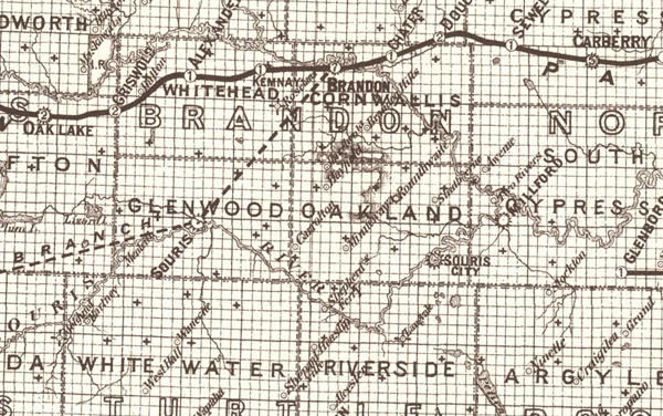
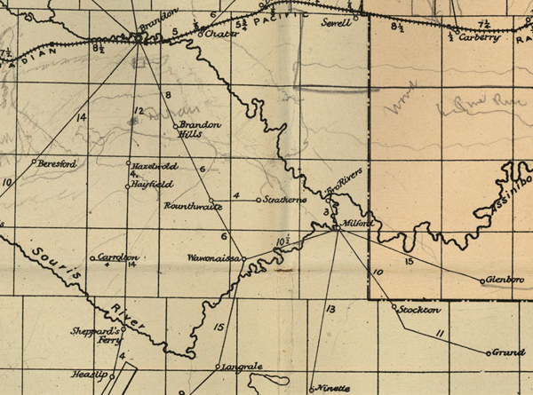
A Map from 1885 - Note some of the place ames are no longer there and some have moved.
Chapter 1: Coulter, Sourisford & the Crossing
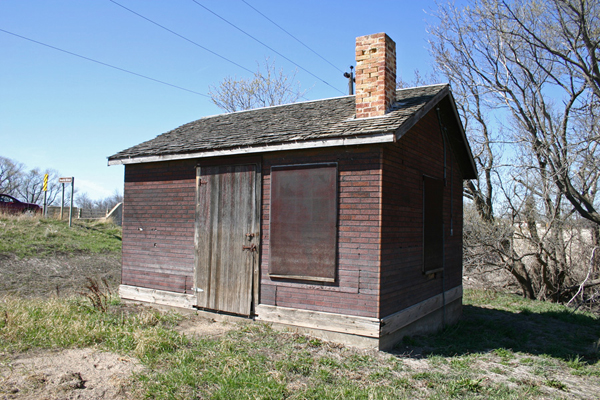
Coulter
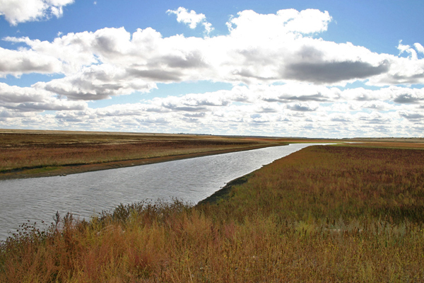
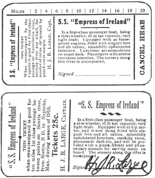
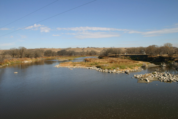
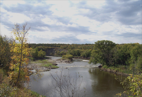
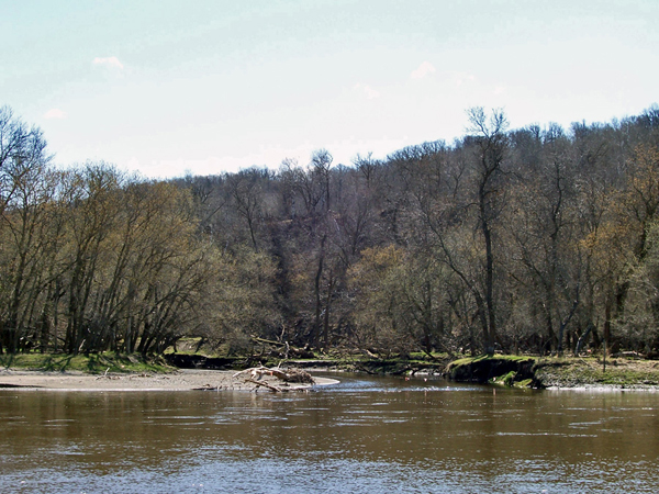
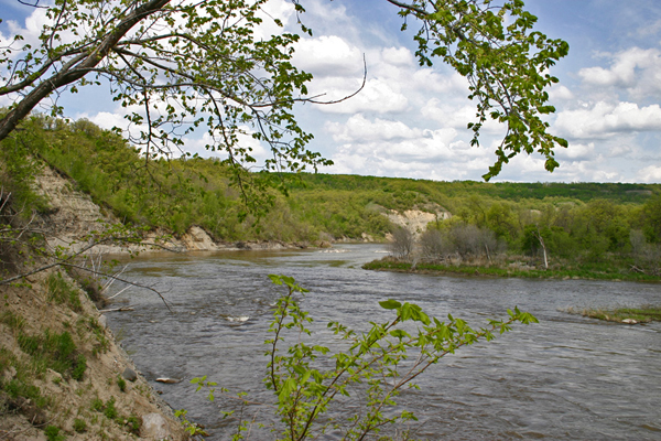
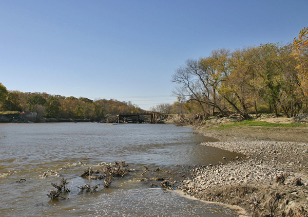
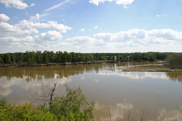
| The
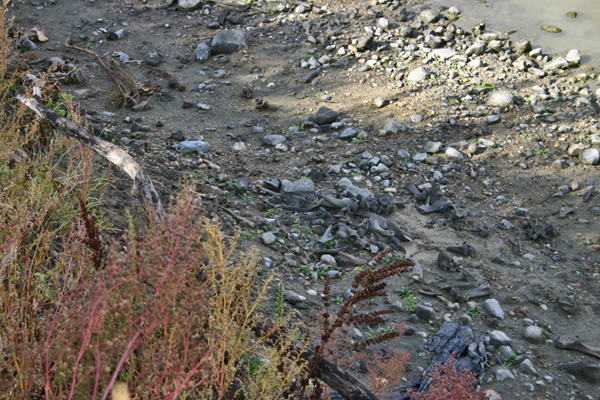
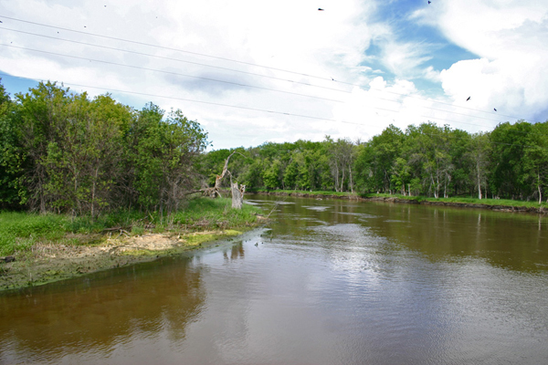
Souris River, seen here near Coulter, enters Manitoba from North
Dakota and runs through level prairie for the first part of its
journey. The village of Coulter, while not situated along the river,
does have a role to play in the story. Local blacksmith, team engineer,
and master mechanic Hunt Johnston Rolston Large built a steamboat to
ply the river. It was launched in 1909 and served for a short while
before being moved to Brandon and put to other commercial use. |
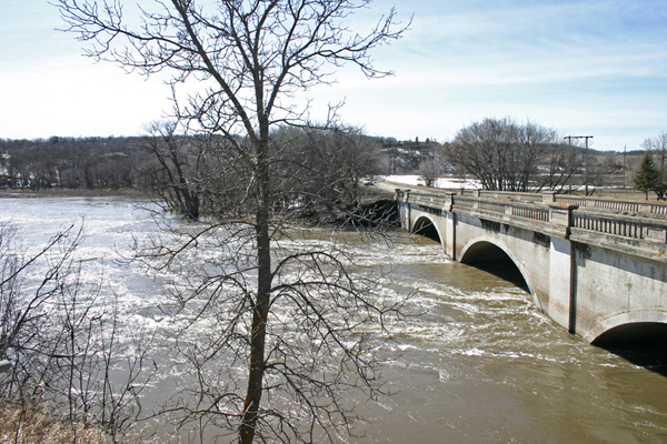
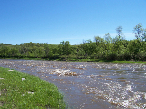
| On
this flat land, even a minor flood can cover quite a bit of farmland.
Higher water can do real damage to roads and bridges. |
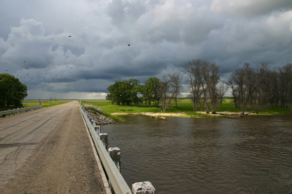
| A
damaged bridge east of Coulter. |
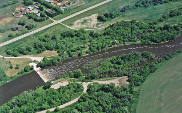
Coulter Park
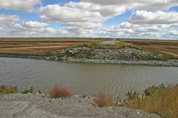
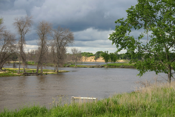
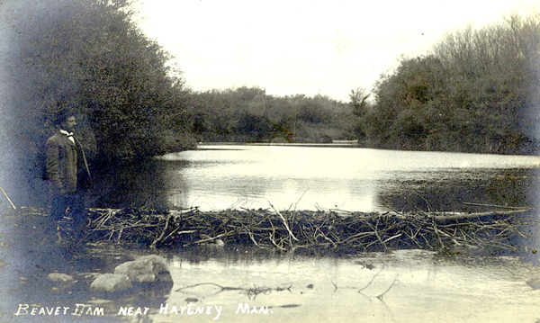
| South
Antler Creek enters the Souris in Coulter Park. |
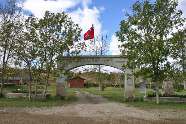
| Today,
Coulter Park is the location of one of the earliest regularly used
recreation sites in rural Manitoba. On July 1, 1882, the first Pioneer
Picnic was attended by a few settlers and local aboriginals. A
tradition was established as each year a larger group attended the
Picnic. Since then, picnics have been held in the grove every summer. |
| High
water at Coulter Park - also prone to damage from floods. |
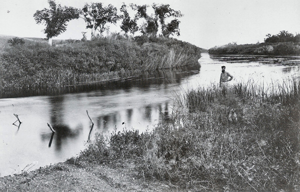
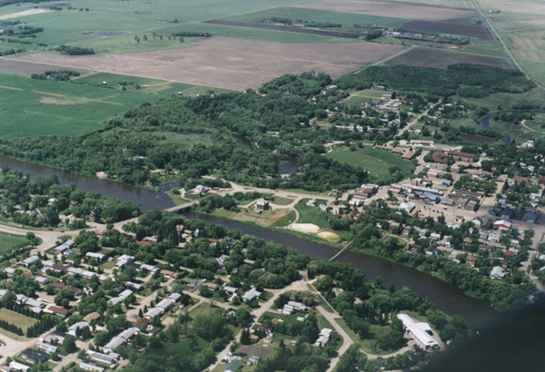
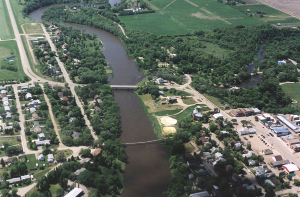
Sourisford Crossing
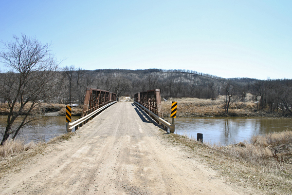
| The
Crossing at Sourisford just
downstream from Coulter Park,
and used for centuries by Aboriginals, Metis Hunters and Traders, was
also used by the International Boundary Commission, beginning in 1873.
It became a hub of local settlement - and the beginnings of a
village. The
Boundary Trail descended to the valley here. |
| The
path of the Boundary Trail. |
| The
Crossing |
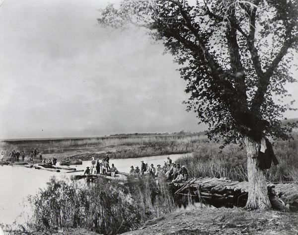
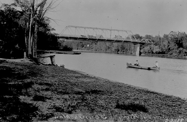
| The
Boundary Commission built a temporary bridge. A few years later
settlers used a ferry service. |
"Sourisford: The History of a River Crossing."
"Kitchen Table Surgery" - Vantage Points
"Sourisford" - Vantage Points
"Against All Odds" - Vantage Points
Chapter 2: Melita & Napinka
The Brockinton Site
Also in the Sourisford neighbourhood, The Brockinton archaeological site is located along the Souris valley wall south of Melita. This site was occupied by three different cultures over the last 1600 years. These occupations left behind rare and archaeologically invaluable finds.
\
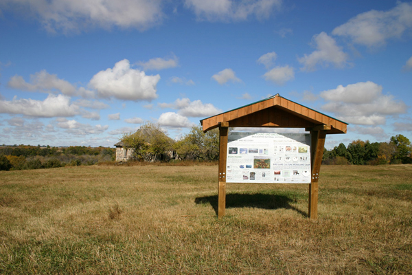
An Interpretive Sign outlines the importance of the location
"The Brockinton Site" - Vantage Points
Bison bones are readily found along the riverbank.
Melita
Napinka
|
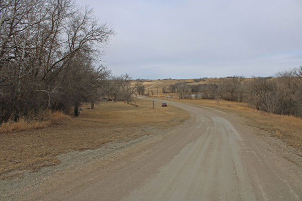
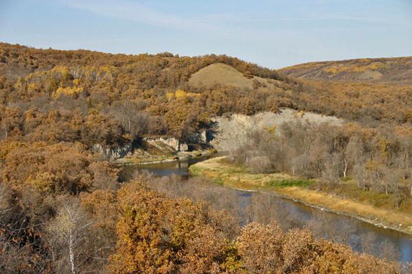
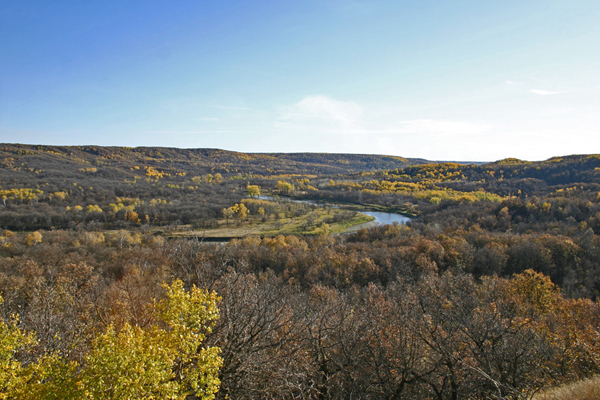
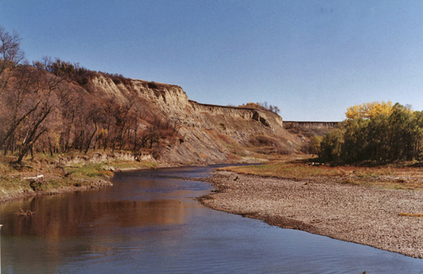
Chapter 3: The Lauder Sand Hills:
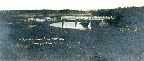
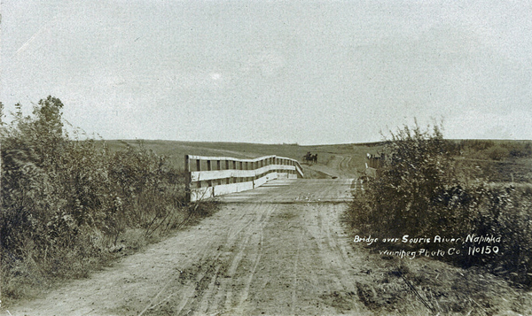
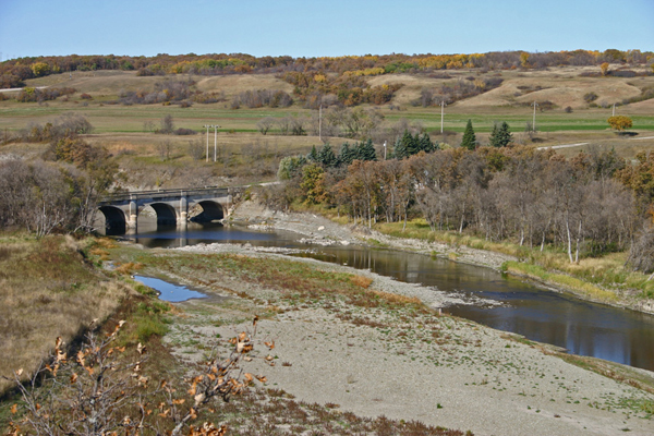
The Bridge on Road #254
| South
of the village of Lauder the river enters the Lauder Sandills, and we
see the first transformation in the topography. Note the sand on the
low
banks. |
|
As
the river proceed into the area, the banks become higher as the river
twists through dunes that were wind-shaped on a huge delta.
"The Lauder Sandhills" - Vantage Points "The People of the Lauder Sandhills" - Vantage Points |
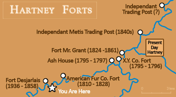
The Fort Desjarlais Site
|
Fort
Dejarlais was situated here from 1836 until 1856. The commercial centre
of the district, it was home to up to 75 people.
"Fort Desjarlais" - Vantage Points |
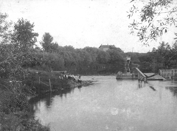
|
The
river between Lauder and Hartney was a busy spot in the 1800's
"The Souris River Fur Trade" - Vantage Points "Fort Mr. Grant" - Vantage Points |
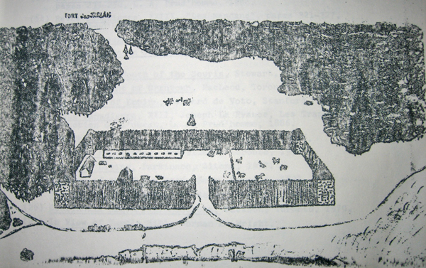
|
Hartney
historian, Larry Clarke, sketched the fort, based on his extensive
research.
|
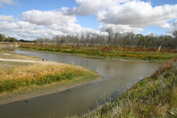
Chapter 4: Hartney & Mentieth
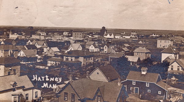
| Hartney
in 1908 - note the bald prairie |
| The
original "Hartney" was a Post Office/Store on the James Hartney
homestead located about two kilometres north of the river. The CPR was
persuaded by local residents to locate a town nearby. They placed it
closer to the river, and to the bridge they constructed. Locomotive
steam engines required water and the railway companies often would
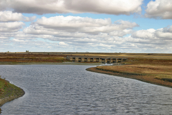
build a dam to ensure a stable supply. |
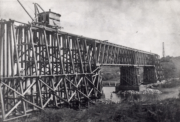
The Hartney Dam
|
CPR
Dam near Hartney - under construction
|
|
The
Pumphouse
|
Mentieth
| The first railway Railway
Crossing south of Souris. |
Chapter 5: Souris
|
The
Souris River entering Souris from the southwest.
|
|
Overviews in 2001. Many
riverside town constructed dams, as river
levels can be very low in the fall.
|
|
The
first traffic bridge.
|
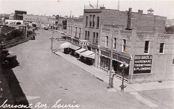
| Crescent
Avenue overlooks the steep valley wall. Until this point, where Plum
Creek enters the Souris from the northwest, the river has wandered
through flat plains and gentle rolling county, contained (or sometimes
not contained, within low banks and almost non-existent valleys. For
the rest of its journey there are spots where the valley is deep and
the valley walls have been etched into steep cliffs. |
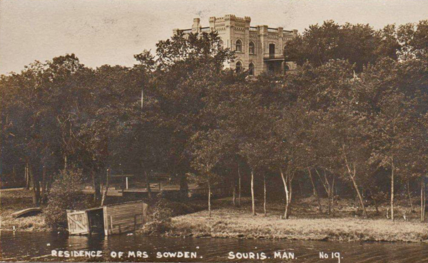
|
Squire
Sowden established the settlement in 1880. It was called Plum Creek.
|
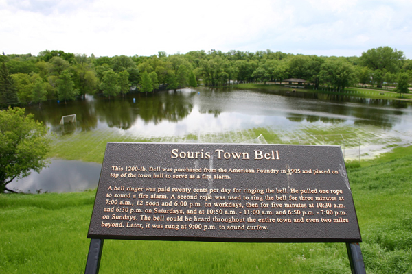
| Souris
saw serious flooding in 2011. The rising water eventually destroyed the
Swinging Bridge. It has since been replaced. |
Chapter 6: Bunclody
Bunclody was established as a Post Office in 1884 and became somewhat of a village in 1906
when a railway line linking the U.S. and Brandon crossed the Souris River near the site.
The Store / Post Office was in the clearing on the left.
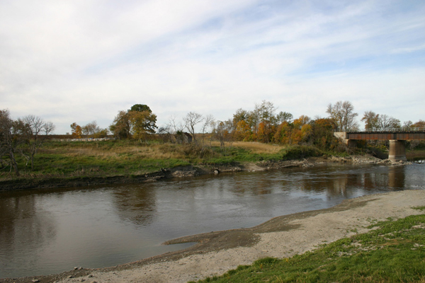
| Steep
cliffs, like those seen along Crescent Avenue in Souris, can be found
as
the river approached the tiny village of Bunclody. |
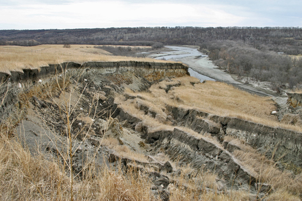
| The
previous picture was taken prior to 2011, when flood waters undercut
valley walls and caused slumping such as seen here. |
|
Looking
east from the Bunclody Bridge.
|
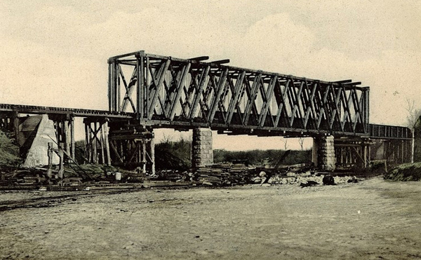
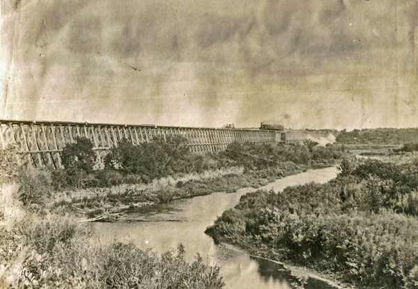
| This
shot shows the Brandon, Saskatchewan and Hudson's Bay Railway line,
which operated from 1906 until 1936. In this photo, the railway bridge
which was top left, has already been dismantled. |
|
Bridge
Construction
|
| A view of the crossing site
with the rail bed still very visible along the bottom of this photo.
The elevator and station were just to the right. Bunclody History |
Chapter 7: Riverside
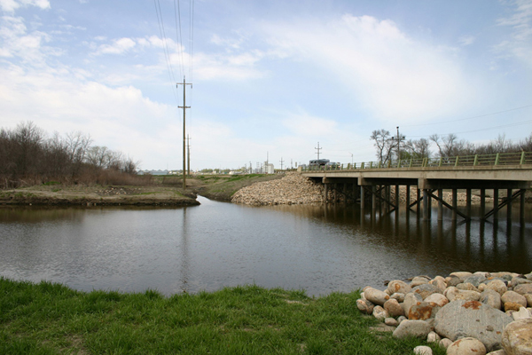
| Almost
directly south of Brandon Highway #10 dips through the wide deep
valley. This spot was the site of Sheppard's Ferry in pioneer times,
and three successive bridges. The remains of the first bridge were
visible in the early 2000's just to the right of this photo. Flood
waters seem to have since washed all signs away. The bridge in the
middle served from about 1929 until the 1960's. It is still intact and
used for local traffic. The new bridge at the left now carries the Highway #10 traffic. |
|
The
view east from the Old Bridge
|
|
Overview
Built at a cost of $34,528 by the Winnipeg construction firm of Macaw and MacDonald, this concrete arch bridge was formerly the primary crossing for Provincial Highway No. 10 over the Souris River. It has been superseded by a newer bridge to the west but is still used for local traffic. |
|
The
"New" bridge.
|
Riverside Park
Liskum Campbell resided in Riverside District 1890 – 1947. He built a cable ferry, store, gas pumps, and dance hall known as Riverside Park. The remains of the Dance Hall can be seen along the riverbank to the right of the "Old Bridge"
A Public Park on this side of the river, between the two bridges, has recently been renovated after the flood of 2011.
|
High
water.
|
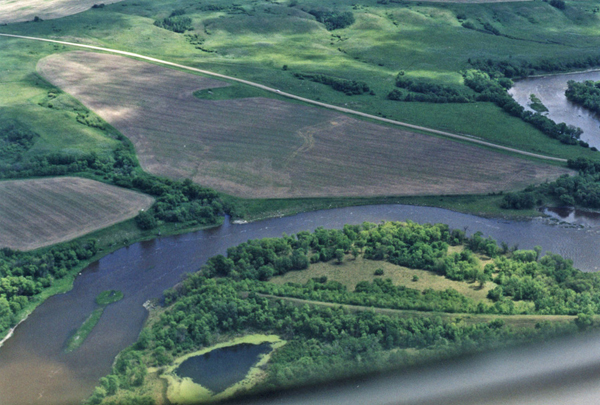
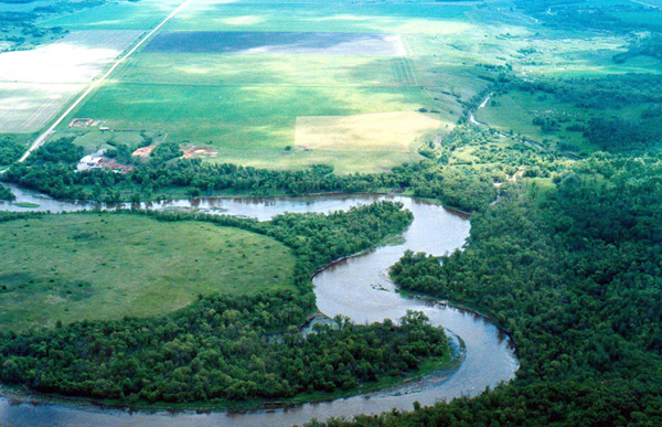
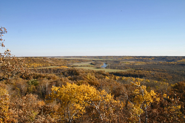
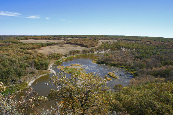
Chapter 8: The Souris Bend
| As
the last glaciers retreated the meltwater form a huge river flowing
east. The
speed of the earth’s rebounding crust finally overtook the stream’s
effort to entrench itself and it found its path blocked, or rather, it
found an alternate route. It was “captured” by a northward bound
tributary of the Assiniboine, and abandoned it’s ancient spillway at a
point called the Souris Bend or the Souris Elbow of Capture, just north
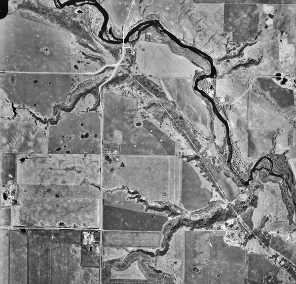
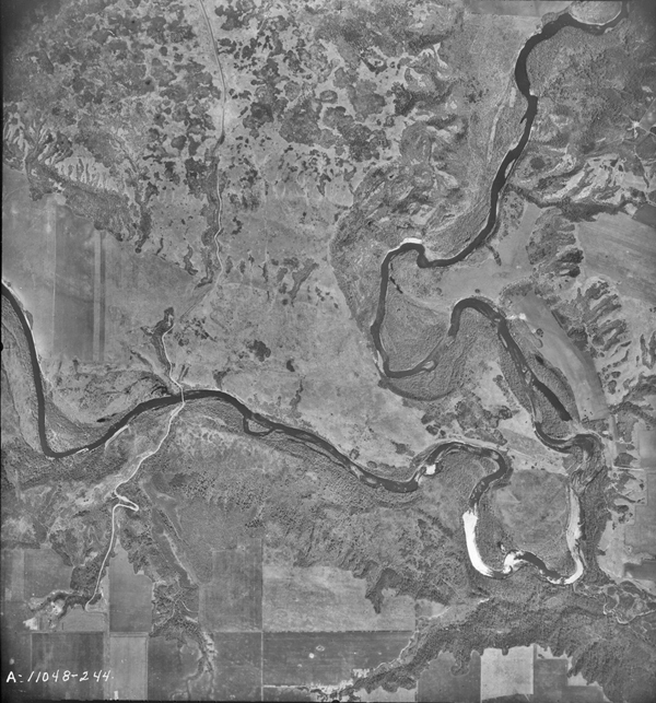
of present day Margaret. A road, visible in the aerial photo twists down the wide deep valley and crosses the Souris. |
|
McKellar's
Bridge.
|
|
The
view west from McKellar's Bridge.
|
|
The
"Elbow of Capture"
A small stream flows in from the southeast, along the route that the Souris once took in the other direction. |
|
The
"Elbow of Capture"
|
| Lang's
Crossing, at the foot of these rapids, was a level shallow spot that
horses and wagons could cross except in the early spring. |
|
A
modern use of the crossing. The extensive trails in the Souris Bend
Wildlife Management Area are maintained by an Equestrian Club.
|
The "Crossing" was near the right side.
|
Rugged
country and isolated wilderness typify the valley for several
kilometres.
|
|
A
long view of the Souris Bend.
|
| "The Souris Bend
Story" |
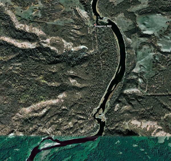
Chapter 9: The Gregory Mill
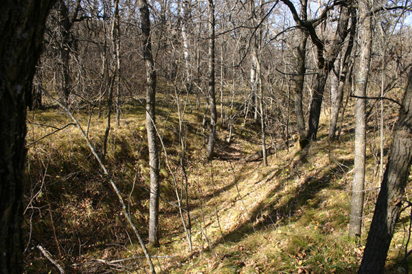
| One
of the Hiking Trails in the Souris Bend Wildlife Management Area takes
you along the valley's edge and down to the site of Gregory's Mill. |
|
The
site today...
|
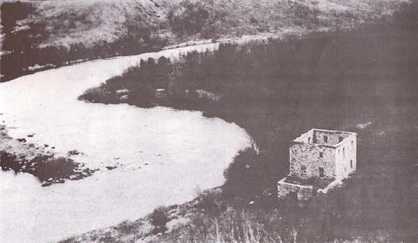
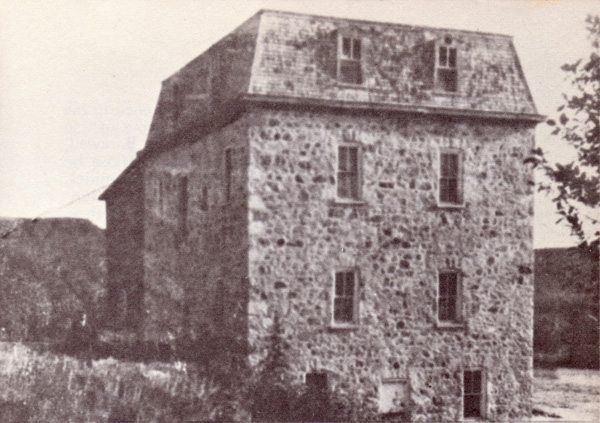
| The
site in earlier times - taken from the same high hill to the south of
the site. |
|
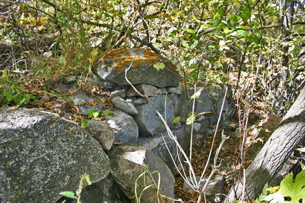
A
few remnants of walls and piles of stones are hidden in dense bush.
|
| The
300 metre long millrace took diverted water to the mill. It is now part
of the Hiking Trail and visible on Google Earth. |
| The
Gregory Mill Story |
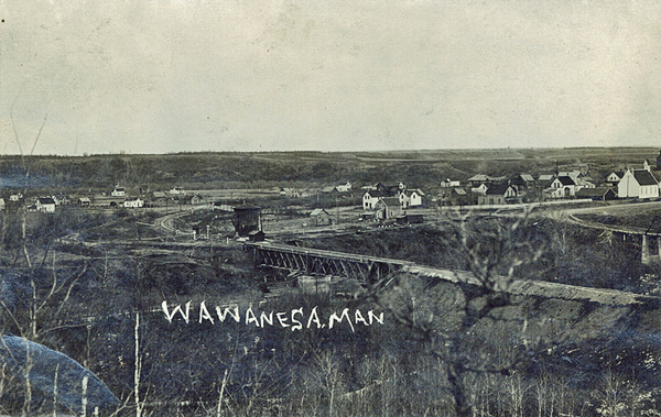
Chapter 10: Souris City & Wawanesa
The Souris City Site
| The
river enters a horseshoe bend as it approaches Highway #2 near Wawanesa. |
| In
the flats surrounded by the bend the village of Souris City was
established in 1881. It soon became one of the most important villages
in the southwest corner - but for a short time. |
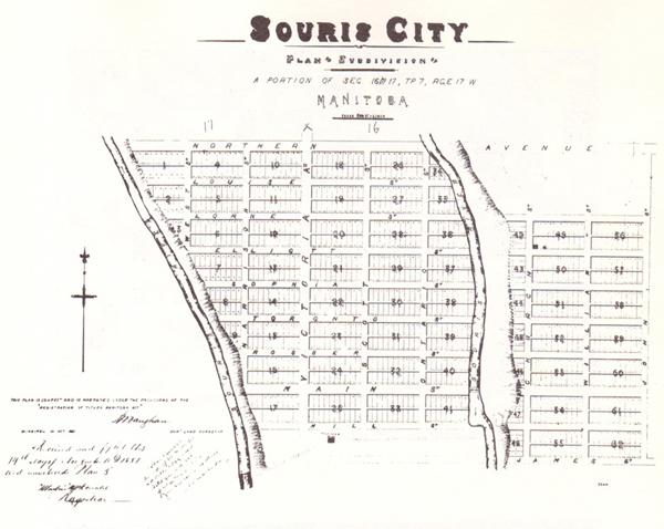
| The
Souris City Story |
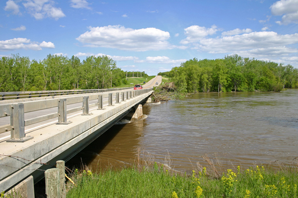
| The
Bridge on Highway #2. It was re-built after the flood of 1976 and
withstood the floods of 2011 and 2013. |
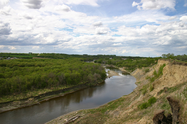
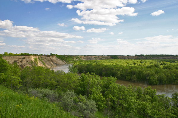
Wawanesa
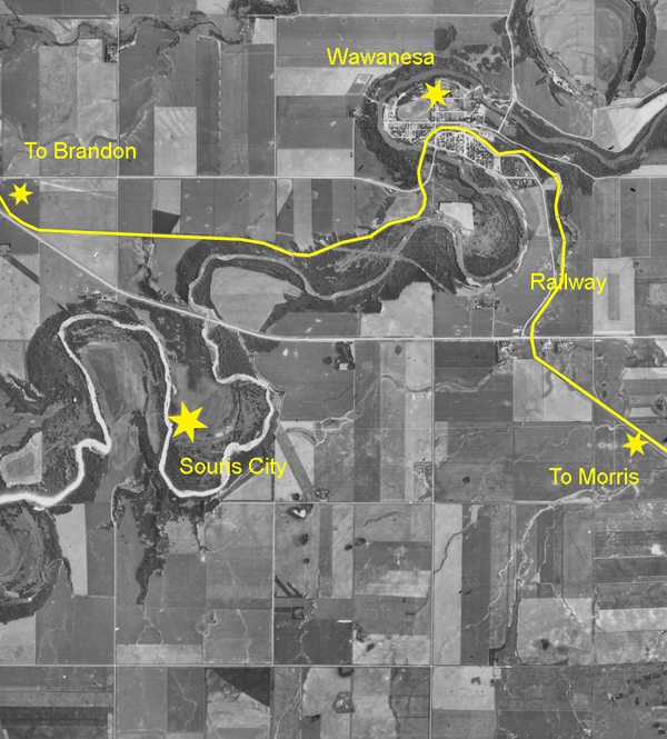
| In1889
the residents of the well-established village of Souris City
hoped that the new rail line being built from Morris to Brandon might
pass through their town, but the railway engineers found a route that
suited them better. Crossing the deep valley of the Souris River was a challenge and the engineers were willing to take a few twists and turns to avoid a difficult crossing. Note the twisting path they took. |
| Approaching
Wawanesa |
| Looking
back as one approaches the town. |
| Another view of the town. Note the
slumping that occurs from time to time as the river cuts into the banks. |
| The
National Headquarters of the Wawanesa Mutual Insurance Company,
founded here in the 1890's. To the left of the prominent brick building is the United Church, built as St. Andrews Presbyterian in 1892. Nellie McClung was married there. |
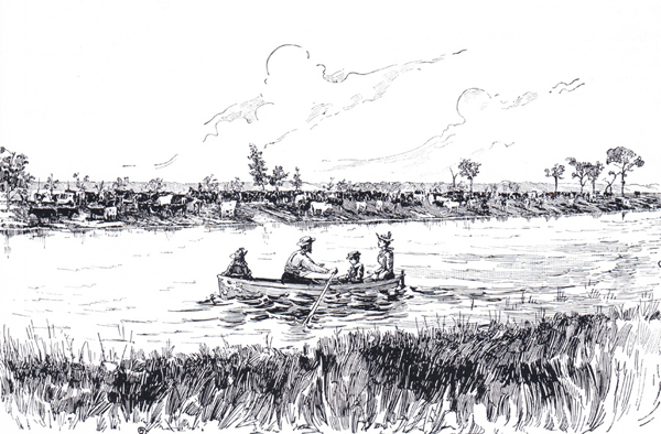
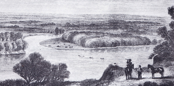
| Views
like the one above were noted by the Hind Expedition in 1859 - see the
sketch below. |
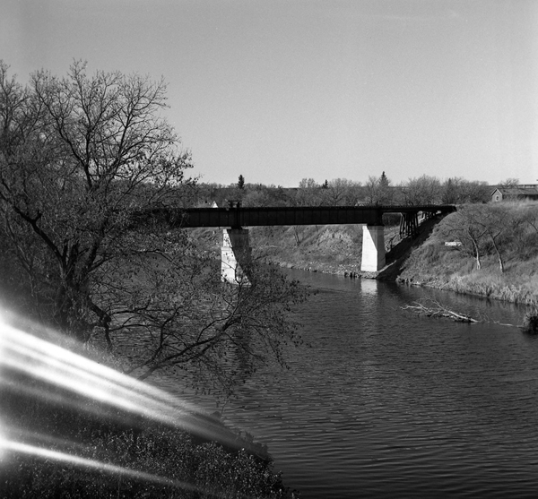
| The
Railway Bridge |
| Visit the Wawanesa Heritage Website |
Chapter 11: Treesbank - Millford
Treesbank
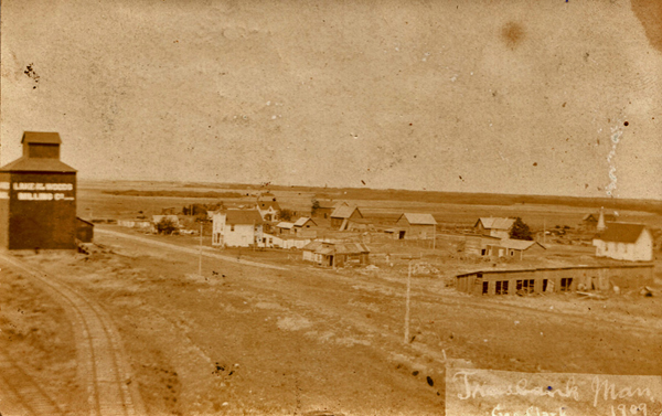
| The
little village of Treesbank was established along the north bank of the
Souris River about two kilometres west of the CPR crossing
established in 1891. |
| This
bridge was built in 1921. The span on the left was rebuilt after a
flood. |
| The
flood of 2011 destroyed the bridge entirely and it hasn't been replaced. |
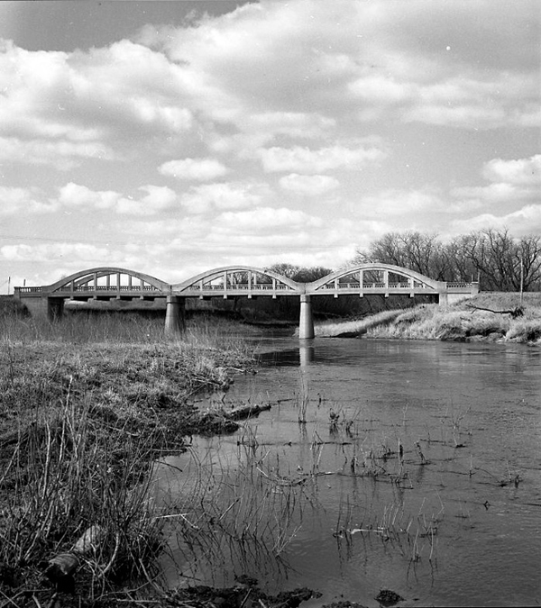
The Treesbank Bridge (Historic Sites of Manitoba)
The Millford Site
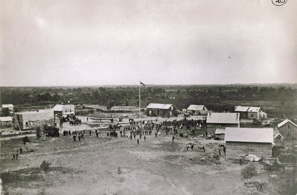
| The
first village of any size in Southwestern Manitoba was Millford,
established in 1880 on the south bank of the Souris just a few
kilometres from the Assiniboine. Six-year-old Helen Mooney, who we know as Nellie McClung, came with her family to Millford in 1880. In her excellent memoir “Clearing in the West”, she recalls that they crossed the Assiniboine a short ways above the Souris Mouth and her recollection captures the site perfectly: “The Souris was a pretty little stream with deep pools connected by an amber current that twisted around the sand bars.” |
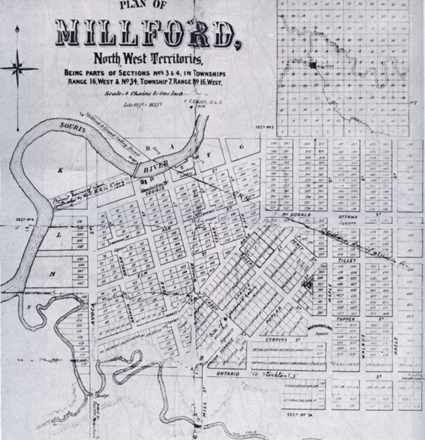
This plan was registered in 1879.
The village was just under Oak Creek near the centre of this photo.
Like all new villages in those times, the hope was that a railway line would pass nearby.
In the case of Millford, it came too late. The line got as far as Glenboro in 1885 and businesses gave up or moved
to the rail line. The line was extended in 1890 and the crossing was close to the village site, but by then the village was nearly deserted.
Treesbank, a few kilometres away, was established.
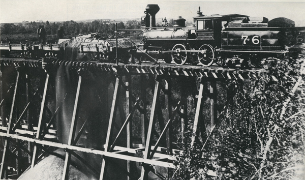
| The
standard method of crossing wide valleys was to build a trestle bridge
then fill in as much as possible to add stability. |
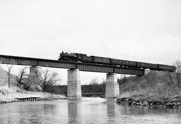
The bridge was replaced with a more modern structure.
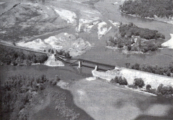
It was seriously damaged in the 1976 flood.
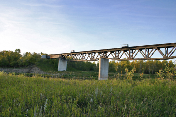
| The
rail line has been abandoned, but the re-built bridge still stands. |
| Millford
was to the left of the river. What remains of Treesbank is on the
top right. |
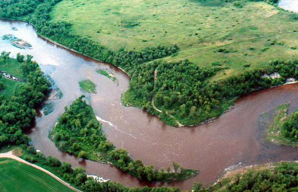
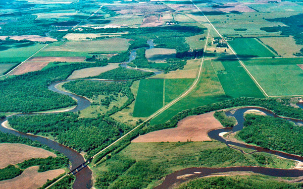
Chapter 12: Souris Mouth
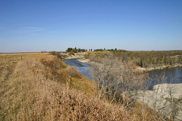
After Millford, the river takes a few twists and turns before emptying into the Assiniboine.
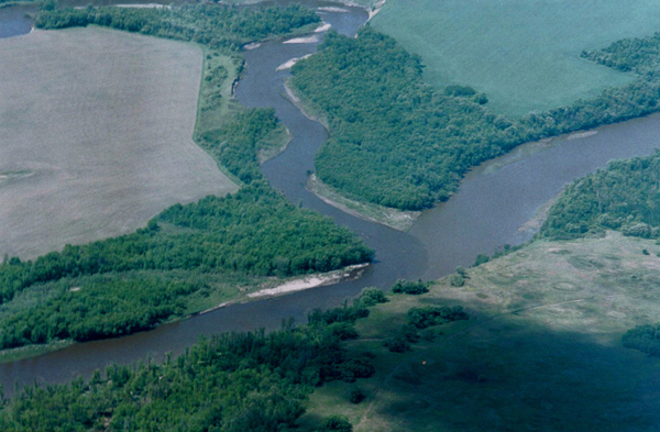
Note the difference in the colour of the water.
Souris Mouth, or alternatively, Two Rivers, was the location of the first Land Titles Office and Post Office south of the Assiniboine.
The building still exists and has been moved about a kilometre to a farm site. Two Rivers School was on this side of the Assiniboine.
Fall colours and fall river level.
Spring conditions
A sketch from the Hind Expedition 1859.
Souris Mouth was an important Fur Trade Era crossroads. As many a five Trading Posts existed
on the Assiniboine a few kilometres upstream.
The Souris River - Vantage Points