Search | Image Archive | Reference | Communities | POV | Lesson Plans | Credits
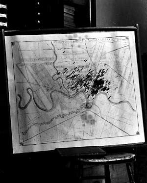
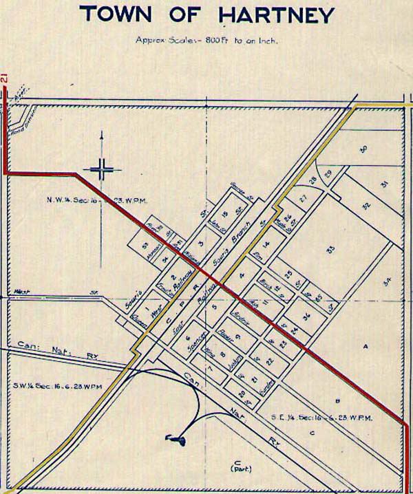
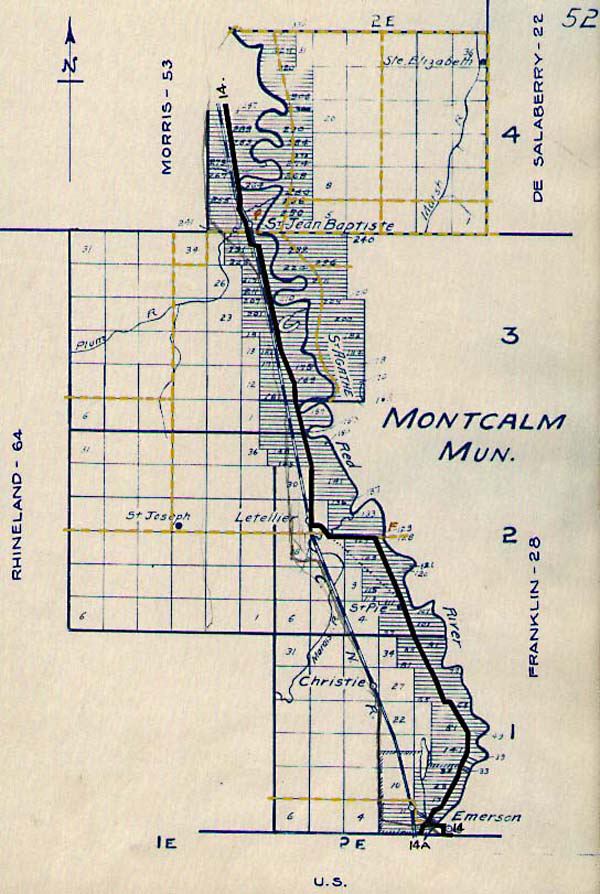
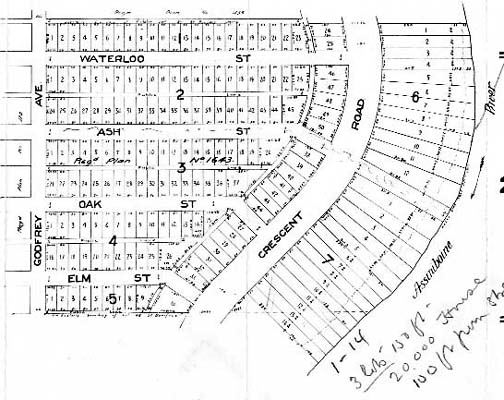
Map of New Iceland Manitoba's Boundaries, 1870-1912 Anglican Missions, Diocese of Rupertsland Vegetation of the Western Interior Indian Territories of the Prairie West The Numbered Treaties of Western Canada Political Boundaries of the Prairie West, 1870-1912 Automobile Road Guide, 1920 Winnipeg Small Pox Epidemic, 1905 Glacial Lake Agassiz Railroad Lines, 1888 Municipality of Assiniboia Municipality of Birch River Municipality of Cameron Municipality of Charleswood Municipality of Cartier Municipality of Dauphin Town of Dauphin Municipality of Fisher Branch Municipality of Gimli Town of Hartney Municipality of Hanover Municipalities of East and North Kildonan Municipality of Lorne Municipality of Montcalm Municipality of Cornwalis Municipality of Portage la Prairie Municipality of Rhineland Municipality of Ritchot City of St. Boniface Municipality of Swan River Town of Swan River Municipality of St. Laurent Municipality of Ste. Rose du Lac Village of Ste. Rose Municipality of Bifrost Hudson's Bay Company Trout Lake Post Hudson's Bay Company Island Lake Post Hudson's Bay Company God's Lake Post Manitoba Municipalities Subdivision of River Heights Manitoba Railways Map of Greater Winnipeg