|
The community of had its beginning when George McGill and James Copeland settled with their families along the banks of the Souris River in 1881,
A school was built in 1884 and George McGill, the Secretary-Treasurer and was given the privilege of naming the school. He chose the name of the district he left in Ireland.
The first church services in the Bunclody district were held in 1883 in the home of Mr. James Copeland and later moved to the school in 1886 and held there until the church was built in 1908.
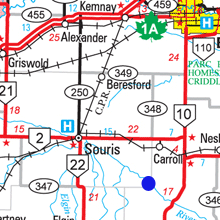
Crossing the river was a necessity, and there were three ferries in operation in the 1880's. The Osborn Ferry near the settlement, the McGill Ferry was three kilometres upstream and Shepherd's Ferry, not far from where Highway #10 crosses river now.
In 1893 a pile bridge was built and in 1902 the river was very high and all the bridges from Souris to Wawanesa were taken out with the ice flow in the spring.
In 1903 the first span bridge was and that served until 1937.
That was Bunclody in 1905. A community, but not a village. It was the decision by the Great Northern Railway, a giant U.S. corporation, to build a line into Canada that put Bunclody on the map.
In 1904 and 1905 the Great Northern survey crews were at work surveying a railroad from St. John’s N.D. to Brandon Manitoba.
They rejected a crossing straight south of Minto (where Highway#10 runs today) where the valley is both deep and wide, and had selected a site a bit upstream where the southern lip of the valley, although steep, brushed right up against the stream, while the gentle slope on the north side could be crossed with a modest embankment. To get there, the line bends westward as it approached the Souris and follows the curve of the river.
The elevators and station established on the south side of the river was called Bunclody, a name already in use for a nearby school and Post Office.
More...