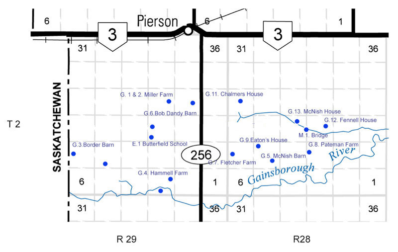
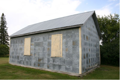
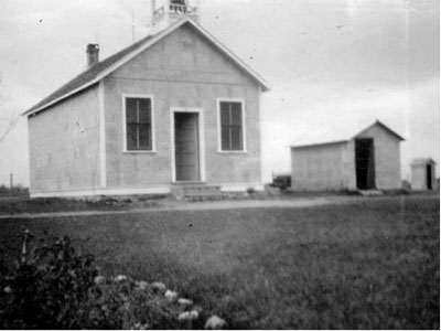
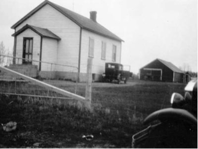
Butterfield School
SW15 -2-29
402. E.1
1905
GPS: N49.11851, W101.29475
Butterfield School No. 1328 (1905 - 1943)
The Butterfield School District was established formally in May 1904
and, by October 1905, it opened a school on the southwest corner of
15-2-29W in the Rural Municipality of Edward. The school closed in 1943
and, henceforth, students from this area were sent to Pierson
School.

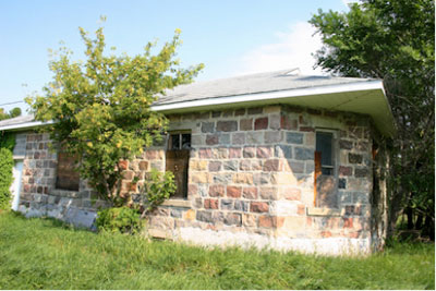
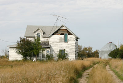
Miller Stone House
1905
GPS: N 49.06.216 W 101.19.562
Stone Mason – William Anderson
One of at least two buildings remaining in the area built by Stone
Mason William Anderson who also had worked on Cannington Manor.
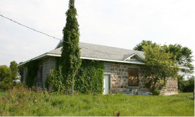
Large cut stones in a variety of colours
Angled from corner
Originally 2 stories
Current owner is a grandson of Harry Miler
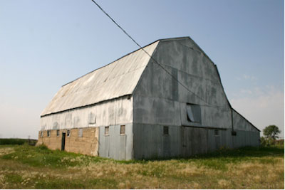
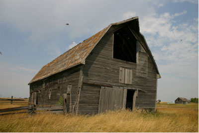
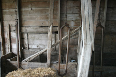
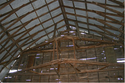
Miller Barn & Farm Site
Harry Miller farm.
Barn with original metal siding
Moved to site from nearby farm. Once owned by James Dandy.
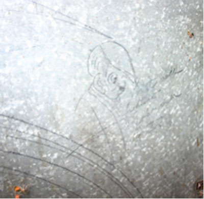
Artifact of Interest
On the Miller Farm site an old threshing machine still retains images
with Nazi themes drawn by a German harvest worker in 1939.
The images include a sketch of Adolph Hitler.
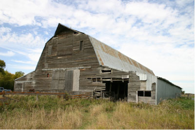
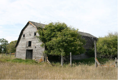
Hammell Barn
McNish Barn
Alex McNish farm site.
Stone foundation / main floor
Drive-in loft
Wood siding
Metal roof added
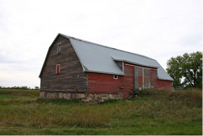
Bob Dandy Barn
Structurally sound, siding in poor repair.
Unique barn style with hay storage taking the entire open centre part
with stalls on the outer sections having direct access to the feed.
Once the Ed Fletcher farm
Pateman House & Barn
Ernie Pateman purchased the Alf Venton farm in after 1912.
Both frame buildings have many original materials and features.
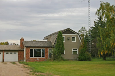
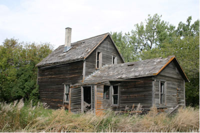
Mayes Eaton’s House
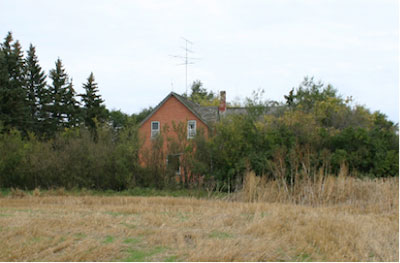
Chalmers House
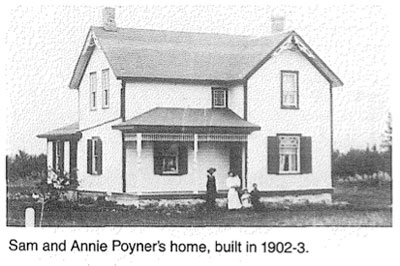
Built for Sam Poyner and renovated by
C.A. (Chris) Chalmers in 1915.
Carpenter -Jack Pitt. Brick work by Morrow bros from Melita.
Once a “grand” house – spoacious rooms, nice woodwork.
“A severe blow came in 1922. Dad had ordered a new threshing outfit. By
coincidence it was delivered at the same time that the Home Bank closed
its doors. Dad dealt with the Bank in Lyleton and lost his shares as
well as his money on deposit.” P 335
 Fennell House
McNish House
1910
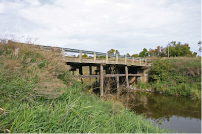 Bridge 1
15-2-28
302. M.1
1930’s
GPS: 49* 7.109’N 101* 17.690’W
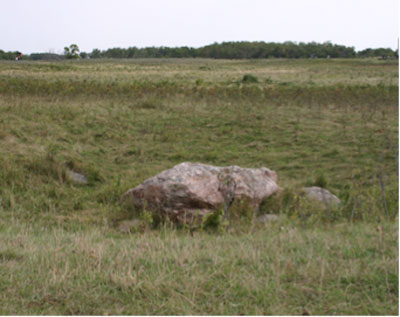
Buffalo Rubbing Stone
W14 -2-29
GPS: 49* 6.385’N 101* 21.652’W
Easily accessible location. Private property along a grid road.
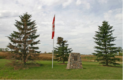
North Antler School Cairn
SE 14-2-28
1988
GPS: 49* 7.078’N 101* 8.289’W
The North Antler School District was established formally in August
1887 and a school was erected the next year, on the northeast quarter
of 9-2-28 west of the Principal Meridian, in the Rural Municipality of
Edward. In 1897, it was moved to SE14-2-28W. The school closed in June
1951 and the district was merged into the Edward Municipal School
District. The school building is no longer present at the site, but a
monument commemorating it was dedicated in 1988.
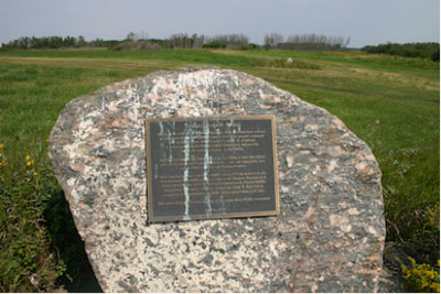
Jack Boyd Plaque / Pierson Wildlife Management Area
S 8-2-29
2001
GPS: 49* 6.216’N 101* 19.562’W
Former Jack Boyd property
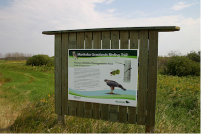
The inscription recounts Mr. Boyd’s interest on natural habitat. His
property was a haven for wildlife. It is now the Pierson Wildlife
Management Area and home to one of several Manitoba Grasslands Birding
Trails in the region.
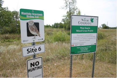
Gainsboro Creek Manitoba Grassland Birding Trail
SE 3-2-29
402.J.1
GPS: 49*6.216’ 101* 19.562’W
|