|
Coulter
The
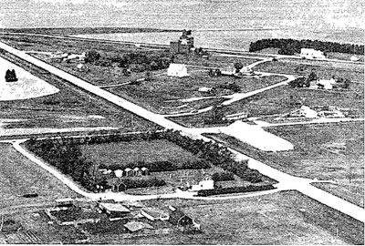
village of Coulter was named after Frank Coulter, an early pioneer
of the district. With the arrival of the Canadian Pacific Railroad in
1901, Coulter began to grow. The C.P.R. established a section house and
station. There was also a livery barn, which was a necessity in every
town, and a lumberyard which supplied materials for a number of houses
and buildings in the area. Alf Gould started a store in Coulter
in 1903.
The first postmaster was Alf Gould 1904.Later, A. E. (Edward)
Andrews operated the post office from a building beside his
Massey-Harris agency.
In 1903 Mr. E. Schneider started up a blacksmith shop. Mr. C. Carlton
ran a boarding house. William Mee had an implement business. Rolston
Large started a business in Coulter under the name of South Antler
Steel Works, specializing in general repairs and machine works. About
1908 he built a boat in Coulter and launched it in 1909 on the Souris
river.
The Western Canada Elevator Company built an elevator in Coulter which
they operated until 1938.
Coulter in 1979
GPS Reading:
49* 05’ 21.04” N
100* 59’ 02.55 W
 Coulter Area


Gould Store Building
Coulter
99.D.1.
1915
Built by Alf Gould
Other Occupants:
Norman Gould
Jim McKague
Dandridge & McIvor
Howard Minne

Photo from “Our First Century”


Coultervale United Church
SE 22-1-28
99.B.1
1956
GPS: N49.04412, W101.02597
Known as the South Antler Presbyterian Church until Union in 1925.
Original (1906) church struck by lightning and burned, 1956. Re-built.


Pool Elevator
Coulter
99.D.1.
1928
There once were two elevators in town.


Cameron Lake of the Woods Elevator
NE 31-1-27
99.D.3
1903
GPS: N49.080862 W 101.078044

A small community was formed when the railway arrived.
The community of Cameron (also known as Cameron Siding) had a post
office starting in 1903 with Postmaster W. D. Hamilton. This office
closed about 1929.
In 1903 the foundation for a third elevator at the new town of Cameron
on the Lyleton extension was laid.
A Lumberyard operated by Cameron & Ferguson was open until 1918.


Coultervale School
SE 16-1-27
99.E.1
1915
GPS: 49* 01’45.46” N 101*02’02.55” W
Municipal Designation M0200
“Being the largest school in the region, it offered high school classes
for areas served by several neighbouring elementary schools. Once the
centre of a small community, it now stands alone, visible from a nearby
highway, overlooking the open prairie. “
Closed in 1958. Used as a community centre as well.


Fraser Cabin
Coulter Park, Sourisford
22-2-27
99.E.2
1885
GPS: N49.13575, W101.00811
Built by H. Fraser on 4-2-27 west of the Principal Meridian in 1885,
was donated by W. R. Cosgrove as a memento of pioneer days. Near the
cabin and arch is a cairn erected by the Rural Municipality of Arthur
commemorating the Canadian centennial year in 1967.


Penninsula School
NW 35-2-27
99.E.3
1897
GPS: N49.175419 W 101.003466

As of 1991 Peninsula School is now owned by a third generation Yeo of
Calgary whose intention is to preserve it as a historical site. It
still exists on site
Closed 1960


Sourisford School
NW 29-2-27
99.E.4
1897
GPS: 49* 7.109’N 101* 17.690’W
Closed 1931
Photo: Alann Fraser


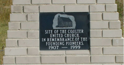
United Church Cairn
Coulter
99.F.2.
1999


Coulter Schools Cairn
Coulter
99.F.1.
2000


Coultervale Cemetery
NW 22-1-27
99. F.3
1898
GPS: N49.05810, W101.02602
Surveyed in 1898


Sourisford Linear Burial Mounds
SE 22-1-28
99. F.4
1956
GPS: N49.04412, W101.02597
The mounds at this site are remnants of the largest concentration of
ancient burial mounds in Canada. Working with fragmented evidence
provided by the expert work of Chris Vickers and Richard McNeish, Dr.
Leigh Syms pieced together a theory of the local mounds and placed them
in the Devil’s Lake Sourisford Burial Complex.
The idea of burial mounds spread from the Mississippian cultures to the
south along with their exotic trade goods found in this area. They
varied in shape from small mounds to the large composite linear mounds
joined by long grades like the ones in this field. Most round mounds
were built well above the flood plain and had one or more circular or
oblong pits often covered with a layer of clay, poles and sods. Some
accumulative mounds had intrusive “bundle mounds” scattered
throughout. Artifacts in the structures included incised stone
tablets, clay mortuary vessels and shell gorget masks made from Gulf
Coast conch shells with the “forked eyemotif”, representing a
Thunderbird design.
Dr. Syms speculates that the Natives interned their casualties of the
harsh winter at the site that coincided with the spring migration route
of the bison herds. The deceased were ceremoniously buried when the
ground thawed – an event of cooperative behavior and cultural
importance.
From the interpretive sign at the site.


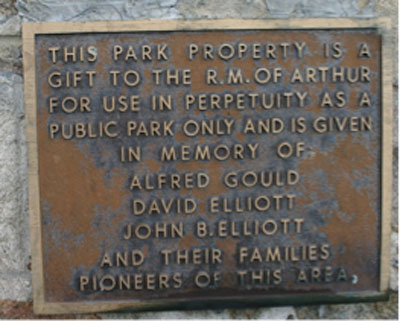
Alfred Gould House
Coulter Park
99.G.1
1902
GPS:
49* 05’ 21.04” N
100* 59’ 02.55 W
Built by Sourisford Pioneer, Alfred Gould.


Gainsboro Creek Bridge
NE 28-2-27
99. M.2
1920’s
GPS: N49.15864 W101.17.04840
On an abandoned section of Highway 83.


Coulter Park
Sourisford
99.J.1.
GPS: N49.13575, W101.00811
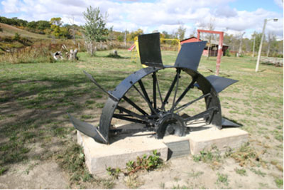
In November 1928, pioneer Francis Coulter donated to the Arthur
Pioneers Association this site south of Melita where he had settled, in
April 1882. It became known as Coulter Park, or Sourisford Park, after
the nearby crossing on the Souris River. It was Western Canada’s oldest
park. Years earlier, in 1873, the site had been a camping place of the
Boundary Commission demarking the border between Canada and the United
States. Local settlers held a picnic here in 1882 that became an annual
event.


Coulter Village
SE 2-2-27
99.M.1.
1901 – with the arrival of the CPR.
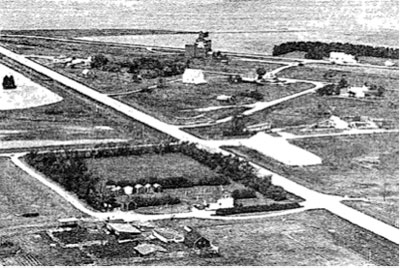
Named for Francis Coulter
See P. 308 – “Our First Century”


Sourisford Bridge
NW 19-2-27
1970’s
GPS: N49.13575, W101.00811
The crossing of North Antler Creek at Coulter Park, Sourisford


Snyder Dam
34-2-27
1988
GPS: N49.172711 W 101.030791
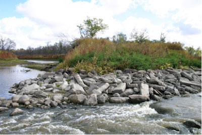
Damaged by floods
|

