 Map Collection: Railway Theme To receive a Hi-Res Copy of any of these maps, for school, museum or private use, e-mail the Webmaster with the Collection Name and Map Number. Map 1. SW Mb. 1880's 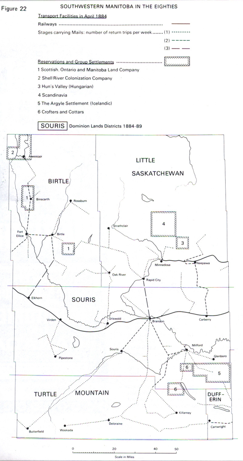 Southwestern Manitoba in the 1880's By Section, Township & Range, Studies in Prairie Settlement, John Langton Tyman Brandon University, 1972 P 48 Back to INDEX Map 2. C.P.R. Routes 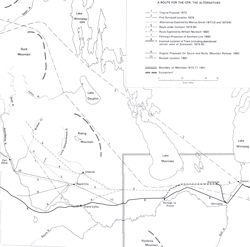 A Route For the CPR: The Alternatives By Section, Township & Range, Studies in Prairie Settlement, John Langton Tyman Brandon University, 1972 P 34 Back to INDEX Map 3. 1886 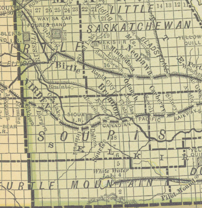 Manitoba and the Northwest Territories of Canada Showing the Lines and Land Grant of the Canadian Pacific Railway (1886) Canadian Pacific Railway Company. Manitoba and the Northwest Territories of Canada Showing the Lines and Land Grant of the Canadian Pacific Railway [map]. Scale not given. In: Canadian Pacific Railway Company. Manitoba the Canadian North-West : Testimony of Actual Settlers. [Montreal]: Canadian Pacific Railway Company, 1886. The Company's lands in part consist of the odd-numbered sections in the belt colored green, the remaining sections being Government Homestead Lands. Image Courtesy of University of Manitoba Archives & Special Collections http://www.flickr.com/photos/manitobamaps/3858739907/ Back to INDEX Map 4. Railway Progress - 1888 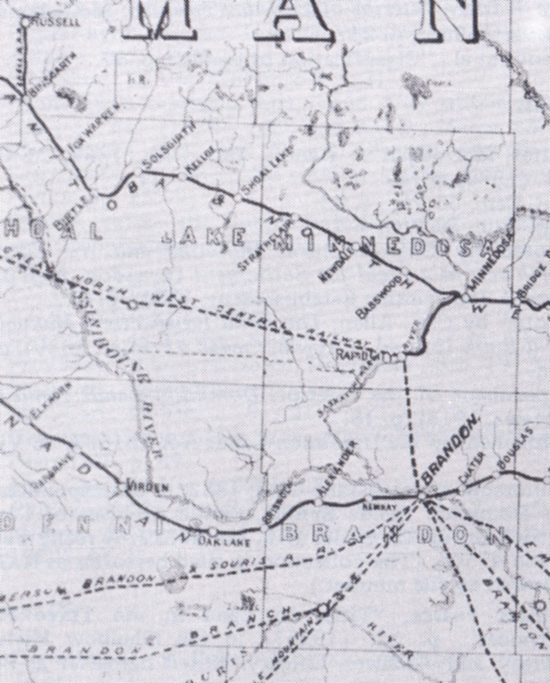 Railways - Real and Imagined 1888 By Section, Township & Range, Studies in Prairie Settlement, John Langton Tyman Brandon University, 1972 P 215 Back to INDEX Map 5. Railway Progress 1889 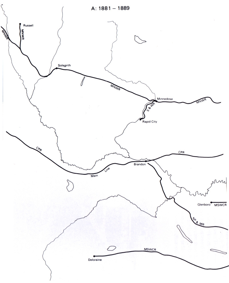 |
Railway Construction in Southwest Manitoba 1881- 1922
By Section, Township & Range, Studies in Prairie Settlement, John Langton Tyman
Brandon University, 1972 P 52-53
Back to INDEX
Map 6. The Region ca. 1893
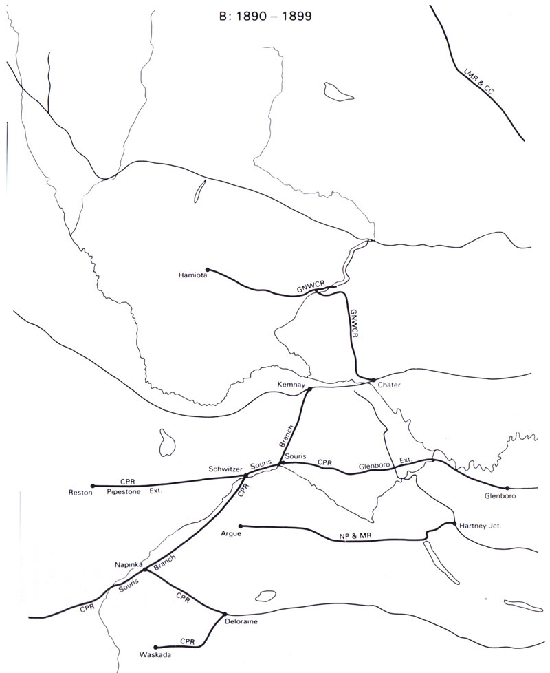
Railway Construction in Southwest Manitoba 1881- 1922
By Section, Township & Range, Studies in Prairie Settlement, John Langton Tyman
Brandon University, 1972 P 52-53
Back to INDEX
M7. Settlement 1893
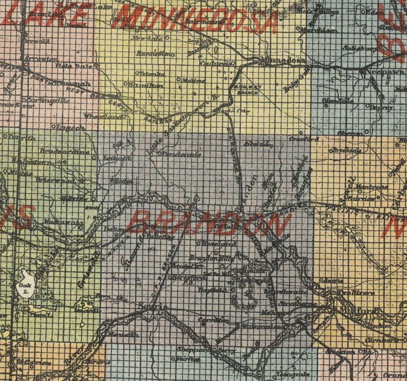
1893 Provincial Map Showing Counties
http://www.flickr.com/photos/manitobamaps/3260755021/
Map of the Province of Manitoba Showing the Division into Provincial Counties (1893)
Dawson, S. E. Map of the Province of Manitoba Showing the Division into Provincial Counties [map]. Scale not given. In: S. E. Dawson. Description of the Province of Manitoba Compiled and Arranged from the Field-notes, Plans and Reports of Dominion Land Surveyors, and Published Reports of the Geological Survey, Canadian Pacific Railway Surveys, and Other Official Reports. Ottawa: 1893.
Image Courtesy of University of Manitoba Archives & Special Collections
Back to INDEX
Map 8. 1900
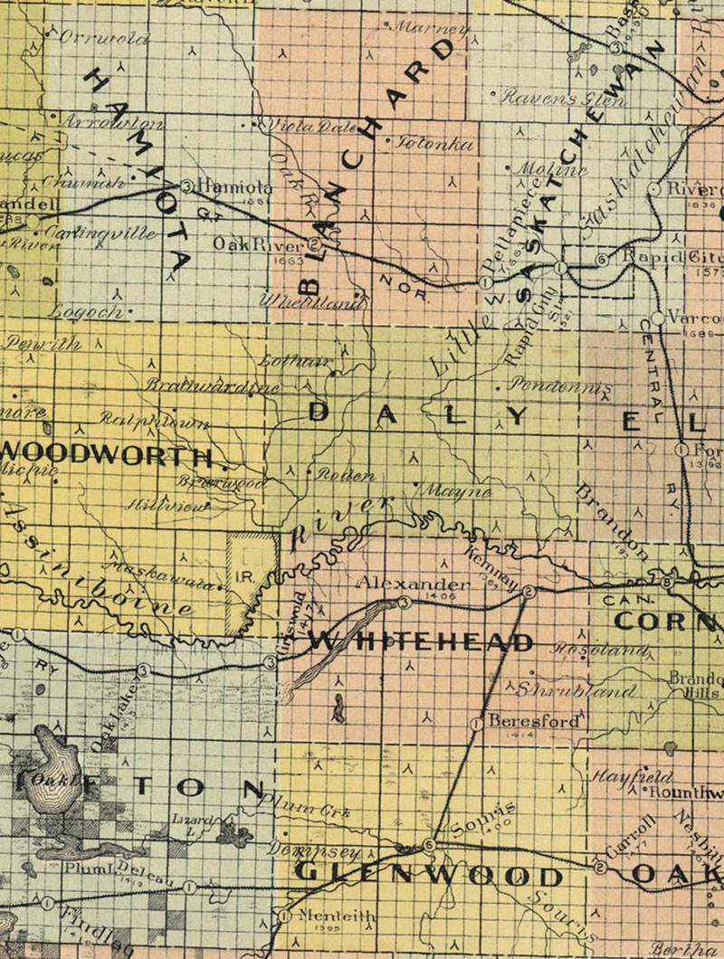
Map of Manitoba (1900)
http://www.flickr.com/photos/manitobamaps/2086270771/
Bulman Bros. & Co. Map of Manitoba Published by Authority of the Provincial Government Winnipeg, April, 1900 [map]. 1:760,320. Winnipeg: Manitoba Department of Agriculture and Immigration, 1900.
Map shows Railways (constructed and projected), Railway Stations, Grain Elevators and Warehouses, Schools, Post Offices, Provincial Lands, Municipal Boundaries, Trails & Colonization Roads.
Other Signees: John Dewise, Minister of Agriculture & Immigration.
Back to INDEX
Map 9. Railway Progress 1900
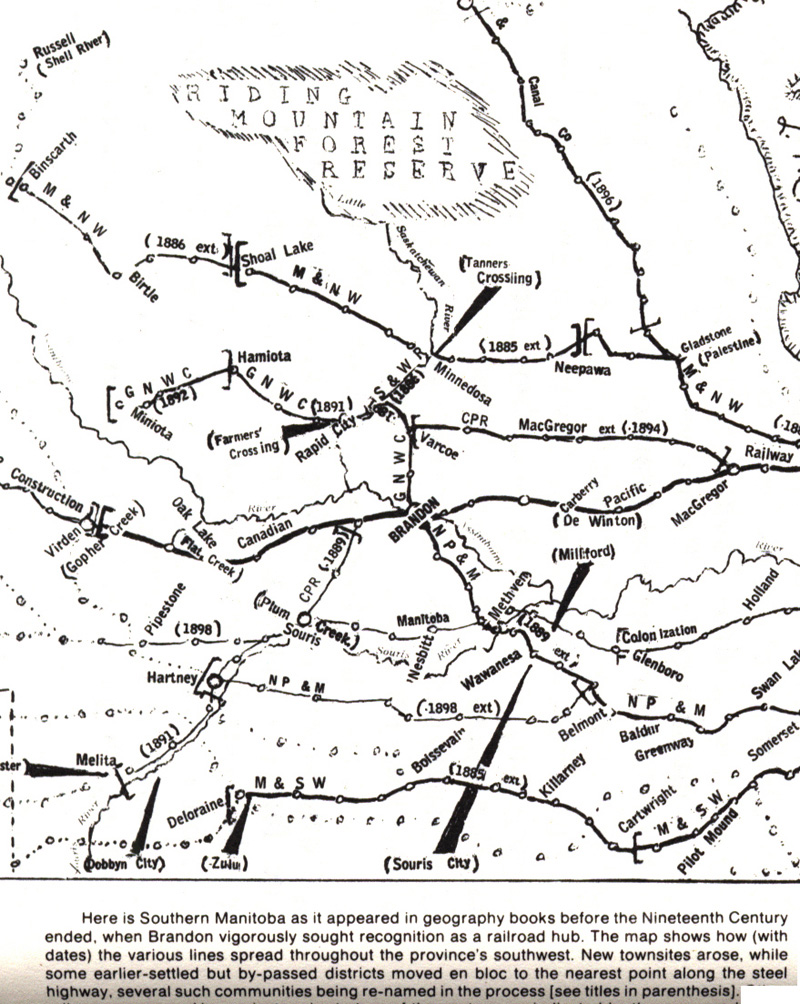
Railway Construction as of 1899
Scanned from "Brandon: A City", by G.F. Barker 1977, p56
Back to INDEX
Map 10. Elevators 1917
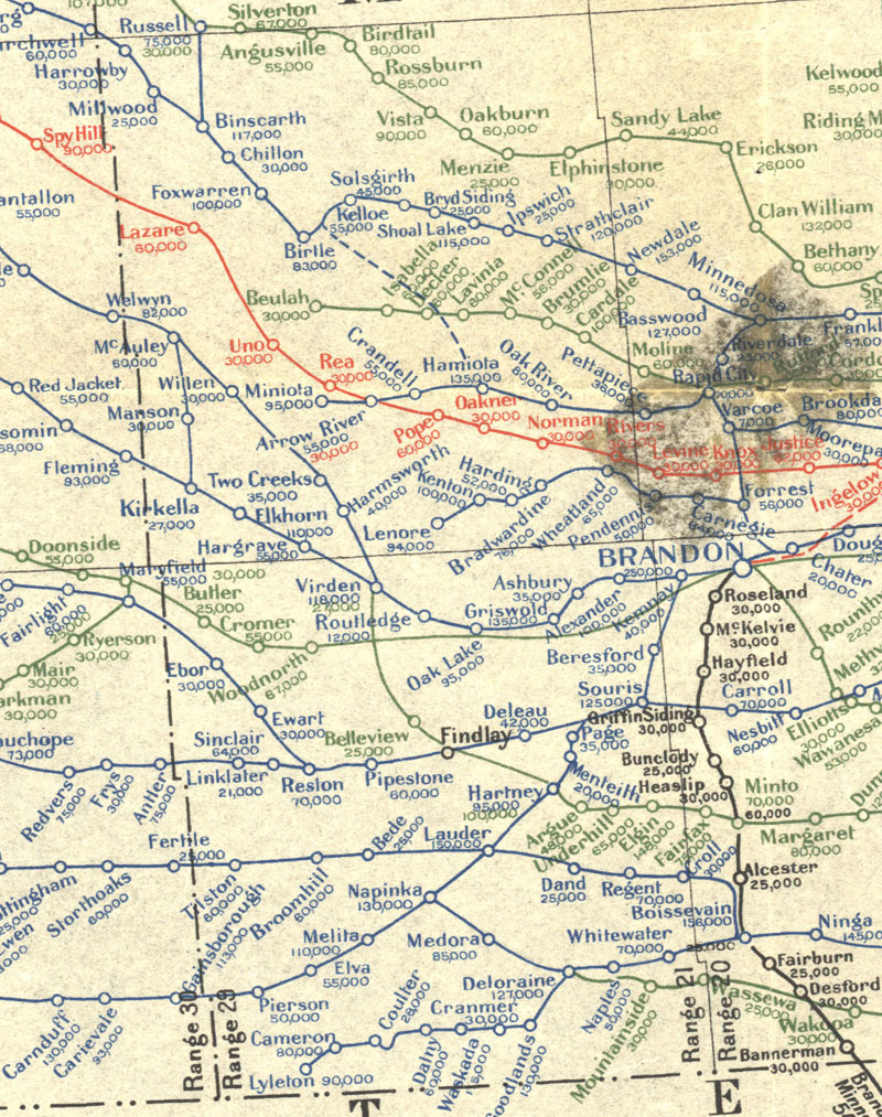
Manitoba Section of Map Showing Elevators in Manitoba, Saskatchewan and Alberta (7th, ed. 1917)
Canada Natural Resources Intelligence Branch. [Manitoba Section of Map Showing Elevators in Manitoba, Saskatchewan and Alberta] [map]. 7th ed. 1:1,584,000. [Ottawa]: Dept. of the Interior, 1917.
Elevators and Milling capacities complied from records of the Inspection Branch of the Department of Trade and Commerce, and other available sources. Legend shows rail routes (in operation and under construction) of Canadian Pacific Railway (Blue), Canadian Northern (Green) Grand Trunk Pacific (Red) and Other Railways (Black). Elevator capacities are given in bushels under each name in the respective colour of the road on which they are located.
Note: Department of the Interior Canada. Honourable W.J. Roche, Minister. W.W. Cory, Deputy Minister. Map prepared in the Natural Resources Intelligence Branch under the direction of F.C.C. Lynch, Superintendent.
Source: University of Manitoba : Elizabeth Dafoe Library : Map Collection
http://www.flickr.com/photos/manitobamaps/2200154066/
Back to INDEX
Map 11. 1909 Rail Lines
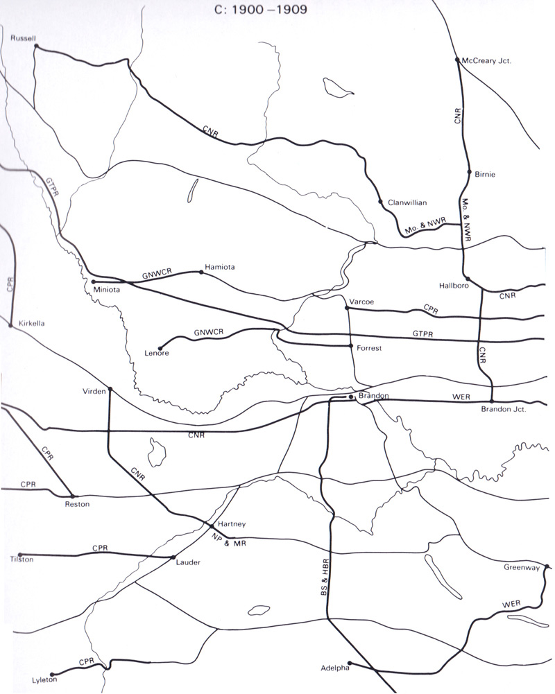
Railway Construction in Southwest Manitoba 1881- 1922
By Section, Township & Range, Studies in Prairie Settlement, John Langton Tyman
Brandon University, 1972 P 52-53
Back to INDEX
Map 12. (1918)
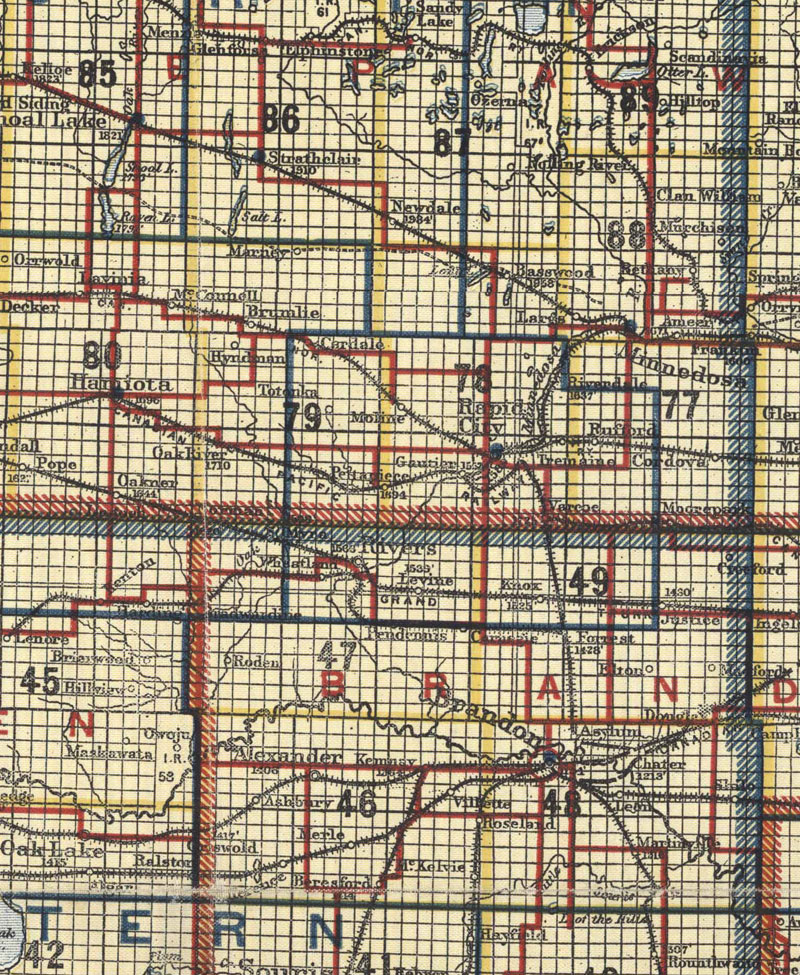
Manitoba 1918
http://www.flickr.com/photos/manitobamaps/2828730480/
Scarborough’s Map of Manitoba Canada South Sheet (1918)
Scarborough Company of Canada Ltd. [Scarborough’s Map of Manitoba Canada South Sheet] [map]. Scale not given. [Regina]: Scarborough Company of Canada Ltd., 1918.
Map shows Organized Municipal Divisions, Judicial Districts, County Court Divisions, Land Registration Districts, Highways, Railways and Electric Railways. There is also a list of Post Offices and Stations in Manitoba. Finally an inset is included titled Map of the Province of Manitoba Showing the Complete Area and all Railway Lines.
Back to INDEX
Map 13. Manitoba 1930
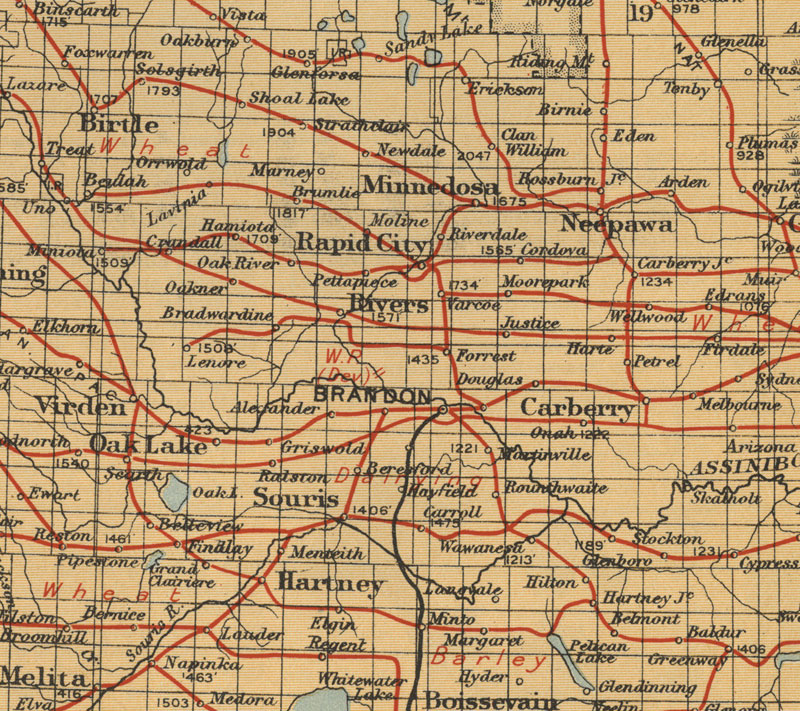
Southern Manitoba (1930)
Canada Natural Resources Intelligence Branch. Southern Manitoba [map]. 1:1,584,000. In: Canada . Dept. of Immigration and Colonization. Canada West. Ottawa: Canada . Dept. of Immigration and Colonization, 1930.
Shows Railways and Natural Resources.
Image Courtesy of University of Manitoba Archives & Special Collections
http://www.flickr.com/photos/manitobamaps/3815079724/
1. The St. Paul Minneapolis & Manitoba Railway (1880)
St. Paul, Minneapolis & Manitoba Railway Company. The St. Paul Minneapolis & Manitoba Railway [map]. Scale not given. [Minneapolis]: [St. Paul, Minneapolis & Manitoba Railway Company], 1880.
A. Manvel (General Manager, St. Paul, Minn.) W.S. Alexander (General Freight and Passenger Agent, St. Paul, Minn.) H.C. Davis, (Assistant General Passenger Agent, St. Paul, Minn.)
Image Courtesy of University of Manitoba : Archives & Special Collections
http://www.flickr.com/photos/manitobamaps/3751818593/
Back to INDEX
Map 14, Roads 1924
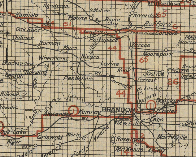
Road Map 1924
Automobile Road Map of Manitoba (1924)
Emmett, A.C. Automobile Road Map of Manitoba [map]. 1:760,320. Winnipeg: Stovel Company Ltd., 1924.
Image Courtesy of University of Manitoba Archives & Special Collections
(Morris Block fonds, MSS 207, A.05-43)
www.umanitoba.ca/libraries/units/archives/collections/com...
Back to INDEX
Map 15. Rail Lines 1935
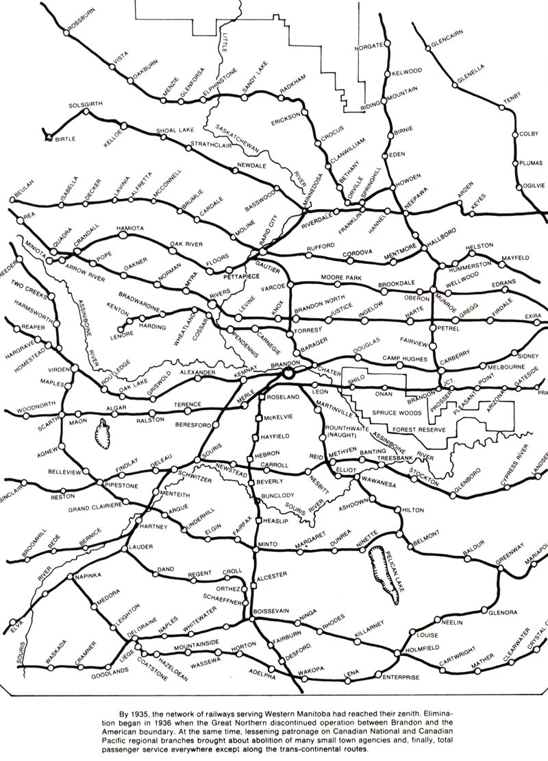
Rail Lines in 1935: Scanned from "Brandon: A City", by G.F. Barker 1977. p284
Back to INDEX