
 |
Collections
|

|

Photo enthusiasts, often photographers themselves, are the
people
responsible for the fine record we have of photography in days gone by.

The James Wall Collection
S.J. McKee Archives, Brandon University
In
2004 a collection of photos of Baldur and region were donated to the
S.J. McKee Archives at Brandon University. The origin of the photos is
unclear, but they were acquired by James Douglas Wall in his capacity
as President of the Southwest Branch of the Manitoba Genealogical
Society.
Identification
on the frames indicates that the prints were the work of
at least three different photography operations:
“E.L. Lane
Glenboro, Man”
“J.G. Macdonald,
Moosomin, Assa.” (Assiniboia – Saskatchewan was not
yet a province) “Steel Co. Limited, Winnipeg & Calgary”.
Of course they
could have originally been taken by a single
photographer and processed or framed by these businesses. We know that
Baldur had at least two professional photographers during that era.
Walter Jackson and S. Frederickson had a studio above Fowler’s Shoe
Store in 1905, but, as yet, we have no evidence linking them to these
photos.
The prints,
though marked with age, are of a very high quality and when
blown up give us a good look at both architectural detail and facial
expression. Many are unidentified except for a few penciled
observations, but comparison with other existing photos has brought a
few facts to light. Alterations to the original included some digital
cleaning of background (skies) in outdoor photos and a slight
alteration of the sepia tones.
Here we present
some samples with brief descriptions when appropriate.
Several of these photos serve as example in other sections of this
project.
The entire
collection is available online as a pdf. Email Ken at:
kenstorie3@gmail.com
Highlights from the James Wall Collection
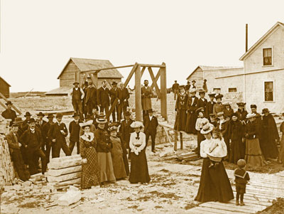
Methodist Church Construction
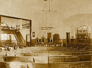
Methodist Church
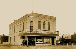
Curtis Block

A Heritage Mystery
One interesting challenge is finding an old photo that doesn’t
correspond to a known site. The James Wall Collection in the S.J.
McKee Archives is such a find.
It is in a group of photos of
Baldur and area, all taken around 1904.
Most of the photos in the collection are views of the town.
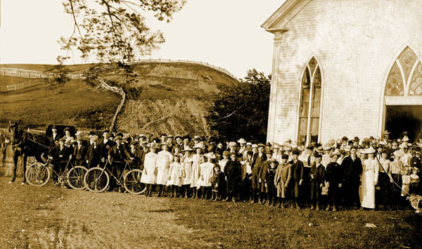
While
it is unfortunate that we only see a small part of the building,
the part we do see is quite revealing. It was a substantial
building – the kind that was built after the pioneer era when
people were getting established. It had a centred front entrance
without a porch. The distinctive windows and the trim on the eaves are
the notable details.
The most readily
identifiable element might be the location with a
prominent hillside in the background. It doesn’t appear to be in a town
but one can’t say that for sure. In general, it is a location one might
remember. The various excellent Argyle histories show no similar
church. The histories of neighbouring municipalities have yielded no
obvious matches.
It could well be
that this photo is nowhere near Baldur and was
included in this collection for some other reason, or by mistake, but
the location looks like a site we might find in the Tiger Hills – or is
it in a valley?
So
far – mystery
unsolved!

The Brandon,
Saskatchewan & Hudson’s Bay Railway
The
Brandon, Saskatchewan and Hudson's Bay Railway, a subsidiary of the
Great Northern Railway from the U.S. was completed in 1906. It offered
service from Brandon to the small town of St. John's, North Dakota
where it made connections on the Great Northern lines south to
Minneapolis, east to Duluth, and west through Montana to the coast.
 |
Gilford Copland
who grew up in the area, collected photos of the
railway, including these of the construction process in 1905 &
1906. No historical account of the building of the railway would be
complete without them. Gilford was born in 1906, so we know he wasn’t
the photographer for these early photos, although some of the ones
taken in the 1930’s and beyond may well be his.
The
surveyors
for the Great Northern had rejected a crossing straight
south of Minto where the valley is both deep and wide, and had selected
a site near the hamlet of Bunclody where the southern lip of the
valley, although steep, brushed right up against the stream, while the
gentle slope on the north side could be crossed with a modest
embankment. To get there, the line bends westward at Heaslip, following
the curve of the river and crossing a series of deep cuts where ravines
enter the valley. After the crossing it drifts even a bit farther west
to avoid the Brandon Hill, before curving back towards Brandon.
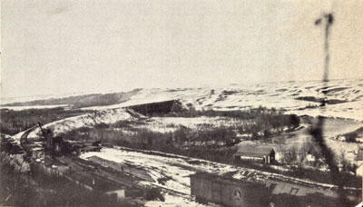 The
bridge over
the Souris was the biggest undertaking. The span was
132 metres long and 26 metres high.
|
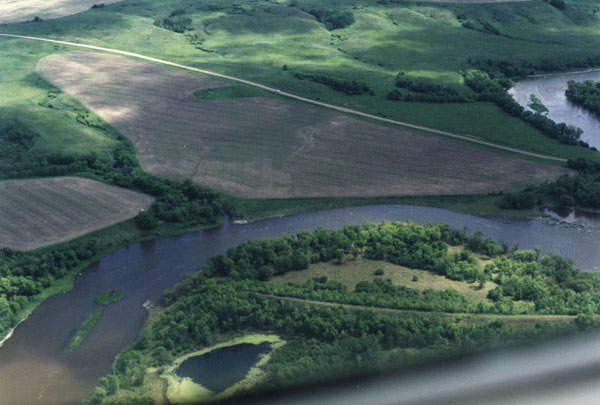
The
small
“island in the river to the left was the footing for the
central pillar – visible in the photo below.
Bunclody
was the
major construction site of the whole project.
Three work camps
were quickly set up, one at the deep ravine 3
kilometres south of the crossing, one at the townsite on the south side
of the river where the station house was built, and one on the north
side of the river.
Each
camp had a
steam shovel, modern technology not available a mere 25
years earlier when the CPR crossed Manitoba.
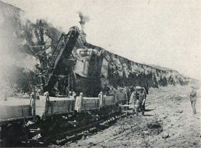 This is the only
print with a photographer’s mark. In this case Osborne
of Boissevain is identified.
The ravines
south of the river were crossed by building temporary
trestles and dumping fill to create a road-level earthen dam, complete
with huge pipes designed to let the runoff through.
The pipes soon
broke and had to be replaced with concrete tunnels two
metres square - still quite visible today, although somewhat clogged
with rubble. One resident told me about boyhood adventures that
included a dare to go through the tunnel.
The entire
collection is available online as a pdf. Email Ken at:
kenstorie3@gmail.com

The Grassland RM
Collection
The Grassland Heritage Website displays copies from the extensive
collection of images gathered over decades.

|