
T14, Elevators and
Capacity 1917
T14.
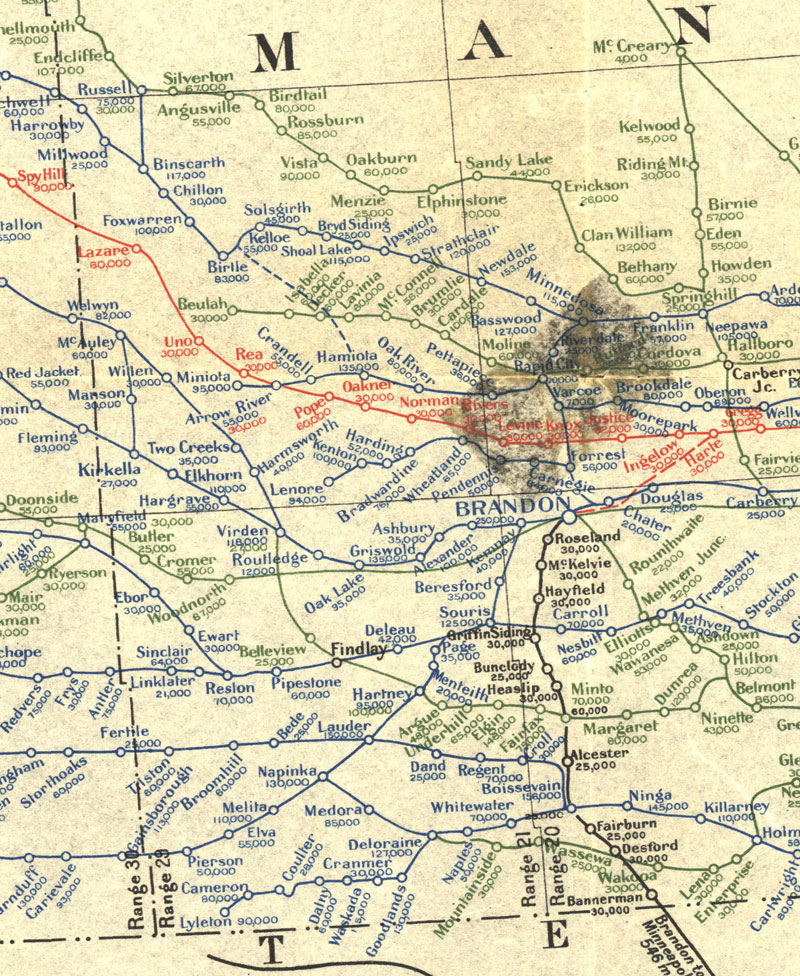
Manitoba Section of Map Showing Elevators in Manitoba, Saskatchewan
and
Alberta (7th, ed. 1917)
Canada Natural Resources Intelligence Branch. [Manitoba Section of Map
Showing Elevators in Manitoba, Saskatchewan and Alberta] [map]. 7th ed.
1:1,584,000. [Ottawa]: Dept. of the Interior, 1917.
Elevators and Milling capacities complied from records of the
Inspection Branch of the Department of Trade and Commerce, and other
available sources. Legend shows rail routes (in operation and under
construction) of Canadian Pacific Railway (Blue), Canadian Northern
(Green) Grand Trunk Pacific (Red) and Other Railways (Black). Elevator
capacities are given in bushels under each name in the respective
colour of the road on which they are located.
Note: Department of the Interior Canada. Honourable W.J. Roche,
Minister. W.W. Cory, Deputy Minister. Map prepared in the Natural
Resources Intelligence Branch under the direction of F.C.C. Lynch,
Superintendent.
Source: University of Manitoba : Elizabeth Dafoe Library : Map
Collection
http://www.flickr.com/photos/manitobamaps/2200154066/
|
|