S2.
Laurie 1870 NWT
http://www.flickr.com/photos/manitobamaps/2231443980/
Laurie’s Map of the North-West Territories (1870)
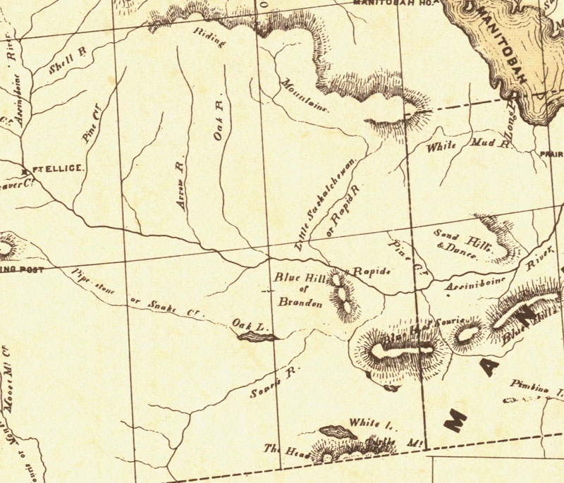
Donald Codd emphasized the different ways of getting to Manitoba in
this
map of 1870. The routes from Lake Superior and St. Paul to Winnipeg are
shown
particularly well. The Dawson Route is correctly marked, even though it
was
not in operation until 1871, and the wagon road from Fort William to
Lake
Shebandowan is indicated. The St. Paul route is shown, along with a
table
of distances. Railroads are just being extended from St. Paul to
Duluth,
and from St. Paul to the Red River. Both points were reached during
1871,
and also a direct line was being constructed in that year from Duluth
to
the Red River. The regular rectangular township survey which was in use
in
the United States, and was to be applied to Manitoba, can be seen in
Minnesota.
The map clearly reveals the later insertion of the name Manitobah
brutally
across the other features on the map. Codd has followed both Hind and
Palliser
as a source, and has fared better than Lionais in showing landforms;
the
Manitoba Escarpment is well done.
(Warkentin and Ruggles. Historical Atlas of Manitoba. map 95, p. 240)
-----------------
Laurie’s Map of the North-West Territories Shewing the Surveys
now made,
and the Railway and other Routes thereto. Compiled by D. Codd, Ottawa.
1870.
Scale 1 inch to 25 miles. Lithographed by Roberts, Reinhold & Co.,
Lith.,
Montreal.
Manitoba Historical Maps - Flickr
|