 |

About ten kilometres east Brandon on the Trans-Canada Highway, an alert traveler might see a sign noting “Currie’s Landing Rd.” marking a gravel road heading south. That trail has a bit of a story to tell.
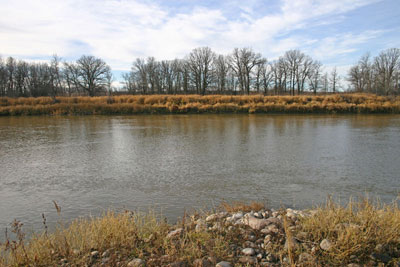
In 1880 William Currie, who had come to Rapid City from St. Mary’s Ontario, in the previous year, bought a quarter section straddling the river east of Brandon, just below a well-known set of rapids. The Brandon Rapids as they were later known, were first identified as the Grand Rapids by HBC surveyor and manager Peter Fidler on his 1819 map of the region. It had been used as a crossing for some time and Mr. Currie, initially for his own convenience, decided to establish a ferry.
He purchased the adjoining 1/4 section on the opposite side of the river, sank two poles in each bank, joined them by wires for a pulley and a scow.
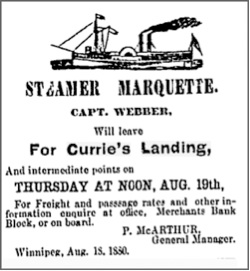
The area was soon to see a rush of settlers and his ferry was soon a vital spot on the trail west. His location at the foot of the most lengthy and challenging rapids on the Assiniboine also presented another opportunity. Here, the Assiniboine which gently twisted and turns for most of its 1070 kilometres makes a steep decline of over three metres in about a kilometre. For the first steamboats to ascend the Assiniboine it was the end of the line. And although enterprising captains did find ways to force their craft through those rapids, in lower water it remained the head of navigation.
That meant that it became the entranceway to the new lands.

Website.....
False Starts...
