Chapter 1: Setting the
Stage

Brandon
is
somewhat famous
skipping the "town" phase and going directly to city status in 1882,
slightly more than a year after the first buildings were erected. So
while we measure Brandon's existence as a city from 1882, Brandon's
real beginning was in 1881.
If there is one
month of the
year that is especially significant to Brandon's appearance on the map,
it would be the month of May. On May 1st, of 1881 no one lived here and
by the end of that month dozens of businesses had been established,
many in tents, and it was already a bustling place.
Not only did
Brandon spring up quickly, it seems its appearance was genuinely
unanticipated - no one saw it coming
The years 1881
and 1882 saw
the "Manitoba Boom". Newspaper ads promoted speculative, or
"paper
cites” with names like "Souris City", "Manitoba City", Dobbyn City" and
yes, even "Rapid City" were promoted as "The Next Great City of the
West". Fortunes were made and lost in selling real estate, largely in
the form of lots in these would-be cities.
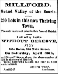
7-April
1881, Winnipeg Times
Brandon arrived
by a different path.
While all this
speculation
was going on, the site of Brandon lay idle, its very sod unbroken, not
a building in sight. Rapid City had already experienced its first boom,
as investors were sure that the C.P.R. would pass that way. It, along
with Birtle to the north and Millford to the south were the only real
towns in the area.
A few miles
downriver from
our current city, William Currie had settled on a farm that straddled
the river at the foot of the Brandon Rapids (then called the Grand
Rapids). He soon had a ferry crossing and steamboat landing that became
the jumping-off point for settlers heading the bustling Rapid City
settlement. Thus, it was also called Rapid City Landing. A post
office
and store a few kilometres east known as Grand Valley was another sign
of settlement, it soon had a warehouse and landing.
Early in the
spring when
rumours began to circulate that the transcontinental railway, instead
of following the expected, more northerly route, might cross the
Assiniboine nearby, and strike a more southerly trail towards the
coast, it began to appear that the little settlement at Grand Valley
might be destined for greater things. It became a place to watch (and
an investment opportunity!), while the site of Brandon attracted only a
would-be homesteader who hadn't yet bothered to build and plant.
Of course the
name Brandon
had been associated with this region for decades. A Hudson's Bay Co.
post named Brandon House was established in 1793 near Treesbank. The
range of hills to the south of our city, previously the Moose Head
Hills, began to be called the Brandon Hills some time after the fur
trade posts appeared. A post office called Brandon was opened in the
area we now know as Brandon Hills, after a group of Nova Scotians
settled there in 1879.
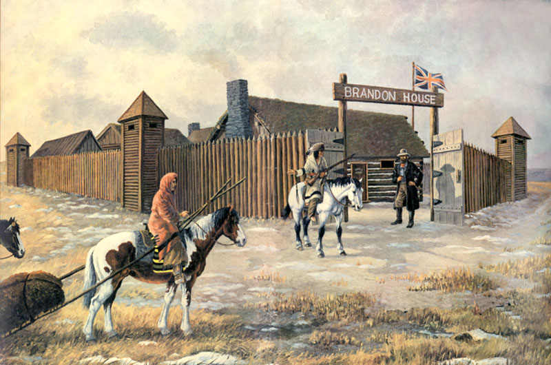
An artist’s
rendition of Brandon House - by Terry McLean
The name Brandon
first
appears on this 1819 map by HBC surveyor Peter Fidler, noting the HBC
Post near the mouth of the Souris River. It shows the Rapid River
(Little Saskatchewan) and calls the rapids we know as the Brandon
Rapids, the Grand Rapids. Today’s Brandon Hills were called the
Moosehead Hills.
On this map from
1825 we see
that today’s Willow Creek was called the Oak River. Fact. Is short for
Factory which was a term often used for Fur Trade Posts. We know there
was a short-lived post near the rapids. The locations of Brandon House
and Pine Fort are reversed. Pine Fort was in the Sandhills north of
Glenboro on Epinette (Pine) Creek. And by 1825 Brandon House had been
re-located upstream, roughly where Pine Fort is marked here. A cairn
now marks the spot.
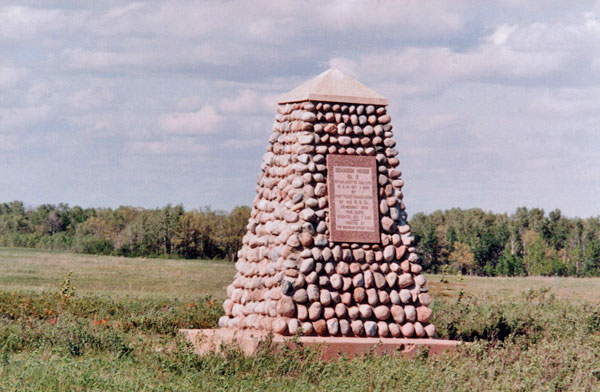
The area around
Brandon had
been home to a succession of cultures prior to European contact. The
fur traders who appeared on Hudson’s Bay in the 1670’s and trekked from
New France in the 1740’s, met the Nakota, Ojibwe, Cree and Dakoka who
generally livedin quite mobile villages. A series of fur trade posts
filled the role of towns. Provisions could be obtained, furs and
pemmican traded.
Before
Brandon
The era of
European
agricultural settlement began when Selkirk Settlers were established
farms along the Red River beginning in 1812. Across the rest of the
prairies, for some time yet, the only European presence was that of the
fur traders and a few adventurers. The site of Brandon is in the Treaty
2 territory negotiated between the Canadian Government and the Chippewa
and Cree in 1871. Earlier, the region had been home also to the
Nakota
and the Dakota.
The
Nakota (also
known as the
Assiniboine) were once members of the Yanktonai arm of the Dakota
Nation, were once a Nation 10000 strong that occupied a territory that
spanned the Prairie Provinces and parts of the northern United States.
They spent at least two centuries hunting bison on the Souris Plains,
and in later years actively participated in the fur trade on the Souris
River.
The decline of
the bison
herds, competition from other groups and the devastation wrought by
diseases like smallpox decimated their population and they moved
westwards where their descendants now live.
The Dakota also
have a long history in the region.
Early Dakota left
behind
fragments of pottery which date back 800 years. These fragments
indicate part of the territory occupied by Dakota long before the
contact era. Records kept by the Hudson’s Bay Company indicate that the
Dakota were active in Canada as far north as Churchill River in
northern Saskatchewan.
By the 1870’s
when the
Treaties affecting Manitoba were being negotiated and implemented,
European agricultural settlement was beginning to move westward from
Winnipeg in to the Portage and Morden areas.
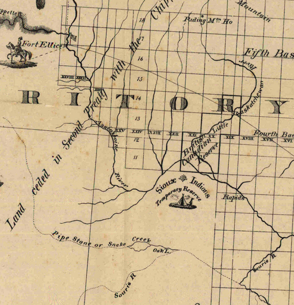
Map of the
Province of Manitoba and Part of the District of Kewatin and North West
Territory (1876)
Notable points on
this 1876
map of what is now Western Manitoba shows the HBC Post of Fort Ellice,
near today’s St. Lazare, a “Sioux Indians Temporary Reserve”, which was
later replaced by what is today the Sioux Valley Dakota Nation, and the
British Canadian Reserve, which was the beginnings of Rapid City.
The main trails
were the
Carlton Trail, which ran from Portage through Fort Ellice and westward
to Fort Edmonton, and the Boundary Commission Trail which ran from
Emerson through to Fort McLeod.
The site of
Brandon was not
on any of these routes, although the rapids noted on the above map were
the site of a crossing on a used by Aboriginals and fur traders heading
southwest.
In 1879 the
concept of a
village or town with streets, shops, services and residential
neighbourhoods, did not apply to the economy, culture and lifestyle of
the region.
That was about to
change.
The region was
making the news.
For instance on
June 11, 1879
the Toronto Daily Mail reported that improved river transport would
soon make it easier for immigrants to, "be provided with through
tickets right to the Little Saskatchewan and to Fort Ellis (sic)" (1)
The report goes on the recognize that the river route will cut travel
times, between Winnipeg and the Saskatchewan River from eight days to
three.
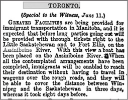 11-June,
1879 -
Toronto Daily Mail
The article
reminds us that
before the long-standing reign of the horse and the canoe as
transportation choices came to an end, the steamboat made a short but
notable appearance.
The ongoing saga
of the long
promised trans-continental railway would soon eclipse all news about
steamboats and river transportation.
A long and
detailed article
in the Montreal Gazette in the summer of 1879 outlines the progress and
plans of this project. The first proposed route would have seen the
railway cross the Red River at Selkirk and proceed north west through
the narrows of Lake Manitoba, through the Swan River Valley, and
towards Edmonton. Now, the plan was to go by way of Portage, Fort
Ellice, and then towards Edmonton. One effect of the plan was to prompt
a fair share of the new settlers to search for land that would be close
to this route, and to avoid even good farmland that was far from it.
This helps explain why the first notable settlements in western
Manitoba evolved to the north of Brandon.
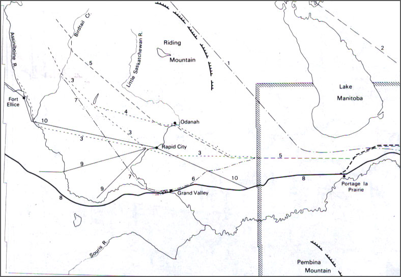
CPR Routes Map - From
by Section, Township and Range, by Tyman
By 1880 however,
some were leaning towards a more southerly route.
Anyone
driving
east of
Brandon on Veteran's Way will pass by a relatively unobtrusive cairn a
few kilometres east of First Street. This is the site of Grand Valley.
It was at a convenient river crossing point (right by the Steam Plant)
, and home to the first (1879) post office south of Rapid City. For a
short period of time (less than two years) it was quite an important
spot, especially as a drop off point for freight shipped by steamboat
to places like Rapid City. If and when a railway arrived, it would be
the logical place to erect a station and build a town.
To get a more
reliable
picture of the general pattern of settlement in western Manitoba one
need only look at the routine publication of Mail Routes and Schedules.
An entry entitled "Western Mails" shows us that Grand Valley was indeed
on the map and receiving mail service in 1879, on a route that included
the well-established village of Rapid City.
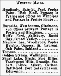
Winnipeg
Times,
Nov. 9. 1879
|


