by David Malaher
Whistler, British Columbia
|
During the fur trade period and over the years since that time many maps have been produced showing the locations of trading posts. Each map is important and provides information about the site or the author, although in numerous cases the maps have errors when compared to present day knowledge of geography and other records of the fur trade. Two Canadian authors stand out for their large collection of trading post sites: E. Voorhis in 1930 and T. B. Smythe in 1968.
In June 2005, Andreas Korsos of Edmonton introduced a thoroughly contemporary map of Canada and the northern United States showing 1,200 North American fur trade post sites. The map is large, 36" x 48", of very high quality colour printing with accurate geographical features and has twice the number of posts compared to Voorhis’s map. Fittingly, Korsos unveiled his map and described his ten years of research at a meeting of the David Thompson Bi-Centennial Committee in Jasper, Alberta. All of a sudden the fur trade history community has a wonderful potential new resource for many avenues of research.
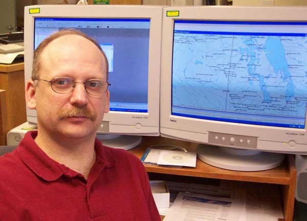
Andy Korsos with fur trade map on the computer.
Source: David Malaher.
Enthusiasm for this new map is well founded because it is supported by a modern Geographical Information System (GIS) and computer aided cartography. By-products of the GIS will be the map itself, a web site for detailed information on each post, flexibility to produce regional maps with finer detail, and an atlas of the North American fur trade.
Andy Korsos was raised in south central British Columbia and now resides in Edmonton, Alberta. He currently works for a municipality in charge of their mapping and GIS. Korsos has been a cartographer for 18 years and has worked for provincial and municipal governments as well as private industry. His experience includes cartography, surveying, photogrammetry and Geographical Information Systems from the days of manual procedures through to the transformation into computer based technology. “My enthusiasm for the fur trade was spawned by my interest in the path finders and explorers of 18th and 19th century Canada,” Korsos says, and “I have visited every site from Rocky Mountain House to Present Day Elk Point, Alberta.” He adds, “My first introduction to Thompson and ‘map-making’ occurred when I was eight years old through a novel by Kerry Wood entitled ‘The Map-Maker’. This along with my interest in fur trade history led to my desire to create a new map of fur trade posts in North America.” Korsos is a busy man. Asked about his historical associations, he tells us “I am presently an executive member of the David Thompson Bicentennial Partnership (www.davidthompson200.org), and I am their Official Cartographer.”
Besides map making, Korsos is an active outdoors’ person and volunteer worker. He is Chairman of the 2008 David Thompson Brigade (www.2008thompson brigade.com), a reality re-enactment to commemorate Thompson’s paddle in 1808 from Rocky Mountain House to Fort William where he informed the partners of the North West Company that he had found a new route across the Rocky Mountains.
Korsos has been working on the database for the new map since the early 1990s. His principal sources of information are Ernest Voorhis, Terrence B. Smythe, Historical Societies via the Internet, and selected fur trade journals and post histories. With over 1,300 records on file he is now at the stage of reviewing the information in preparation for formal release of the map. Four items make up the basic data:
- Name of the post or fort
- Owner (HBC, NWC, XYC, AFC etc.)
- Dates of construction and period of use
- Location by latitude and longitude
If at first this list looks daunting for 1,300 posts, consider the problems that are added by questioning the reliability of each item! Ascribing ownership is perhaps the least difficult, but not simple. The name, time period and location, on the other hand, can be very indefinite. Duplications are a constant hazard. When all four items are believed to be established, the ultimate test of validity is archeological evidence. There are places where evidence is indisputable, such as Prince of Wales Fort, Lower Fort Garry, Fort Union, and Fort Vancouver to name just a few. Other sites have been verified by archeological work such as Kootenay House on the Columbia River in the summer of 2005. A great many other posts are known only by journal descriptions and the accuracy of their sites is based on archival records, surface examination, local history, topographical maps, and possibly from Global Positioning System readings (GPS). While GPS readings are precise there can still be doubt about whether there is truly a fur trade post under the ground. Other than a short list of proven posts and sites, the majority of the 1,300 are still under investigation.
A map or database limited to archeologically proven sites is too restrictive and would not contribute a great deal to the overall picture of the geographic, timeline, and business history of the fur trade. Some doubts will remain forever. However, this map with its ability to update or add to its information in a manner never dreamt of by Voorhis and Smythe gives an exciting tool to all those who are seriously interested in advancing our knowledge of the fur trade. Not only can the data be updated quickly, special reports can be made on-request for researchers who are studying a complex pattern of information. By classifying the data into “definite” or “indefinite” it will be possible to analyse the information with confidence. Archival and archeological resources can be applied to posts and sites identified as deserving more attention.
The current database has been printed onto a splendid map and looks very reassuring. Several qualified people have examined the map, expressing admiration for the work done, but everyone, especially Korsos, is anxious to have a full review of the data before the map is officially released. The plan is to check every site. He is intending to have a preliminary review done by May of 2006 at which time he will present the map to the North American Fur Trade Conference and Rupert’s Land Colloquium in St. Louis, MO (24-28 May 2006).
Korsos is seeking help from people with intimate knowledge of fur trade posts. He would like to organize a users group who will help with gathering and evaluating data, and to give guidance for future developments of the map, database, website and atlas. If you would like more information on this exciting project and the users group, get in touch with Andy Korsos by e-mail at foxhnd@shaw.ca.
See also:
MHS Resources: Historic Sites of Manitoba
Page revised: 26 July 2021