
|
Maps / Settlement
Palliser Map
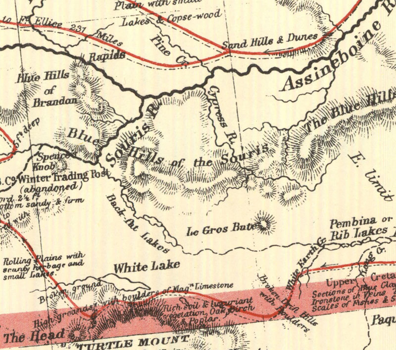
http://www.flickr.com/photos/manitobamaps/2211818555/
A Section of a General Map of the Routes in British North America Explored by the Expedition Under Captain Palliser (1865)
(Warkentin and Ruggles. Historical Atlas of Manitoba. map 93, p. 224)
----------------
A General Map of the Routes in British North America Explored by the Expedition under Captain Palliser, During the Years 1857, 1858, 1859, 1860. Compiled from the Observations and Reports of Captain Palliser and his Officers, including the Maps constructed by Dr. Hector, and other authentic documents. 1865.
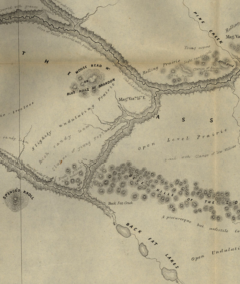
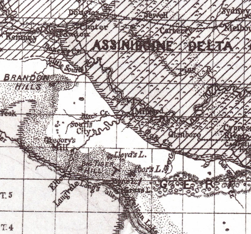
S1. Hind 1859
http://www.flickr.com/photos/manitobamaps/3808734146/
Map of a Portion of Rupert's Land Surveyed and Examined by the Assinniboine & Saskatchewan Exploring Expedition in the Year 1858 [Sheet 3] (1859)
(Warkentin and Ruggles. Historical Atlas of Manitoba. map 91, p. 220)
Image Courtesy of University of Manitoba Archives & Special Collections
Settlment 1870
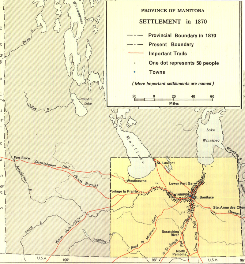
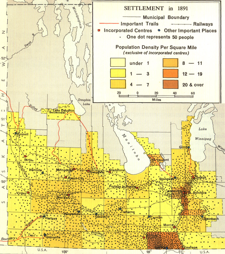
These maps show the growth of population during the great settlement period of the late 19th and early 20th centuries. From 1870 to 1901 the population of Manitoba increased from 12,288 to 255,211. The influence of the rivers was still evident in 1870, but by 1881 farmers had leapfrogged the wet and sandy areas, were above the Escarpment and also moving up the Riding Mountain slope, and Icelanders were occupying the western shore of Lake Winnipeg. By 1891 the most favourable areas were settled, except for the Dauphin and Swan river areas which were only beginning to be taken up shortly before 1901. The fringe of agricultural settlement was being reached by that time, though in the next few decades settlers continued to move into the marginal lands of eastern and Interlake Manitoba. The maps also show clearly the expansion of the transportation facilities, particularly the development of the railroad network.
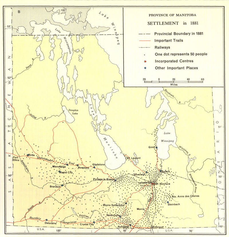
Settlement - 1881
These maps show the growth of population during the great settlement period of the late 19th and early 20th centuries. From 1870 to 1901 the population of Manitoba increased from 12,288 to 255,211. The influence of the rivers was still evident in 1870, but by 1881 farmers had leapfrogged the wet and sandy areas, were above the Escarpment and also moving up the Riding Mountain slope, and Icelanders were occupying the western shore of Lake Winnipeg. By 1891 the most favourable areas were settled, except for the Dauphin and Swan river areas which were only beginning to be taken up shortly before 1901. The fringe of agricultural settlement was being reached by that time, though in the next few decades settlers continued to move into the marginal lands of eastern and Interlake Manitoba. The maps also show clearly the expansion of the transportation facilities, particularly the development of the railroad network.
Weir, Thomas R. [Settlement 1870-1921] [map]. 1:3,041,280. In: Thomas R. Weir. Economic Atlas of Manitoba. Winnipeg: Manitoba Dept. of Industry and Commerce, 1960, pate 13.
http://www.flickr.com/photos/manitobamaps/2129548738/
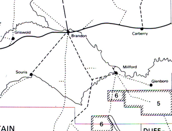
1880's Stage Lines
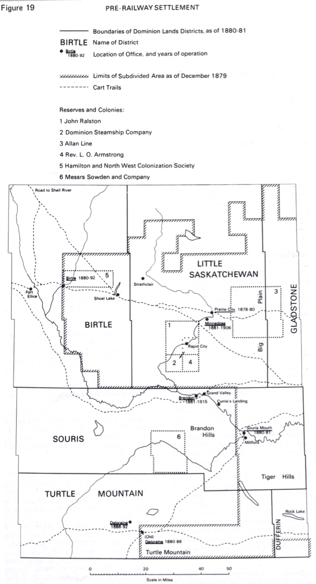
By Section, Township & Range, Studies in Prairie Settlement,
John Langton Tyman. Brandon University, 1972, P39
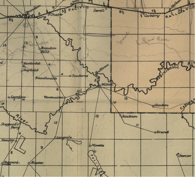
http://www.flickr.com/photos/manitobamaps/3875351518/
Postal Map of Manitoba Shewing Post Offices and Mail Routes in Operation on 1st April 1884 (1884)
Maingy, Le F. Ans. Postal Map of Manitoba Shewing Post Offices and Mail Routes in Operation on 1st April 1884 [map]. 1:570,340. [Ottawa]: Canada Post Office Department, 1884.
Image Courtesy of University of Manitoba Archives & Special Collections
Upham, 1890
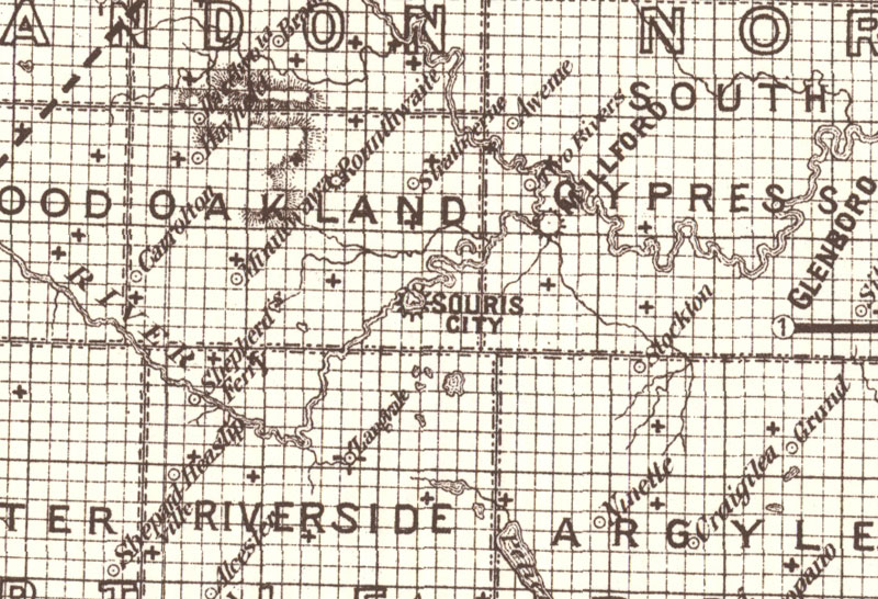
Railway & Guide Map of Manitoba (1887)
http://www.flickr.com/photos/manitobamaps/4139208350/in/photostream/
Brownlee, J. H. Railway & Guide Map of Manitoba [facsimile]. 1:760,320. Winnipeg: Manitoba Department of Agriculture, 1887. As reproduced by, Ottawa: Association of Canadian Map Libraries and Archives, ACMLA Facsimile Map Series #63, 1980.
As settlement advanced in Manitoba local administrative units were established, and various kinds of units were tried before a satisfactory system was found. This map of 1887 shows the stage when municipalities were already in existence, but the boundaries of the much larger counties which had been the administrative units from 1880 until 1886 are still on the map.. (Warkentin and Ruggles. Historical Atlas of Manitoba. map 71, p. 180).
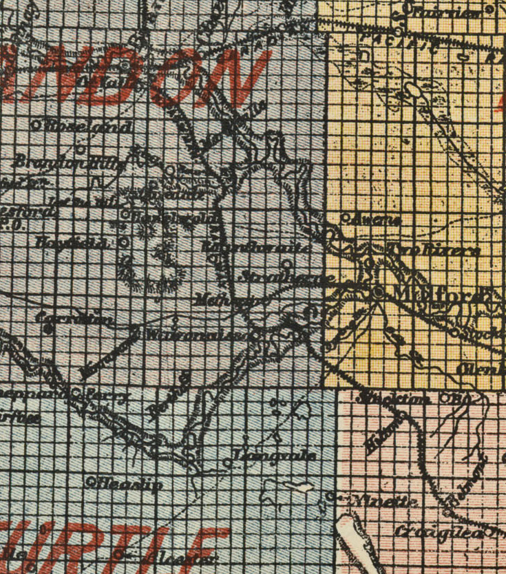
Manitoba 1897
Map of Manitoba, British Columbia and the NorthWest Territo(ies (1897)
http://www.flickr.com/photos/manitobamaps/4114634725/
Matthews-Northrup Co. Map of Manitoba, British Columbia and the NorthWest Territories [map]. 1:2,787,840. Buffalo: Matthews-Northrup Co., 1897.
Image Courtesy of University of Manitoba Archives & Special Collections
(Morris Block fonds, MSS 207, A.05-43)
www.umanitoba.ca/libraries/units/archives/collections/com...
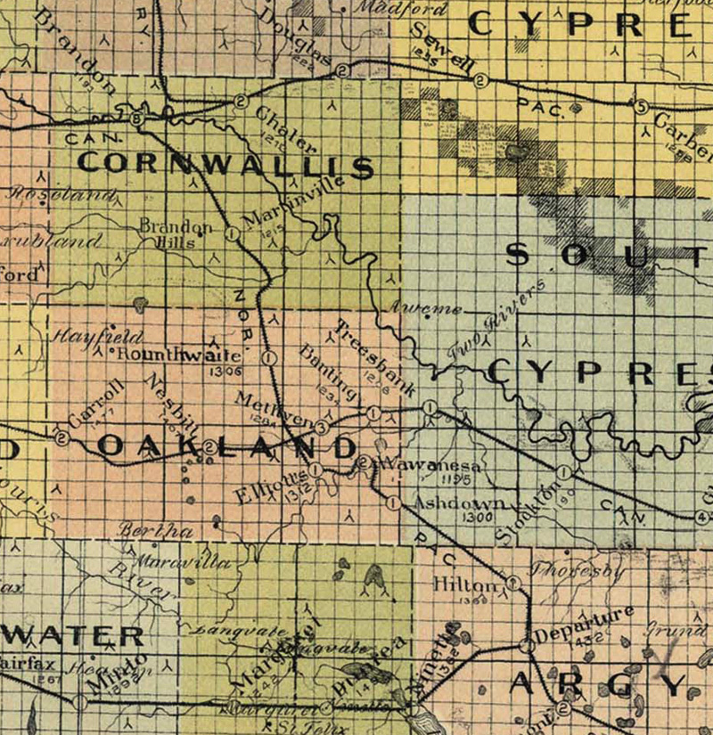
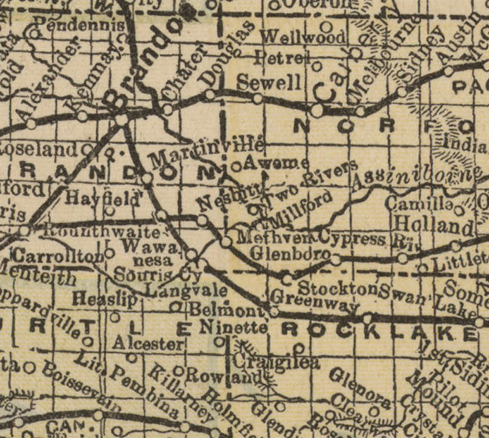
Map of Manitoba (1900)
http://www.flickr.com/photos/manitobamaps/2086270771/
Bulman Bros. & Co. Map of Manitoba Published by Authority of the Provincial Government Winnipeg, April, 1900 [map]. 1:760,320. Winnipeg: Manitoba Department of Agriculture and Immigration, 1900.
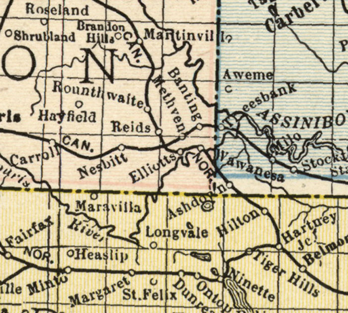
Manitoba 1918
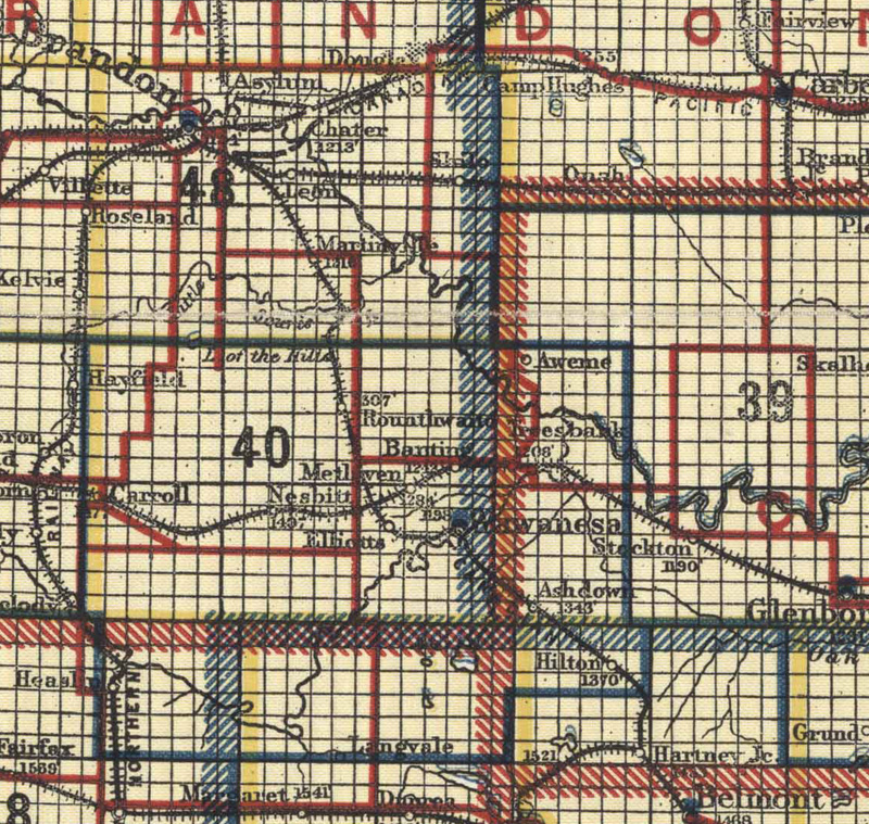
http://www.flickr.com/photos/manitobamaps/2828730480/
Scarborough’s Map of Manitoba Canada South Sheet (1918)
Scarborough Company of Canada Ltd. [Scarborough’s Map of Manitoba Canada South Sheet] [map]. Scale not given. [Regina]: Scarborough Company of Canada Ltd., 1918.