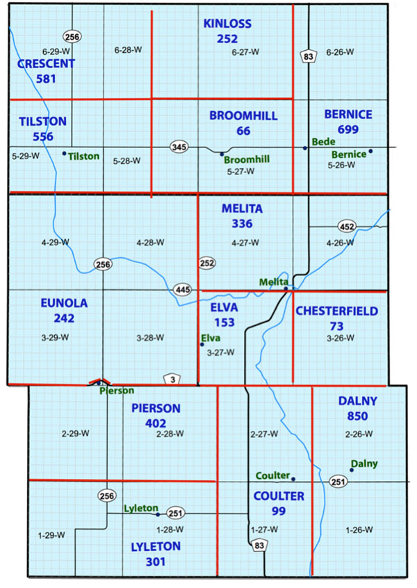
For Historic Resources branch purposes, Municipalities are divided into
regions, each with its own
identification code for cataloguing sites.
Sites in this inventory are grouped using those regions and codes.
Rural areas without villages are presented in this section: Bernice,
Crescent, Dalny, Eunola, Kinloss, & Melita.
(The Town of Melita is
the subject of its own Special Places Project).
 Bernice Area: Code 699


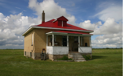
Bede School
SE 19-5-26
699.E.1
1913
GPS: N49.39975, W100.96578
Closed 1966.
Built by R.N. Wyatt of Melita. Closed in 1966. Recently used as a Gift
Shop.

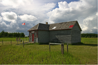
Bernice School
SE 23-5-26
699.E.2
1914
GPS: N49.39976, W100.87775
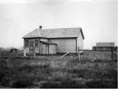
Near the school building is a cairn, erected in July 1988,
commemorating the teachers, students and families of Bernice School No.
547, which was established as Gould School at SW22-5-26W in the Rural
Municipality of Albert, and operated between 1888 and 1914. It became
Bernice (Berneice) School in 1914, situated at SE23-5-26, continuing
until 1965. A nearby station of the Canadian Pacific Railway, also
named Bernice, existed at NE14-5-26 from 1906 to 1952.

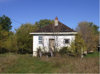
Belses School
SE 22 -6-26
699.E.3
1927
GPS: N49.48822, W100.91583
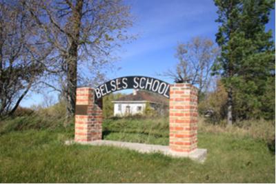
The Belses School District was established formally in March 1887, with
a one-room frame schoolhouse constructed on the southwest corner of
22-6-26. The original building was replaced by the present one sometime
before 1927. The district was dissolved in 1968 and the remaining
students went to Pipestone Consolidated School No. 737. A commemorative
plaque was unveiled near the former school building in 1987. The
building itself was renovated into a private residence but, as of late
2011, stands vacant.

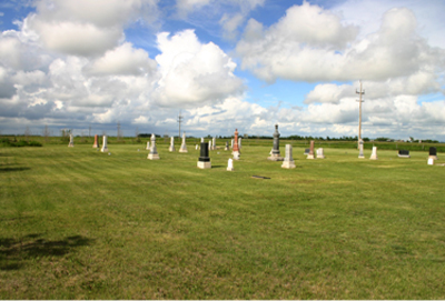
Bede Cemetery
SE 19-5-26
699.F.1
Created ca. 1900 – before the railway arrived.. Enlarged 1913
GPS: N49.39968, W100.96420

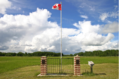
Bernice Townsite Marker
Bernice
NE 14-5-26
GPS: 49* 23’ 59.24” N
100* 52’ 14.18” W
Alternate spelling – Berneice
Townsite est. 1906 on the CPR Branch from Lauder to Tilston

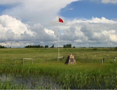
Gould Family Cairn
Bernice Area
NW 14-5-26
GPS: N49.39924, W100.8951
1882 Homestead of John & Matilda Gould
Bernice School No. 547, which was established as Gould School at
SW22-5-26W in the Rural Municipality of Albert,
and operated between
1888 and 1914

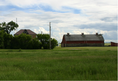
Carr Farm
House 1909 / Barn 1907
GPS: N49.398330 W100.968014
Original Ownership
Peter Wetteraurer
Jane Carr
House built of Melita Brick
Large barn.

Crescent Area: Code 581


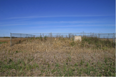
Diana Icelandic Cemetery
SE 20-6-29 W
581.F.1
1898
GPS :
49* 29’ 30.56” N
101* 20’ 54.72” W
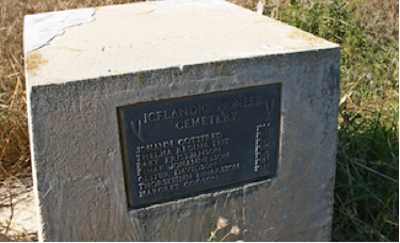
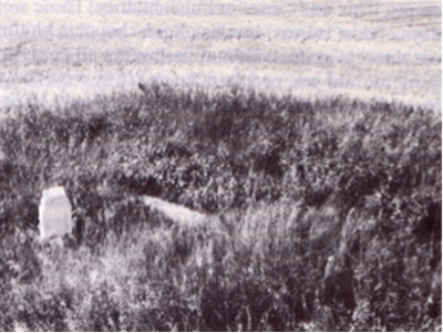
Photo from “Reflections of Time”
The region was settled by Icelandic settlers, beginning in 1892. Some
came from the R.M. of Argyle.
A fenced cemetery in the Municipality of Two Borders, in a farm field
about one-third of a mile from the nearest road, contains the graves of
Johann Gottfred (1898), Thelma Regina Tait (1901), Baby Kristjanson
(1916), Einar Johannesson (1916), Gestur Davidson (1919), Thorsteinn
Einarsson (1921), and Margret Oddson (1921). A monument in the cemetery
lists their names.

Dalny Area: Code 850


http://yourrailwaypictures.com/GrainElevators/manitoba.html
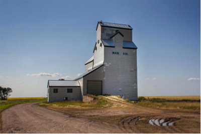
Dalny Pool Elevator
Dalny / 4-2-26
850.D.1
1918
GPS:
49* 05’ 57.98” N
100* 54’ 10.11” W
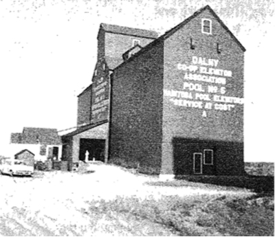
Photo from “Our First Century”

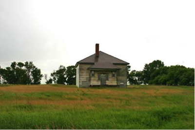
Verona School
NE 15-2-26 W
850.E.1
1918
GPS: N49.13201, W100.88705
Municipal Designation: M0201
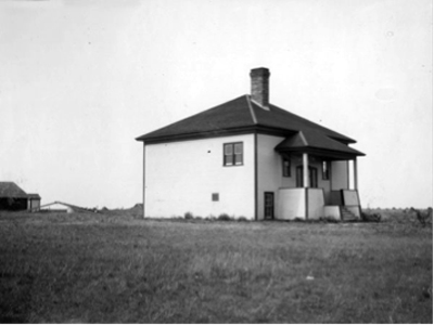
Verona School, completed in 1918, is a small wood-frame building on a
schoolyard property surrounded by crop and hay land in the Coulter
area. Closed 1958
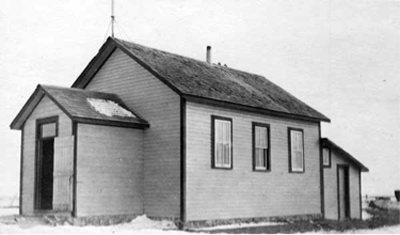
The original Verona School (circa 1911)
Source: Archives of Manitoba, School Inspector Photos GR2664, C65.

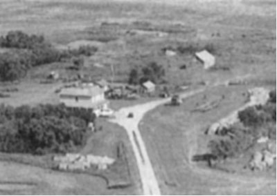 Cheyne House
1900
Homestead of John Spence / step grandfather of John Cheyne
Century Farm

Eunola Area: Code 242


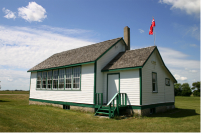
Eunola School
SE 11-4-29 W
242.E.1
1937
GPS: N49.28170, W101.27986
Municipal Designation: M0074

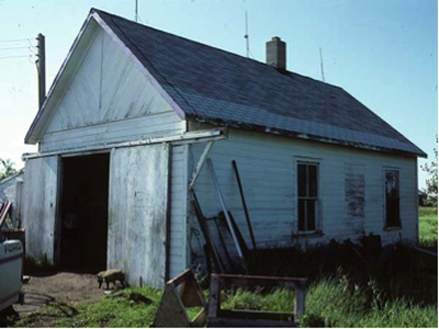
Wicks School
SW 21-3-29
242. E.2
1907
GPS: 49* 7.109’N 101* 17.690’W
The Wicks School District was established formally in September 1907
and it operated a one-room schoolhouse at SW21-3-29W in the Rural
Municipality of Edward. The school closed in June 1953 and the
remaining students were bused to Pierson School. The district was
dissolved in 1956. As of 2012, the building is used as a garage on the
privately-owned site.
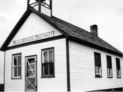
**Photos and info from Historic Sites of Manitoba
http://www.mhs.mb.ca/docs/sites/wicksschool.shtml

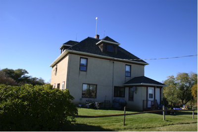
Smith / Berns Farm
1911
Ownership:
Xavier & Guido Berns
Guido Berns
Lawrence Smith
Building Features of Interest:
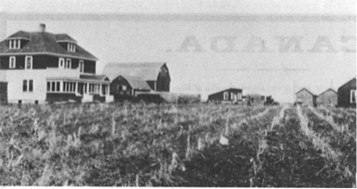
In 1910 Henry Berns came to Canada and purchased section 3I-4-29 … from
R. E. Denny of Melita. In February, l9ll, Xavier and his brother Guido
(second son) came to Canada and settled on the southeast quarter of
3l-4-29. They built all the buildings which included a two-storey
house, two hip-roofed barns, and a large granary.
Hardwood floors & Nice dormers

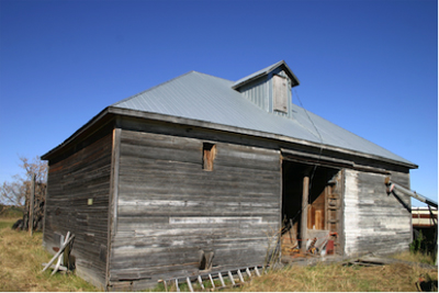
Berns Granary
1911
GPS: N49. 345179 W 101.375451
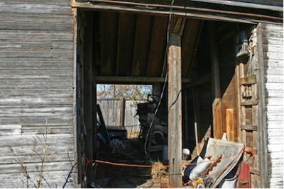
The granary was designed to accommodate seed cleaning with the grain
flowing from the top level into the cleaner and then into one of the
four ground floor compartments.

Kinloss Area: Code 252


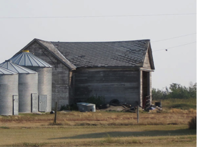
Huston School
SE 2 -6-27
252. E.1
1894
GPS: N49.45764, W101.02018
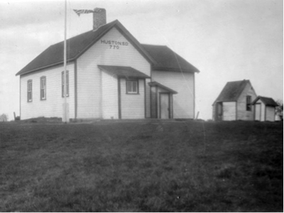
Huston School District was registered in 1894. It was named for Fred
Huston who gave the land for the site and helped to organize the
district. It operated on the southeast corner of 2-6-27. The district
was dissolved in 1961 and, henceforth, students from this area went to
Broomhill Consolidated School No. 2363, Paramount School No. 1289,
Kinloss School No. 934, or Belses School No. 501. The former school
building was later used for storage.
 Melita Area: Code #336


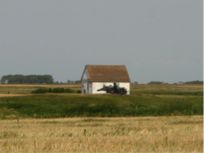
Former Coulter Church
Now on private land near Melita
Methodist Congregation
Closed in 1999
Moved to this site.
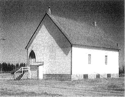
The Coulter United Church began originally as a Methodist Church, and
was organized and built as part of the field consisting of Coulter,
North Antler and Chesterfield.

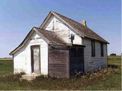
Belfry School
SW5 -4-27
336. E.2
1891
GPS: 49* 7.109’N 101* 17.690’W
Land for the school was provided by local farmer Warren Belfry, from
whom the school name was derived.
Belfry School was established in January 1891, with a frame building
erected in the southwest quarter of 12-4-28 west of the Principal
Meridian, in the Rural Municipality of Arthur.
Five years later, the building was moved to its present location at
SW5-4-27W. With declining enrollment, the school closed in 1963 and the
remaining students were bussed to Edward Municipal School No. 2353.

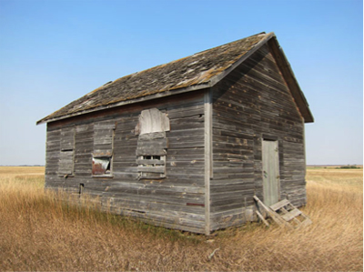
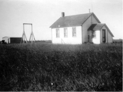
West Brenda School
NW 20-4-26
336. E.3
1885
GPS: N49.34076, W100.89100
** Photos & Info from Historic Sites of Manitoba
http://www.mhs.mb.ca/docs/sites/westbrendaschool.shtml
The West Brenda School District was established formally in April 1885
and it operated a school on the northeast corner of 20-4-26W. The
district was dissolved in 1960 and, henceforth, students from this area
went to Melita Consolidated School No. 440. The former school building
still stood at the time of a 2012 site visit.

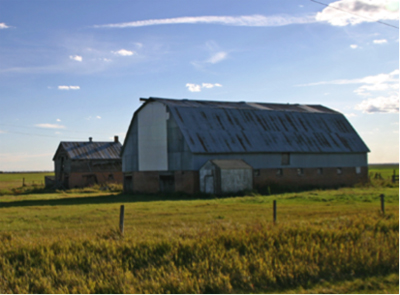
Dobbyn Barn
ca. 1900
Frame / Metal Siding

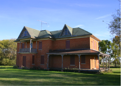
Dobbyn Farm House
ca. 1900
Large brick house in good condition.
The Dobbyn family were Melita pioneers.

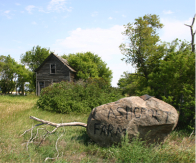
Ashcroft Farm Site
ca. 1900
Original Ownership:
John Ashcroft bought the property in about 1949 and lived here for 20
years.
Typical abandoned farm site except for the large stone with the name
Ashcroft Farm.

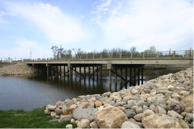
Melita Highway 3 Bridge
S 6-4-26
ca. 2000
GPS: 49*
Highway 3

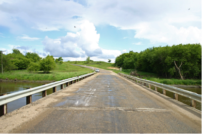
Napinka Souris River Bridge
NW 23-4-26
ca. 2000
GPS: 49*
Over the Souris River.

|

