 Map Archive 1. Tracing the changes in our region. 2. Cummins Rural Directory Maps - 1923 3. Selected Topical Maps 1. Tracing the changes in our region 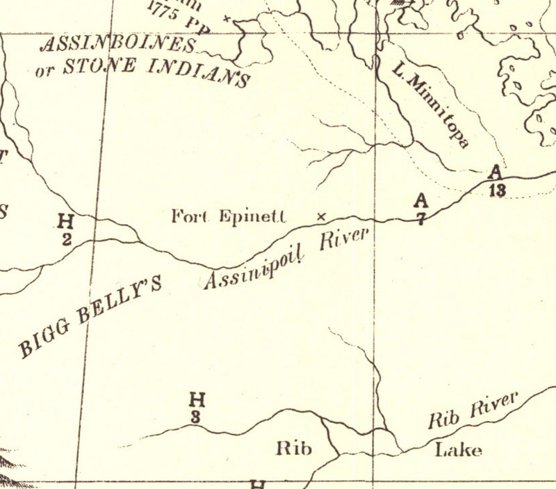 1790 Fort Epinette (Pine Fort) was located north of Glenboro. Rib Lake is Rock Lake. Rib River is the Pembina. 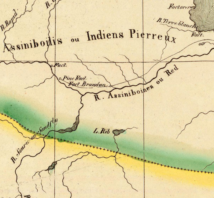 1825 The Souris River was also called the Sandfly. The locations of Pine Fort and Fort Brandon are incorrectly reversed. The "Fact" noted above Fort Brandon stands for Factory, as the Fur Trade Posts were sometimes called. It was located at the crossing near the Brandon Rapids. The Rapid River we know as the Little Saskatchewan. The city of Brandon would be located about midway between the mouth of the Little Saskatchewan and the Rapids. 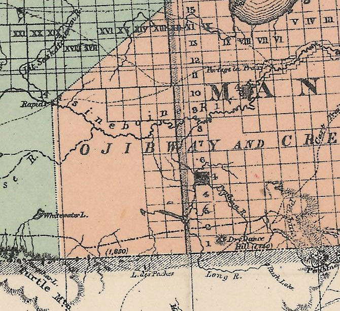 1877 This map shows the extent of the survey in 1877. It had almost reached Prairie Lakes. 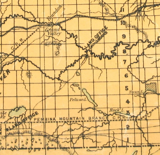 1882 The Land Office at Souris Mouth was where homesteaders heading towards the Pelican Lake region would register their claim. Many early settlers came by steamboat to that point and could get provisions at the nearby village of Millford. 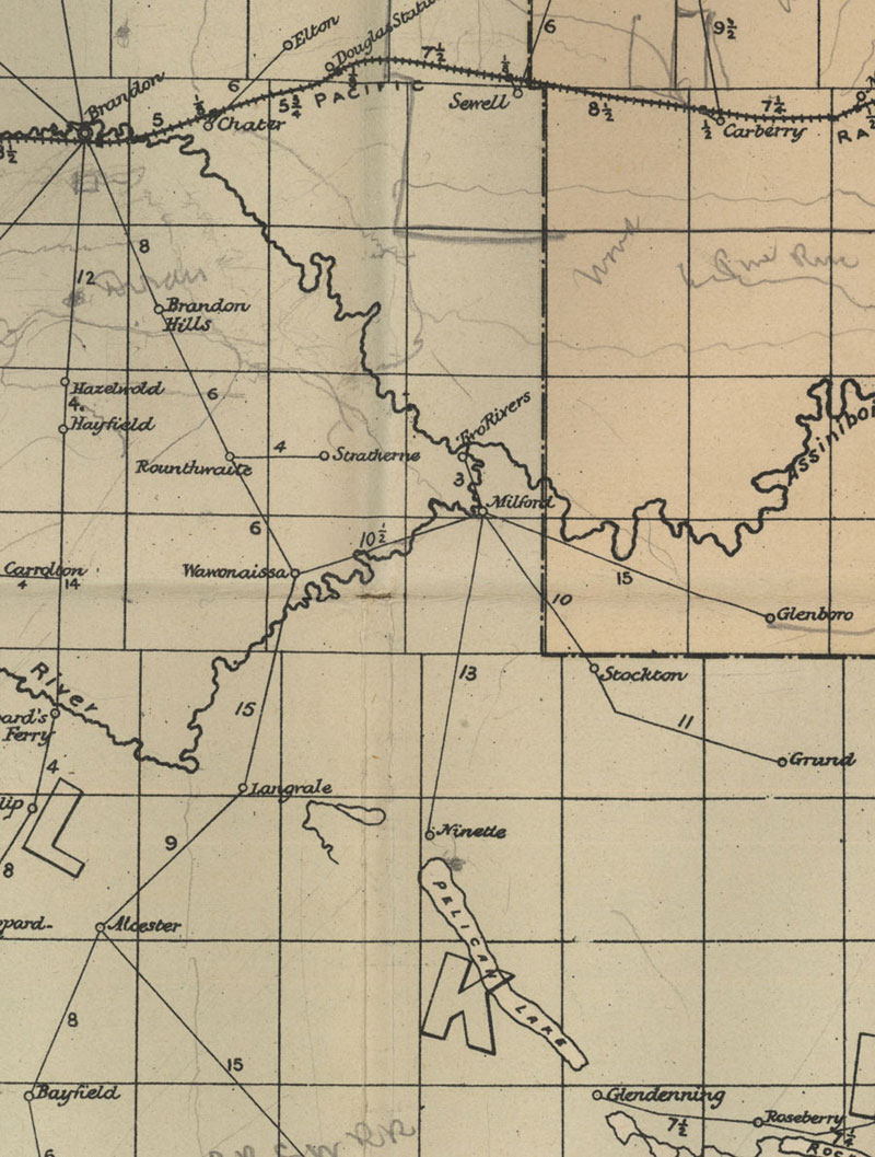 Postal Routes - 1884 The Post Office at Craiglea opened in 1884 but didn't make it onto this map. 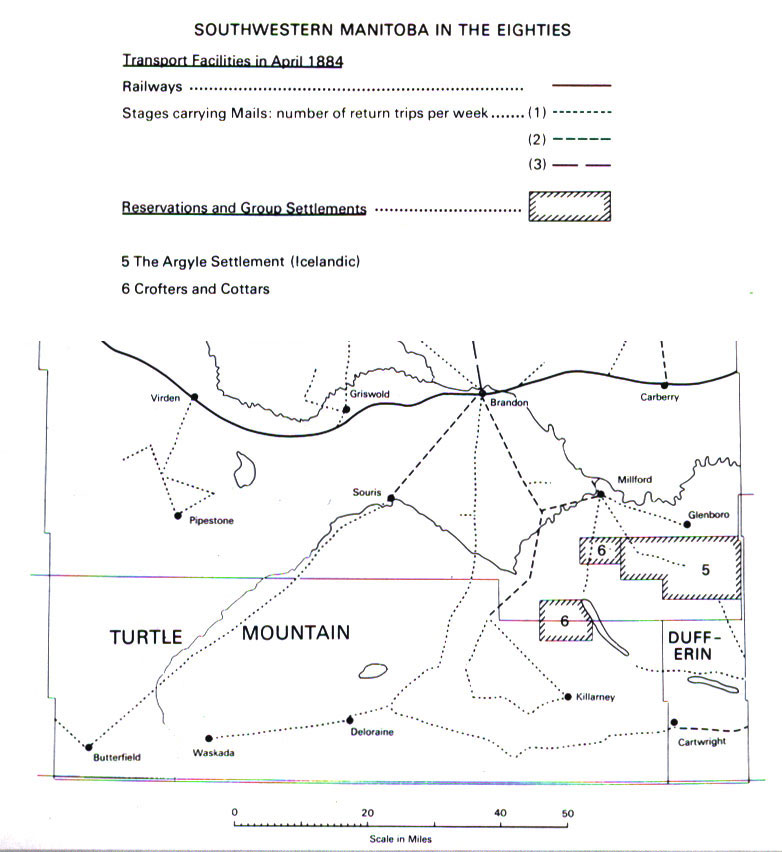 Mail to the area now known as Prairie Lakes came by way of Millford. 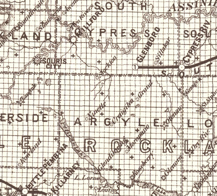 1887 Post Offices and the beginning of Railway Service. 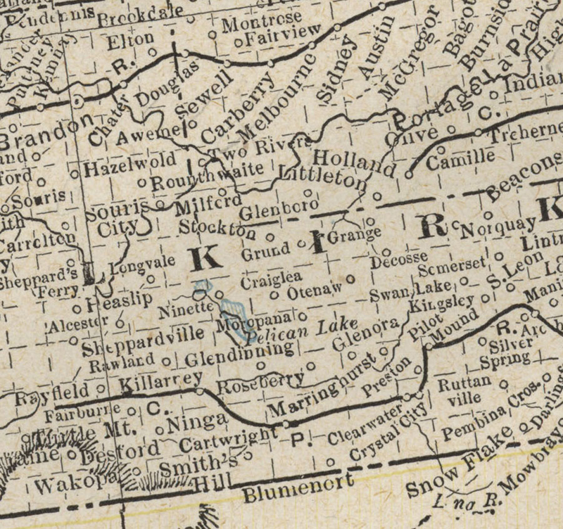 1887 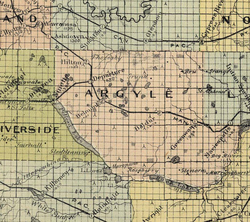 1900 Railway service is in place. 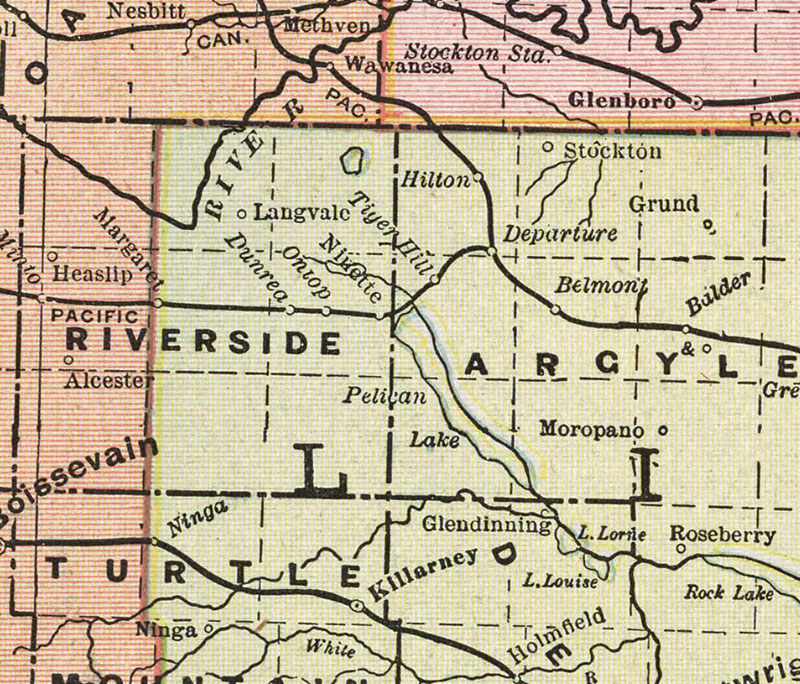 1912 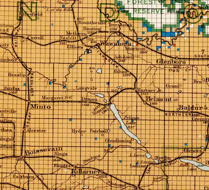 1915 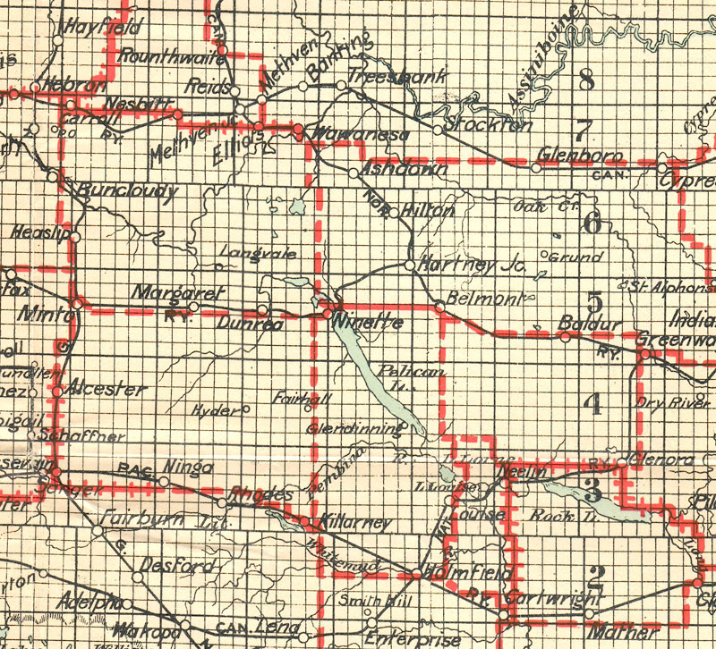 1926 Highways began appearing on maps in the mid 1920's. 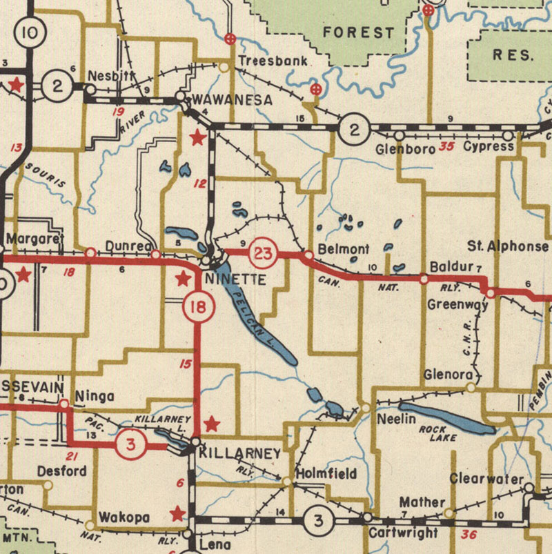 1956 2. Cummins Rural Directory Maps - 1923  Moving east to west.... 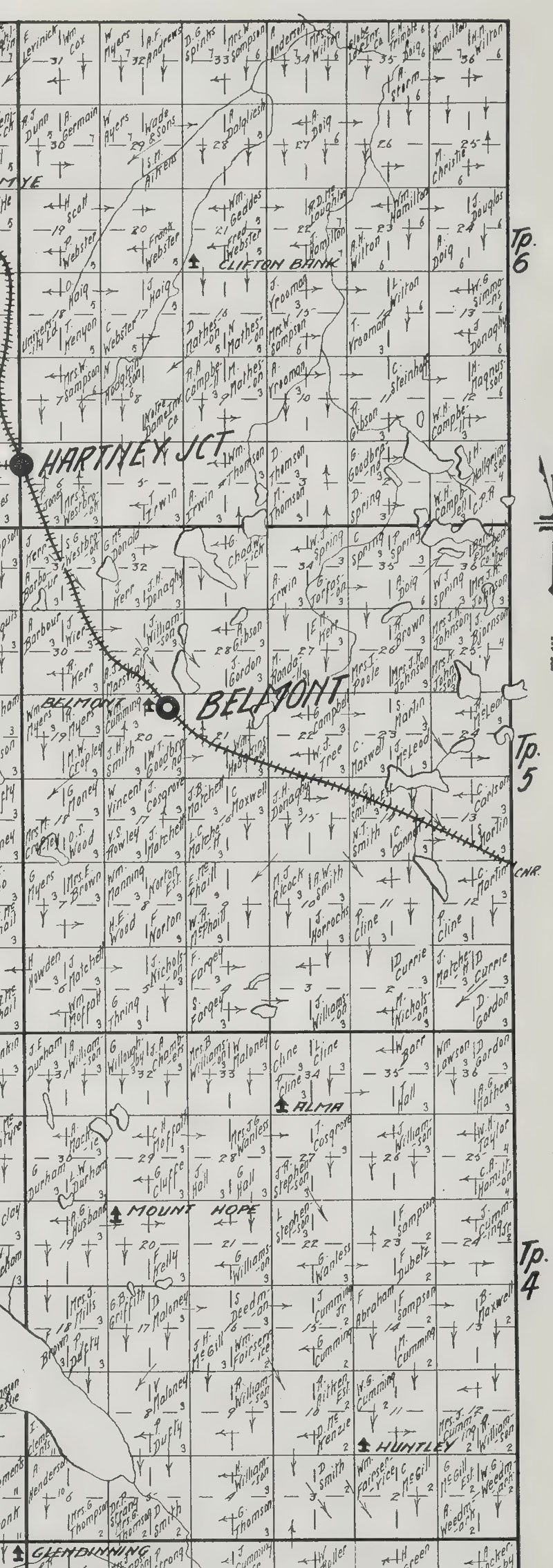 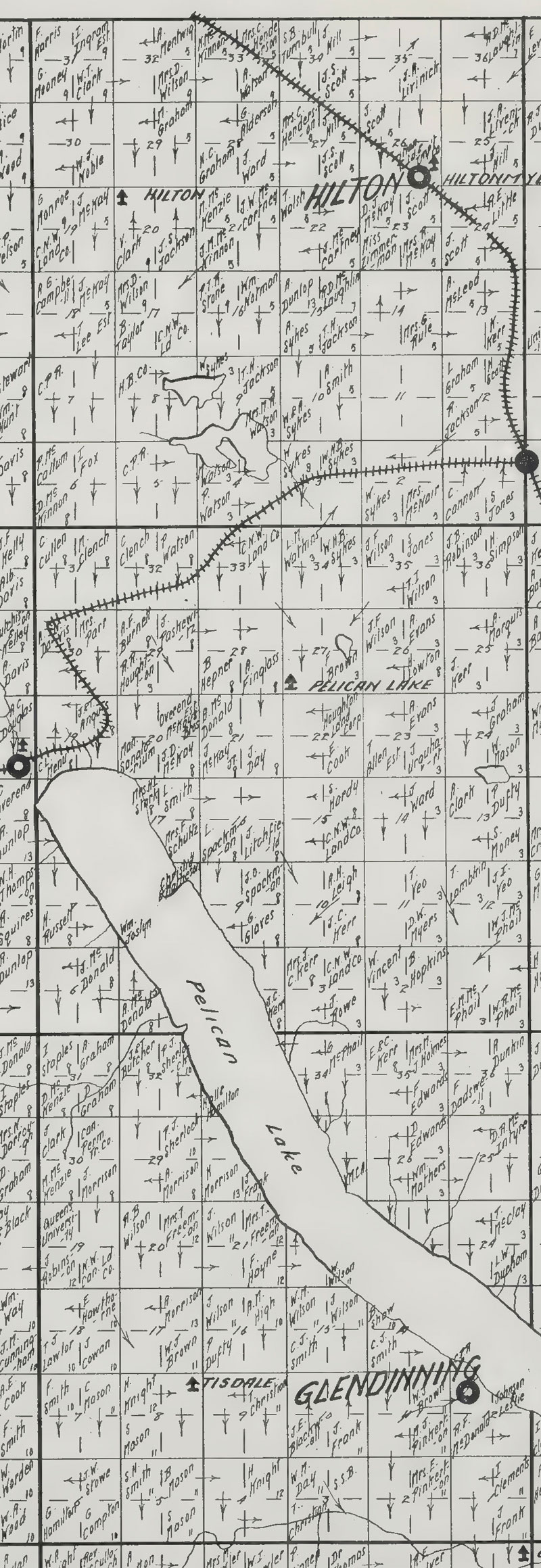 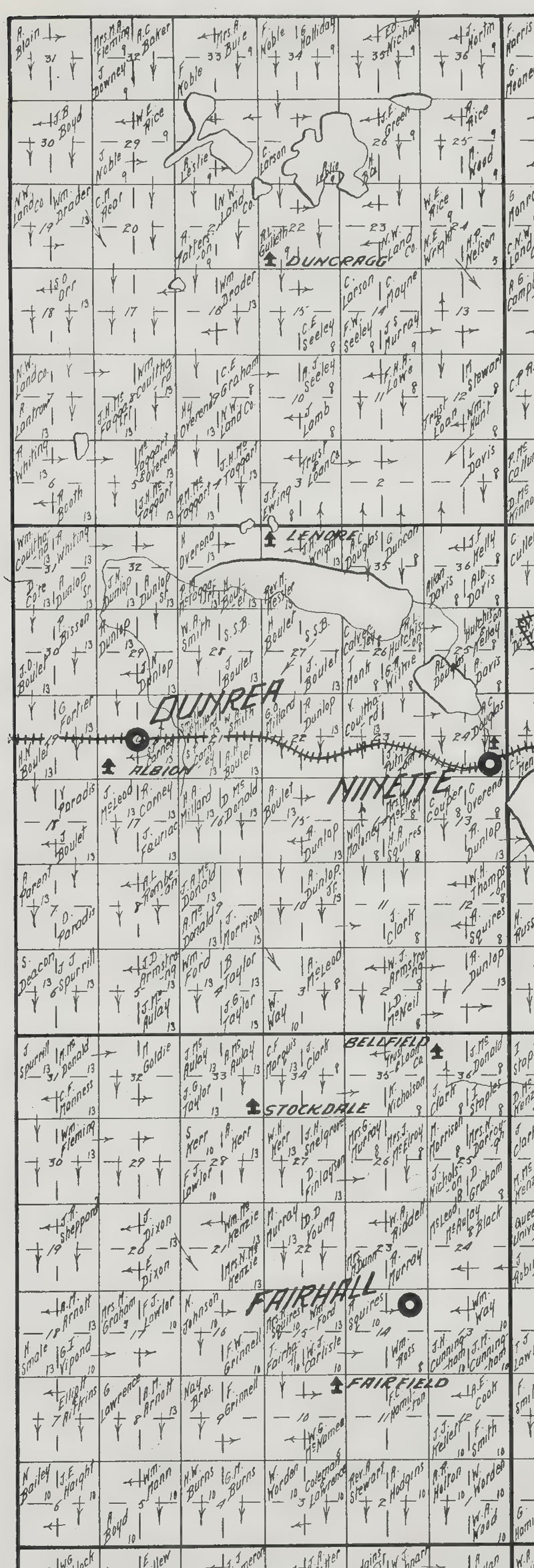 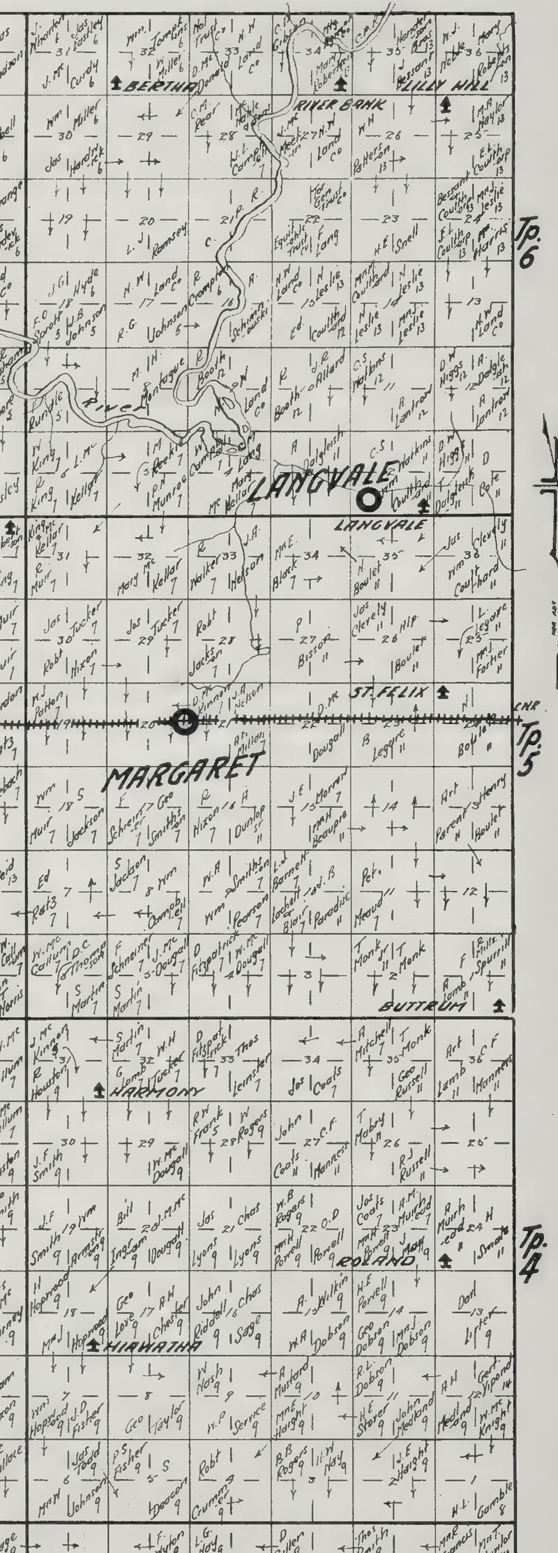 Download a pdf of the full map for Prairie Lakes... View the full Cummins Rural Directory 3. Topical Maps 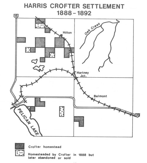 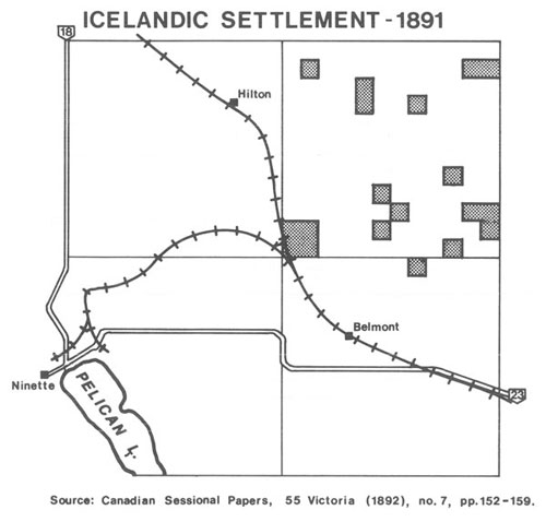 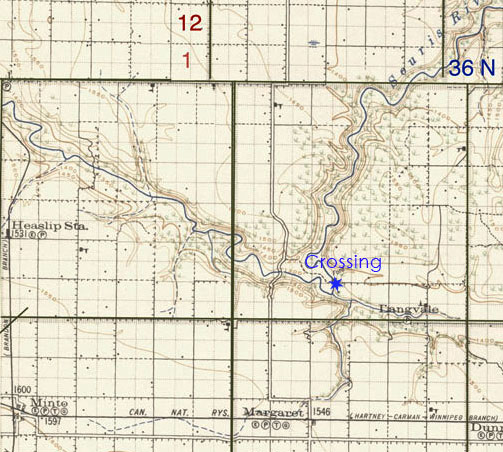 Lang's Crossing |