S15.
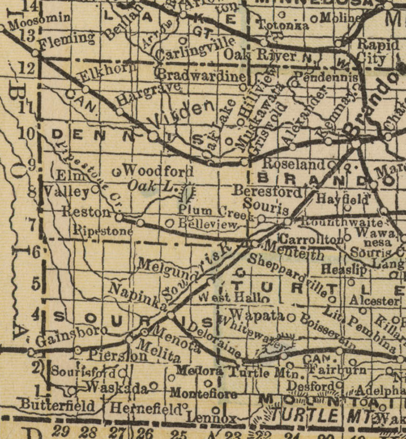
Manitoba 1897
Map of Manitoba, British Columbia and the NorthWest Territo(ies (1897)
http://www.flickr.com/photos/manitobamaps/4114634725/
Matthews-Northrup Co. Map of Manitoba, British Columbia and the
NorthWest
Territories [map]. 1:2,787,840. Buffalo: Matthews-Northrup Co., 1897.
Image Courtesy of University of Manitoba Archives & Special
Collections
(Morris Block fonds, MSS 207, A.05-43)
www.umanitoba.ca/libraries/units/archives/collections/com... |