
 |
The
Souris River / Route #5 / Margaret to Wawanesa |
 |


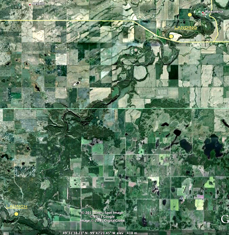
Launch :
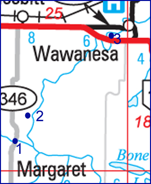
Drive south from Brandon on Highway #10. Turn east on Highway #2 a few
kilometres past the Log Cabin. Take the Margaret road (#346) south.
Access is on the north east bank.
Landing : The
destination drop is on the north side of Highway #2 near Wawanesa, just
east of the bridge.
Distance : About
40 km
Time : 7 - 9
hours
|
 |

When we did this stretch,
in
the early summer of 1996, it took 6 1/2 hours of steady paddling. The
water was still high but not nearly so high as earlier in the spring.
There are many rapids, all passable with caution if the water is high
enough. This is by far the most interesting stretch of the Souris -
rapids around every corner - just enough rocks to keep it interesting.
The secret is doing this stretch at just the right time of year. 1998
proved to be an exception due to extremely high rainfall, we were able
to do this stretch twice in early July.
The first part of the journey seems to
take the longest. The river changes in direction from south-east to
north-east in a twisted series of meanders. After the first few hours
it straightens out and you begin to make progress. The first rapids are
just before Lang's Crossing. We stopped in a small channel on the left
side to survey them. We were able to pick a spot between the rocks on
the left side about 6 metres in - clear sailing if you start at the
right spot. There are more like this to come.
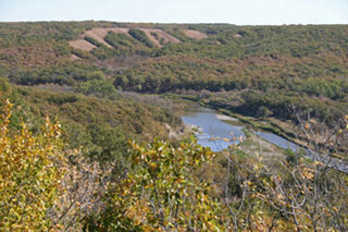
During the quiet stretches, enjoy the
high cliffs, watch for wildlife (we saw a large group of eagles ), and
listen for the next set of rapids.
The river nearly reaches Highway 2
before doubling back, so if you find yourself turning almost south
west, and you've noticed highway sounds, that's a sign that your
getting close - another half hour or so.
|

Historical
Notes

| As you
proceed southeast about a mile
downstream from McKellar's Bridge you make a sharp left turn in what
is known as the "Souris Elbow of Capture." At one time the Souris kept
on in a southwest direction and occupied what is now the Pembina
Valley. At some time after the most recent glaciers as the earth was
rebounding from the pressure of the ice fields, the Souris was diverted
by a tributary of the Assiniboine. (Geog. of Man.)
The spot just at the foot of the first
rapids is Lang's Crossing, an important ford in the days before roads
and bridges.
Gregory's Mill served the area in the
1880's. The three story stone structure was abandoned after flood water
washed the dam away two years in a row, and competing mills were
established in surrounding towns. All that remains are some foundation
stones and the overgrown mill race. Just past the mill site is a steep
cliff that was used as a buffalo jump site. Early settlers found piles
of buffalo bones which were later collected and sold for use in
fertilizer production.
Souris City was another "speculative
city"
which in 1882, according to the Free Press, had a gristmill, two
stores, a hotel, blacksmith shop and school. It was located on the last
bend before the river heads towards the the bridge at Highway #2.
(16-7-17). All that remains is a small cemetery. It is the site of what
must surely be the shortest lived bridge ever erected in Canada. The
structure, built in 1882, was 92 metres in length and cost $9000.00.
The night before it was to be dedicated an ice packed flood ripped away
part of it. It was repaired with a special centre spans that were
removable during spring breakup, but the maintenance costs were high
and the municipal council had it dismantled in 1889. (Ghost Towns) In
that winter of 89/90 most of the buildings in Souris City were moved to
the new site of Wawanesa as it was a more advantageous site for a rail
crossing. An excellent retelling of the town's story exists in "The
Prairie W.A.S.P (A History of the Rural Municipality of Oakland
Manitoba) by J.A.D. Stuart.
|
Google
Earth View

|


